Lenox is a city in Taylor and Adams counties in the U.S. state of Iowa. The population was 1,339 at the time of the 2020 census.

Stockton is a city in Muscatine County, Iowa, United States. The population was 176 at the time of the 2020 census. It is part of the Muscatine Micropolitan Statistical Area.

Kiowa is a city in Barber County, Kansas, United States. As of the 2020 census, the population of the city was 902. It is located 1 mile north of the Kansas / Oklahoma state border.

Norcatur is a city in Decatur County, Kansas, United States. As of the 2020 census, the population of the city was 159.

Howard is a city in and the county seat of Elk County, Kansas, United States. As of the 2020 census, the population of the city was 570.

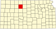
Gove City, more commonly known as Gove, is a city in and the county seat of Gove County, Kansas, United States. As of the 2020 census, the population of the city was 80.

Meriden is a city in Jefferson County, Kansas, United States. As of the 2020 census, the population of the city was 744.

Nortonville is a city in Jefferson County, Kansas, United States. As of the 2020 census, the population of the city was 601.

Edgerton is a city in Johnson County, Kansas, United States, and part of the Kansas City metropolitan area. As of the 2020 census, the population of the city was 1,748. It is home to a large BNSF intermodal train facility named Logistics Park Kansas City.

Roeland Park is a city in Johnson County, Kansas, United States, and located within the Kansas City metropolitan area. As of the 2020 census, the population of the city was 6,871.

Centralia is a city in Nemaha County, Kansas, United States. As of the 2020 census, the population of the city was 485.

Lyndon is a city in and the county seat of Osage County, Kansas, United States. As of the 2020 census, the population of the city was 1,037.

Scranton is a city in Osage County, Kansas, United States. As of the 2020 census, the population of the city was 653. It was named after the city of Scranton, Pennsylvania due to its coal mining in the 19th century.

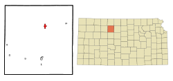
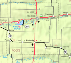
Woodston is a city in Rooks County, Kansas, United States. As of the 2020 census, the population of the city was 94.

Andale is a city in Sedgwick County, Kansas, United States. As of the 2020 census, the population of the city was 941.

Alma is a city in and the county seat of Wabaunsee County, Kansas, United States. As of the 2020 census, the population of the city was 802.
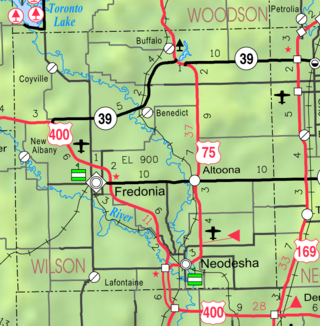
Altoona is a city in Wilson County, Kansas, United States, along the Verdigris River. As of the 2020 census, the population of the city was 354.

Stockton is a city in Winona County, Minnesota, United States. The population was 809 at the 2020 census.

Stockton is a city in Cedar County, Missouri, United States. The population was 1,683 at the 2020 census. It is the county seat of Cedar County.

St. John or Saint John is a city in St. Louis County, Missouri, United States, with its commercial district centered along St. Charles Rock Road. It is a few miles southeast of Lambert-St. Louis International Airport.