Chandler, Kansas

Last updated
Chandler, Kansas
USA Kansas location map.svg
Red pog.svg
Chandler
Location within the state of Kansas
Usa edcp location map.svg
Red pog.svg
Chandler
Chandler (the United States)
Coordinates: 39°19′20″N99°25′53″W / 39.32222°N 99.43139°W / 39.32222; -99.43139 Coordinates: 39°19′20″N99°25′53″W / 39.32222°N 99.43139°W / 39.32222; -99.43139
Country United States
State Kansas
County Rooks
Elevation
1,959 ft (597 m)
Population
  Total0
Time zone UTC-6 (CST)
  Summer (DST) UTC-5 (CDT)
Area code 785
GNIS ID 482529 [1]

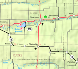
Chandler is a ghost town in Logan Township, Rooks County, Kansas, United States. [1]

History

Chandler was issued a post office in 1880. The post office was discontinued in 1892. There is nothing left of Chandler. [2]

Related Research Articles

Agra, Oklahoma Town in Oklahoma, United States

Agra is a town in northern Lincoln County, Oklahoma, United States. The population was 339 at the 2010 census. An early real estate developer coined the town's name from the word "agriculture".

19th United States Congress 1825-1827 U.S. Congress

The 19th United States Congress was a meeting of the legislative branch of the United States federal government, consisting of the United States Senate and the United States House of Representatives. It met in Washington, D.C. from March 4, 1825, to March 4, 1827, during the first two years of the administration of U.S. President John Quincy Adams. The apportionment of seats in the House of Representatives was based on the Fourth Census of the United States in 1820. The Senate had a majority of Jackson Men, while the House had an Anti-Jackson (pro-Adams) majority.

Zachariah Chandler American businessman and politician

Zachariah Chandler was an American businessman, politician, one of the founders of the Republican Party, whose radical wing he dominated as a lifelong abolitionist. He was mayor of Detroit, a four-term senator from the state of Michigan, and Secretary of the Interior under President Ulysses S. Grant.

John Chandler American politician and soldier 1762–1841

John Chandler was an American politician and soldier of Maine. The political career of Chandler, a Democratic-Republican, was interspersed with his involvement in the state militia during both the American Revolutionary War and the War of 1812.

33rd United States Congress 1853-1855 U.S. Congress

The 33rd United States Congress was a meeting of the legislative branch of the United States federal government, consisting of the United States Senate and the United States House of Representatives. It met in Washington, D.C. from March 4, 1853, to March 4, 1855, during the first two years of the administration of U.S. President Franklin Pierce. During this session, the Kansas–Nebraska Act was passed, an act that soon led to the creation of the Republican Party. The apportionment of seats in the House of Representatives was based on the Seventh Census of the United States in 1850. Both chambers had a Democratic majority.

George A. Neeley American politician

George Arthur Neeley was a U.S. Representative from Kansas.

Julius C. Holmes American diplomat

Julius Cecil Holmes was a US government official who served as Ambassador to Iran.

Farlington, Kansas Unincorporated community in Crawford County, Kansas

Farlington is an unincorporated community in Crawford County, Kansas, United States. As of the 2020 census, the population of the community and nearby areas was 68. Farlington is located near K-7, 8 miles (13 km) north of Girard.

Chandler Air Force Station is a closed United States Air Force General Surveillance Radar station. It is 2.2 miles (3.5 km) south of Chandler, Minnesota, on the Buffalo Ridge in section 13 of Moulton Township, Murray County. It was closed in 1969.

1956 United States Senate special election in Kentucky

The 1956 United States Senate election in Kentucky was held on November 6, 1956 to fill the vacant seat left by Alben Barkley. Former Senator John Sherman Cooper was elected to complete the term ending in 1961, defeating Democratic former Governor Lawrence Wetherby.

Chandlers Valley is an unincorporated community in Warren County, Pennsylvania, United States. Chandlers Valley has a post office with ZIP code 16312.

Sugarloaf is a ghost town in Sugar Loaf Township, Rooks County, Kansas, United States.

Highhill is a ghost town in Medicine Township, Rooks County, Kansas, United States.

Decatur is a ghost town in Decatur County, Kansas, United States.

Hooker is a ghost town in Decatur County, Kansas, United States.

Sheffield w is a ghost town in Decatur County, Kansas, United States.

Shibboleth is a ghost town in Decatur County, Kansas, United States.

Chandler is an unincorporated community in Wayne Township, Jefferson County, Ohio, United States. It is located south of Bloomingdale at the intersection of Bloomingdale-Smithfield-Chandler Road and County Road 24, at 40°18′28″N80°48′15″W.

References

  1. 1 2 "Chandler, Kansas", Geographic Names Information System , United States Geological Survey
  2. "Kansas Post Offices, 1828-1961". Kansas Historical Society. Retrieved 2017-12-30.