Stokeleigh Camp

Last updated
Stokeleigh Camp
Stokeleigh Camp in Leigh Woods.jpg
Location Leigh Woods, North Somerset, England
Coordinates 51°27′25″N2°38′15″W / 51.45694°N 2.63750°W / 51.45694; -2.63750 Coordinates: 51°27′25″N2°38′15″W / 51.45694°N 2.63750°W / 51.45694; -2.63750
Area7.5 acres (3.0 ha)
Built Iron Age
Reference no.198375 [1]
Somerset UK location map.svg
Red pog.svg
Location of Stokeleigh Camp in Somerset

Stokeleigh Camp is an Iron Age promontory fort in Leigh Woods North Somerset near Bristol, England. The hill fort is one of three Iron Age fortifications overlooking the Avon Gorge, the others being Burgh Walls Camp south of the Nightingale Valley, of which almost no trace remains, and the other being Clifton Down Camp on the opposite side of the gorge, on Clifton Down near the Observatory. [2] A prehistoric road is believed to have connected Stokeleigh Camp with Cadbury Camp near Tickenham in North Somerset. [3]

The Iron Age is the final epoch of the three-age division of the prehistory and protohistory of humanity. It was preceded by the Stone Age and the Bronze Age. The concept has been mostly applied to Europe and the Ancient Near East, and, by analogy, also to other parts of the Old World.

Promontory fort Fortification, usually dating from the Iron Age

A promontory fort is a defensive structure located above a steep cliff, often only connected to the mainland by a small neck of land, thus using the topography to reduce the ramparts needed. Although their dating is problematic, most seem to date to the Iron Age. They are mainly found in Brittany, Ireland, the Orkney Islands, the Isle of Man, Devon and Cornwall.

North Somerset Non-metropolitan district in England

North Somerset is a unitary authority area in England. Its area covers part of the ceremonial county of Somerset but it is administered independently of the non-metropolitan county. Its administrative headquarters is in the town hall in Weston-super-Mare.

Contents

Description

Stokeleigh Camp is situated on a promontory, [4] and occupies around 7.5 acres (3.0 ha). [1] [2] It was protected by the Avon Gorge to the north and east, by the steeply sloping Nightingale Valley on the south and by three ramparts which increase in size as they move inwards towards the central plateau, with the innermost vallum (a ditch and rampart with a palisade) being over 30 feet (9.1 m) high. [5] [6] It shows evidence of dry walling along most of its length, [1] although this may not be an original feature. [2]

Vallum is either the whole or a portion of the fortifications of a Roman camp. The vallum usually comprised an earthen or turf rampart (Agger) with a wooden palisade on top, with a deep outer ditch (fossa). The name is derived from vallus, and properly means the palisade which ran along the outer edge of the top of the agger, but is usually used to refer to the whole fortification.

Archaeological remains

Stokeleigh Camp is thought to have been occupied from the late pre-Roman Iron Age, when it was in the area controlled by the Dobunni. [7] Archaeological investigations suggest during the 1st century Belgae tribes may have been present with some of the pottery showing the influence of the Durotriges. There may have been a break in occupation before reuse in the middle to late 2nd century. [1]

Dobunni British tribe of the Iron Age and Roman era

The Dobunni were one of the Iron Age tribes living in the British Isles prior to the Roman invasion of Britain. There are seven known references to the tribe in Roman histories and inscriptions.

Belgae Historical Gallic-Germanic tribal confederation

The Belgae were a large Gallic-Germanic confederation of tribes living in northern Gaul, between the English Channel, the west bank of the Rhine, and northern bank of the river Seine, from at least the third century BC. They were discussed in depth by Julius Caesar in his account of his wars in Gaul. Some peoples in Britain were also called Belgae and O'Rahilly equated them with the Fir Bolg in Ireland. The Belgae gave their name to the Roman province of Gallia Belgica and, much later, to the modern country of Belgium; today "Belgae" is also Latin for "Belgians".

Durotriges British tribe of the Iron Age and Roman era

The Durotriges were one of the Celtic tribes living in Britain prior to the Roman invasion. The tribe lived in modern Dorset, south Wiltshire, south Somerset and Devon east of the River Axe and the discovery of an Iron Age hoard in 2009 at Shalfleet, Isle of Wight gives evidence that they lived in the western half of the island. After the Roman conquest, their main civitates, or settlement-centred administrative units, were Durnovaria and Lindinis. Their territory was bordered to the west by the Dumnonii; and to the east by the Belgae.

In addition to the pottery recovered a possible coin of Gallienus dating from his reign between 253 and 268 has been recovered. An iron-involuted brooch of the La Tène II type has also been found. [1]

Gallienus Augustus

Gallienus, also known as Gallien, was Roman Emperor with his father Valerian from 22 October 253 to spring 260 and alone from spring 260 to September 268. He ruled during the Crisis of the Third Century that nearly caused the collapse of the empire. While he won a number of military victories, he was unable to prevent the secession of important provinces. His 15-year reign was the longest since the 19-year rule of Caracalla.

It is unclear whether the occupation of Stokeleigh Camp in the 3rd century was for a formal garrison or whether it was just used by "squatters" or as a place of refuge in times of crisis. It has been suggested that Stokeleigh was connected with the Wansdyke, a series of defensive linear earthworks, consisting of a ditch and an embankment running at least from Maes Knoll in Somerset, to the Savernake Forest near Marlborough in Wiltshire, however there is little evidence for this. [2]

Wansdyke (earthwork) ancient trackway

Wansdyke is a series of early medieval defensive linear earthworks in the West Country of England, consisting of a ditch and a running embankment from the ditch spoil, with the ditching facing north. There are two main parts: an eastern dyke which runs between Savernake Forest and Morgan's Hill in Wiltshire, and a western dyke which runs from Monkton Combe to the ancient hill fort of Maes Knoll in historic Somerset. Between these two dykes there is a middle section formed by the remains of the London to Bath Roman road. There is also some evidence in charters that it extended west from Maes Knoll to the coast of the Severn Estuary but this is uncertain. It may possibly define a post-Roman boundary.

Maes Knoll hillfort in Bath and North East Somerset

Maes Knoll is an Iron Age hill fort in Somerset, England, located at the eastern end of the Dundry Down ridge, south of the city of Bristol and north of the village of Norton Malreward near the eastern side of Dundry Hill. It is a Scheduled Ancient Monument.

Somerset County of England

Somerset is a county in South West England which borders Gloucestershire and Bristol to the north, Wiltshire to the east, Dorset to the south-east and Devon to the south-west. It is bounded to the north and west by the Severn Estuary and the Bristol Channel, its coastline facing southeastern Wales. Its traditional border with Gloucestershire is the River Avon. Somerset's county town is Taunton.

It is also possible that the site was occupied in the Middle Ages. [8]

See also

Related Research Articles

Hillfort Type of earthworks used as a fortified refuge or defended settlement

A hillfort is a type of earthworks used as a fortified refuge or defended settlement, located to exploit a rise in elevation for defensive advantage. They are typically European and of the Bronze and Iron Ages. Some were used in the post-Roman period. The fortification usually follows the contours of a hill, consisting of one or more lines of earthworks, with stockades or defensive walls, and external ditches. Hillforts developed in the Late Bronze and Early Iron Age, roughly the start of the first millennium BC, and were used in many Celtic areas of central and western Europe until the Roman conquest.

Avon Gorge Gorge on the River Avon in Bristol, England

The Avon Gorge is a 1.5-mile (2.5-kilometre) long gorge on the River Avon in Bristol, England. The gorge runs south to north through a limestone ridge 1.5 miles (2.4 km) west of Bristol city centre, and about 3 miles (5 km) from the mouth of the river at Avonmouth. The gorge forms the boundary between the unitary authorities of North Somerset and Bristol, with the boundary running along the south bank. As Bristol was an important port, the gorge formed a defensive gateway to the city.

Small Down Knoll hillfort in Somerset

Small Down Knoll, or Small Down Camp, is a Bronze Age hill fort near Evercreech in Somerset, England. The hill is on the southern edge of the Mendip Hills, and rises to 222 m (728 ft).

Cadbury Camp hillfort in North Somerset

Cadbury Camp is an Iron Age hill fort in Somerset, England, near the village of Tickenham. It is a scheduled monument. Although primarily known as a fort during the Iron Age it is likely, from artefacts, including a bronze spear or axe head, discovered at the site, that it was first used in the Bronze Age and still occupied through the Roman era into the sub-Roman period when the area became part of a Celtic kingdom. The name may mean "Fort of Cador" - Cado(r) being possibly the regional king or warlord controlling Somerset, Bristol, and South Gloucestershire, in the middle to late 5th Century. Cador has been associated with Arthurian England, though the only evidence for this is the reference in the Life of St. Carantoc to Arthur and Cador ruling from Dindraithou and having the power over western Somerset to grant Carantoc's plea to build a church at Carhampton. Geoffrey of Monmouth invented the title 'Duke of Cornwall' for Cador in his misleading History of the Kings of Britain.

Leigh Woods National Nature Reserve woodland on the south-west side of the Avon Gorge in England

Leigh Woods is a 2-square-kilometre (0.77 sq mi) area of woodland on the south-west side of the Avon Gorge, close to the Clifton Suspension Bridge, within North Somerset opposite the English city of Bristol and north of the Ashton Court estate, of which it formed a part. Stokeleigh Camp, a hillfort thought to have been occupied from the third century BC to the first century AD and possibly also in the Middle Ages, lies within the reserve on the edge of the Nightingale Valley. On the bank of the Avon, within the reserve, are quarries for limestone and celestine which were worked in the 18th and 19th centuries are now derelict.

Burledge Hill hillfort in Bath and North East Somerset

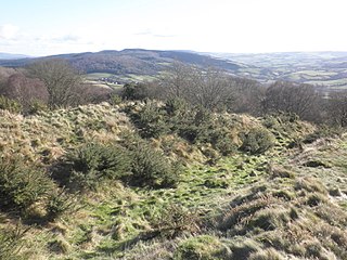
Burledge Hill is on the southern edge of the village of Bishop Sutton, Somerset, England. It is the site of a Site of Special Scientific Interest and an univallate Iron Age hill fort.

Dolebury Warren hillfort in North Somerset

Dolebury Warren is a 90.6 hectares biological Site of Special Scientific Interest (SSSI) and ancient monument near the villages of Churchill and Rowberrow in North Somerset, part of South West England. It is owned by the National Trust, who acquired the freehold in 1983, and managed by the Avon Wildlife Trust.

Norton Camp Bronze Age hill fort in Somerset, England

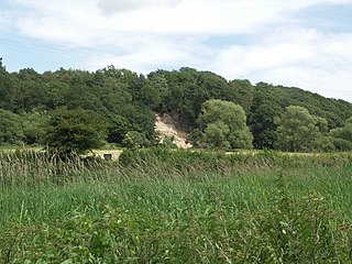
Norton Camp is a Bronze Age hill fort at Norton Fitzwarren near Taunton in Somerset, England.

Blackers Hill hill fort in Somerset, England

Blacker's Hill is an Iron Age hill fort at Chilcompton, 4.5 kilometres (3 mi) south west of Radstock, Somerset, England. It has been designated as a Scheduled Ancient Monument.

Bury Castle, Selworthy hillfort in Somerset

Bury Castle is an Iron Age hill fort near Selworthy, Somerset, England. It has been scheduled as an ancient monument.

Burrough Hill Iron Age hill fort in Leicestershire, UK

Burrough Hill is an Iron Age hillfort in Burrough on the Hill, 7 miles (11 km) south of Melton Mowbray in the English county of Leicestershire. Situated on a promontory about 210 metres (690 ft) above sea level, the site commands views over the surrounding countryside for miles around. There has been human activity in the area since at least the Mesolithic, and the hillfort was founded in the early Iron Age. In the medieval period, after the hillfort was abandoned, the hill was used as farmland. This ended in the 17th century when the parish the hill was in was enclosed. Traces of ridge and furrow show where the medieval fields were ploughed. Since the 1930s the site has been the subject of archaeological investigations and renewed excavations under the auspices of the University of Leicester began in 2010. Part of Burrough Hill Country Park and open to the public, the hillfort is protected as a Scheduled Ancient Monument.

Frankenbury Camp

Frankenbury Camp is the site of an Iron Age univallate hillfort located in Hampshire. The site is on a very slight promontory overlooking the Avon Valley on the north-western edge of the New Forest. The fort encloses approximately 11 acres. It has very steep natural slopes on the west and south sides. The northeast sides are defended by a simple rampart and ditch. The original entrance on the southeast corner has since been widened. It is listed as a scheduled ancient monument no.122. The site is currently pasture, and part of Folds Farm, for the most part, although the earthworks themselves are lined with trees and the south and western parts are now encroached by woodland. Various archaeological relics have been found in the area:

Bury Camp site of an Iron Age multivallate hillfort located in Wiltshire, England

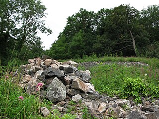
Bury Camp is the site of an Iron Age multivallate hillfort in Wiltshire, England. It occupies a triangular promontory of Colerne Down at the southern edge of the Cotswold Hills between two spurs of a river valley. The enclosed area of approximately 9.2ha is surrounded by a ditch 4m wide and up to 1m deep, and an outer rampart up to 1.5m high on the east and northwestern sides and up to 2m high on the southwestern side, across the neck of the promontory.

Worlebury Camp hillfort in North Somerset

Worlebury Camp is the site of an Iron Age hillfort on Worlebury Hill, north of Weston-super-Mare in Somerset, England. The fort was designed for defence, as is evidenced by the number of walls and ditches around the site. Several large triangular platforms have been uncovered around the sides of the fort, lower down on the hillside. Nearly one hundred storage pits of various sizes were cut into the bedrock, and many of these had human remains, coins, and other artefacts in them. During the 19th and 20th centuries the fort has suffered damage and been threatened with complete destruction on multiple occasions. The site has been designated a Scheduled monument; it falls within the Weston Woods Local Nature Reserve which was declared to Natural England by North Somerset Council in 2005.

Burgh Walls Camp hillfort in North Somerset

Burgh Walls Camp is a multivallate Iron Age hill fort in the North Somerset district of Somerset, England. The hill fort is situated within Leigh Woods approximately 1.6 miles (2.6 km) north-east from the village of Long Ashton near Bristol, above the banks of the River Avon. The hillfort has some alternative names such as Bower Walls Camp, Burwalls, or Bowre Walls.

Promontory forts of Cornwall

Cornish promontory forts, commonly known in Cornwall as cliff castles, are coastal equivalents of the hill forts and Cornish "rounds" found on Cornish hilltops and slopes. Similar coastal forts are found on the north–west European seaboard, in Normandy, Brittany and around the coastlines of the British Isles, especially in Wales, Scotland and Ireland. Many are known in southwest England, particularly in Cornwall and its neighbouring county, Devon. Two have been identified immediately west of Cornwall, in the Isles of Scilly.

Dudsbury Camp hillfort in Dorset, UK

Dudsbury Camp is one of a series of Iron Age earthworks in Dorset, starting from Hambledon Hill, and including Hod Hill, Spetisbury Rings, Buzbury Rings, Badbury Rings and Dudsbury Camp. The Iron Age port at Hengistbury Head forms a final Iron Age monument in this small chain of sites. The fort is located near the village of West Parley.

Caesars Camp, Rushmoor and Waverley Iron Age hill fort on the Surrey/Hampshire border, England

Caesar's Camp is an Iron Age hill fort straddling the border of the counties of Surrey and Hampshire in southern England. The fort straddles the borough of Waverley in Surrey and the borough of Rushmoor and the district of Hart, both in Hampshire. Caesar's Camp is a Scheduled Ancient Monument with a list entry identification number of 1007895. It lies approximately 3 kilometres (1.9 mi) north of the town of Farnham, and a similar distance west of Aldershot. The hillfort lies entirely within the Bourley and Long Valley Site of Special Scientific Interest. Caesar's Camp is a multivallate hillfort, a fort with multiple defensive rings, occupying an irregular promontory, with an entrance on the south side. The site has been much disturbed by military activity, especially at the southeast corner. The remains of the hillfort are considered to be of national importance.

The Bulwarks, Porthkerry hillfort in Vale of Glamorgan

The Bulwarks, Porthkerry is a promontory fort in Rhoose, Vale of Glamorgan, on the southern coast of Wales overlooking the Bristol Channel. It probably dates to the Iron Age and continued to be occupied during the Roman period in Britain. The ramparts and ditches along the west side are well preserved, but the fortifications are heavily overgrown.

Trevelgue Head Headland in Cornwall

Trevelgue Head, also known as Porth Island, is a headland a short distance north-east of Newquay, in Cornwall, England. It is adjacent to Porth and is at the eastern end of Newquay Bay.

References

  1. 1 2 3 4 5 Historic England. "Stokeleigh Camp (198375)". PastScape. Retrieved 30 January 2011.
  2. 1 2 3 4 Bain, Nigel B. (2009). "Stokeleigh Camp". villages of Wraxall and Failand. Retrieved 29 January 2011.[ permanent dead link ]
  3. Page, William (1906). "Early Man". A History of the County of Somerset: Volume 1. British History Online. Retrieved 30 January 2011.
  4. "Stokeleigh Camp Hillfort". Hillfort in England in Somerset. Megalithic Portal. Retrieved 26 December 2010.
  5. "Stokeleigh Camp". Roman Britain. Archived from the original on 3 July 2011. Retrieved 29 January 2011.
  6. Haldane, J.W. (1966). "Stokeleigh Camp, Somerset" (PDF). Proceedings of the University of Bristol Spelæological Society. Bristol: University of Bristol Spelæological Society. 11 (1): 31–38. Retrieved 30 January 2011.
  7. "Stokeleigh Camp". English Heritage . Retrieved 30 January 2011.
  8. "Where I Live: Bristol". British Broadcasting Corporation. October 2004. Retrieved 26 December 2010.