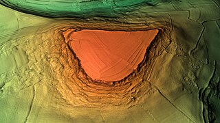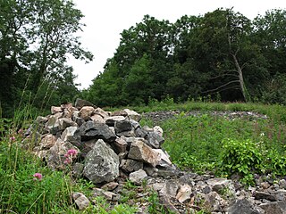
A hillfort is a type of earthwork used as a fortified refuge or defended settlement, located to exploit a rise in elevation for defensive advantage. They are typically European and of the Bronze Age or Iron Age. Some were used in the post-Roman period. The fortification usually follows the contours of a hill and consists of one or more lines of earthworks, with stockades or defensive walls, and external ditches. Hillforts developed in the Late Bronze and Early Iron Age, roughly the start of the first millennium BC, and were used in many Celtic areas of central and western Europe until the Roman conquest.

Little Solsbury Hill is a small flat-topped hill and the site of an Iron Age hill fort, above the village of Batheaston in Somerset, England. The hill rises to 625 feet (191 m) above the River Avon, which is just over 1 mile (2 km) to the south, and gives views of the city of Bath and the surrounding area. It is within the Cotswolds Area of Outstanding Natural Beauty.

Cadbury Castle is a Bronze and Iron Age hillfort in the civil parish of South Cadbury in the English county of Somerset. It is a scheduled monument and has been associated with King Arthur's legendary court at Camelot.
Cadbury Hill is a small hill, mostly in the civil parish of Congresbury, overlooking the village of Yatton in North Somerset. On its summit stands an Iron Age hill fort, which is a Scheduled Ancient Monument.

Worlebury Hill is the name given to an upland area lying between the flatlands of Weston-super-Mare and the Kewstoke area of North Somerset, England. Worlebury Hill's rises from sea level to its highest point of 109 metres (358 ft), and the western end of the hill forms a peninsula, jutting out into the Bristol Channel, between Weston Bay and Sand Bay. A toll road follows the coast around the hill from Sand Bay in the north to the now derelict Birnbeck Pier in the west, although tolls are not currently collected on the road. Worlebury Golf Club is situated on the Hill and the area is known for being one of the wealthiest areas in the county of Somerset.

Burledge Hill is on the southern edge of the village of Bishop Sutton, Somerset, England. It is the site of a Site of Special Scientific Interest and an univallate Iron Age hillfort.

Dolebury Warren is a 90.6 hectares biological Site of Special Scientific Interest (SSSI) and ancient monument near the villages of Churchill and Rowberrow in North Somerset, part of South West England. It is owned by the National Trust, who acquired the freehold in 1983, and managed by the Avon Wildlife Trust.

Cleeve Toot is an Iron Age univallate hillfort above Goblin Combe, Cleeve, Somerset, England. It is a Scheduled Ancient Monument.

Norton Camp is a Bronze Age hill fort at Norton Fitzwarren near Taunton in Somerset, England.

Clatworthy Camp is an Iron Age hill fort 3 miles (4.8 km) North West of Wiveliscombe, Somerset, England. It has been scheduled as an Ancient Monument. Due to the vulnerability to scrub and tree growth it has been added to the Heritage at Risk Register.
Kingsdown Camp is an Iron Age hill fort at Buckland Dinham 4.5 kilometres (3 mi) South East of Radstock, Somerset, England. It is a Scheduled Ancient Monument.

Sweetworthy is the site of two Iron Age hill forts or enclosures at Luccombe, 4 kilometres (2 mi) south of Porlock, Somerset, England. They are on the north-facing slope of Dunkery Hill. One has a single rampart and external ditch, enclosing 0.25 hectares. The rampart is still visible and the ditch on the east side is used as a trackway. There was a defended settlement above the main site.
Mellor hill fort is a prehistoric site in North West England, that dates from the British Iron Age—about 800 BC to 100 AD. Situated on a hill in Mellor, Greater Manchester, on the western edge of the Peak District, the hill fort overlooks the Cheshire Plain. Although the settlement was founded during the Iron Age, evidence exists of activity on the site as far back as 8,000 BC; during the Bronze Age the hill may have been an area where funerary practices were performed. Artefacts such as a Bronze Age amber necklace indicate the site was high status and that its residents took part in long-distance trade. The settlement was occupied into the Roman period. After the site was abandoned, probably in the 4th century, it was forgotten until its rediscovery in the 1990s.

Worlebury Camp is the site of an Iron Age hillfort on Worlebury Hill, north of Weston-super-Mare in Somerset, England. The fort was well defended with numerous walls, embankments and ditches around the site. Several large triangular platforms have been uncovered around the sides of the fort, lower down on the hillside. Nearly one hundred storage pits of various sizes were cut into the bedrock, and many of these had human remains, coins, and other artefacts in them. During the 19th and 20th centuries the fort suffered damage and was threatened with complete destruction on multiple occasions. Now, the site is a designated Scheduled monument. it falls within the Weston Woods Local Nature Reserve which was declared to Natural England by North Somerset Council in 2005.

Brent Knoll Camp is an Iron Age hillfort at Brent Knoll, 3 kilometres (1.9 mi) from Burnham-on-Sea, Somerset, England. It has been designated as a Scheduled Monument, and is now in the care of the National Trust.

Stokeleigh Camp is an Iron Age promontory fort in Leigh Woods North Somerset near Bristol, England. The hill fort is one of three Iron Age fortifications overlooking the Avon Gorge, the others being Burgh Walls Camp south of the Nightingale Valley, of which almost no trace remains, and the other being Clifton Down Camp on the opposite side of the gorge, on Clifton Down near the Observatory. A prehistoric road is believed to have connected Stokeleigh Camp with Cadbury Camp near Tickenham in North Somerset.

Sigwells is a hamlet located in an area rich in archaeology remains, overlooking Cadbury Castle in Somerset, England.


