The Avon Wildlife Trust aims to protect and promote wildlife in the area of the former county of Avon — now Bath and North East Somerset, Bristol, North Somerset and South Gloucestershire, in England. It has its headquarters in Bristol and runs wildlife centres at Folly Farm, Somerset and Feed Bristol, Frenchay, North Bristol.

The Avon Gorge is a 1.5-mile (2.5-kilometre) long gorge on the River Avon in Bristol, England. The gorge runs south to north through a limestone ridge 1.5 miles (2.4 km) west of Bristol city centre, and about 3 miles (5 km) from the mouth of the river at Avonmouth. The gorge forms the boundary between the unitary authorities of North Somerset and Bristol, with the boundary running along the south bank. As Bristol was an important port, the gorge formed a defensive gateway to the city.
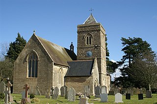
Weston in Gordano is a village and civil parish in Somerset, England. It is situated in the middle of the Gordano valley on the north side, and in the Unitary Authority of North Somerset, on the road between Clevedon and Portishead. The parish has a population of 301.

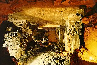
Leigh Woods is a 2-square-kilometre (0.77 sq mi) area of woodland on the south-west side of the Avon Gorge, close to the Clifton Suspension Bridge, within North Somerset opposite the English city of Bristol and north of the Ashton Court estate, of which it formed a part. Stokeleigh Camp, a hillfort thought to have been occupied from the third century BC to the first century AD and possibly also in the Middle Ages, lies within the reserve on the edge of the Nightingale Valley. On the bank of the Avon, within the reserve, are quarries for limestone and celestine which were worked in the 18th and 19th centuries are now derelict.

Folly Farm is a traditionally managed working farm and nature reserve run by the Avon Wildlife Trust. It is located between Stowey, Clutton and Stanton Wick in the civil parish of Stowey in the English county of Somerset.
Brown's Folly or Brown's Folly is a folly tower sitting within a 39.9 hectare biological and geological Site of Special Scientific Interest (SSSI) near the village of Bathford in Somerset, notified in 1974: the site itself is known as the Farleigh Down Stone Quarry, and is managed as a nature reserve by the Avon Wildlife Trust (AWT). The tower was built in 1848 and is a Grade II listed building.
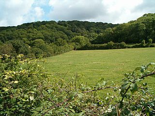
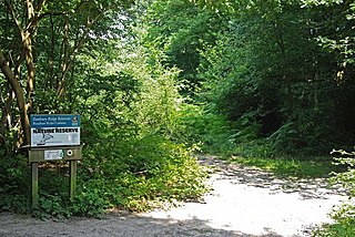
Weston Big Wood is a 37.48 hectare woodland west of the town of Portishead, North Somerset, England. It is a nature reserve and biological Site of Special Scientific Interest, notified in 1971. The wood takes its name from the nearby village of Weston-in-Gordano.

Lower Woods is a 280.1-hectare (692-acre) biological and geological Site of Special Scientific Interest near the village of Wickwar, South Gloucestershire, notified in 1966 and renotified in 1985. The site area has increased at last revision in 1974 to a 284.1-hectare (702-acre) site. The site is a nature reserve managed by the Gloucestershire Wildlife Trust.
Aller and Beer Woods is a 56.9 hectares biological Site of Special Scientific Interest. off the A372 Othery to Langport road near Aller in Somerset. It was notified in 1952.

Stockwood is a residential area and council ward in south Bristol, between Whitchurch and Brislington, and west of the Somerset town of Keynsham.

Willsbridge is a village in the unitary authority of South Gloucestershire, England, located on the outskirts of Bristol. Willsbridge Castle, situated on a prominent hillside site, was built around 1730, with crenellations added in the nineteenth century.

Sheepleas is a 99.9-hectare (247-acre) biological and geological Site of Special Scientific Interest east of Guildford in Surrey. It is a Geological Conservation Review site and a Local Nature Reserve. It is owned by Surrey County Council and managed by the Surrey Wildlife Trust.

Portbury Ashlands which is now known as Portbury Wharf Nature Reserve is a nature reserve between Portishead and the Royal Portbury Dock in Somerset, England. It was formed from the redevelopment of the area of Portishead formerly occupied by two power stations. To the east of the harbour, an area known as "the Ashlands" was used for over 50 years to get rid of power station waste which was dumped into lagoons on the site.
There are several nature reserves in the surroundings of Nailsea, North Somerset, England, which is located at 51°25′55″N2°45′49″W.

Collinpark Wood is a 66.69-hectare (164.8-acre) biological Site of Special Scientific Interest in Gloucestershire, notified in 1966, revised in 1974 and renotified in 1983. There was a boundary change in 1983. There are seven units of assessment. Unit 1 is a 15-hectare (37-acre) area owned and managed by the Gloucestershire Wildlife Trust. The trust purchased this part of the wood in 1979 with grant aid from WWF. The site is listed in the 'Forest of Dean Local Plan Review' as a Key Wildlife Site (KWS).
Woodham Walter Common SSSI is an 80-hectare (200-acre) biological Site of Special Scientific Interest (SSSI) in Danbury in Essex. The site includes six nature reserves within the Danbury Ridge Nature Reserves, managed by the Essex Wildlife Trust. These are Woodham Walter Common itself, Birch Wood, Pheasanthouse Wood, Poors' Piece, Scrubs Wood and a small area in Pheasanthouse Farm. The largest part of the SSSI is the 32.3-hectare (80-acre) Woodham Walter Common, which is managed by the Wildlife Trust on behalf of Maldon District Council and Woodham Walter Parish Council.

Danbury Ridge Nature Reserves are a group of nature reserves totalling 101 hectares near Danbury in Essex, England. They are managed by the Essex Wildlife Trust, and most of them are in Sites of Special Scientific Interest (SSSIs). Two areas, the Backwarden and Hitchcock's Meadow, are part of Danbury Common SSSI, and Woodham Walter Common, Birch Wood, Pheasanthouse Wood, Poors Piece, Scrubs Wood, and a small area in Pheasanthouse Farm, are part of Woodham Walter Common SSSI.

