
The Kingsway tramway subway is a cut-and-cover tunnel in central London, built by the London County Council, and the only one of its kind in Britain. The decision in 1898 to clear slum districts in the Holborn area provided an opportunity to use the new streets for a tramway connecting the lines in the north and south. Following the pattern of tramways in New York and Boston, it was decided to build this as an underground connection.

Holborn is a London Underground station in Holborn, Central London, located at the junction of High Holborn and Kingsway. It is served by the Central and Piccadilly lines. On the Central line the station is between Tottenham Court Road and Chancery Lane stations and on the Piccadilly line it is between Covent Garden and Russell Square stations. The station is in Travelcard Zone 1. Close by are the British Museum, Lincoln's Inn Fields, Red Lion Square, Bloomsbury Square, London School of Economics and Sir John Soane's Museum.

The Blackwall Tunnel is a pair of road tunnels underneath the River Thames in east London, England, linking the London Borough of Tower Hamlets with the Royal Borough of Greenwich, and part of the A102 road. The northern portal lies just south of the East India Dock Road (A13) in Blackwall; the southern entrances are just south of The O2 on the Greenwich Peninsula. The road is managed by Transport for London (TfL).

The Rotherhithe Tunnel, designated the A101, is a road tunnel under the River Thames in East London, connecting Limehouse in the London Borough of Tower Hamlets north of the river to Rotherhithe in the London Borough of Southwark south of the river. It was formally opened in 1908 by George, Prince of Wales, and Richard Robinson, Chairman of the London County Council. It is a rare example of a road tunnel where road traffic, pedestrians and cyclists all share the same tunnel bore. Transport for London took over ownership and maintenance of the tunnel in 2001.
Aldwych tramway station was a tram stop underneath Kingsway, a road in central London, England. It was built in 1906 by the London County Council Tramways as part of the Kingsway tramway subway, joining the separate networks of tramways in North and South London.

Holborn tramway station was a tram stop underneath Kingsway in central London, England. It was built in 1906 by the London County Council Tramways as part of the Kingsway tramway subway, joining the separate networks of tramways in North and South London. When opened it was named Great Queen Street.
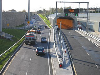
The Dublin Tunnel, originally and still commonly known as the Port Tunnel, is a road traffic tunnel in Dublin, Ireland, that forms part of the M50 motorway.

A median strip, central reservation, roadway median, or traffic median is the reserved area that separates opposing lanes of traffic on divided roadways such as divided highways, dual carriageways, freeways, and motorways. The term also applies to divided roadways other than highways, including some major streets in urban or suburban areas. The reserved area may simply be paved, but commonly it is adapted to other functions; for example, it may accommodate decorative landscaping, trees, a median barrier, or railway, rapid transit, light rail, or streetcar lines.

In civil engineering, grade separation is a method of aligning a junction of two or more surface transport axes at different heights (grades) so that they will not disrupt the traffic flow on other transit routes when they cross each other. The composition of such transport axes does not have to be uniform; it can consist of a mixture of roads, footpaths, railways, canals, or airport runways. Bridges, tunnels, or a combination of both can be built at a junction to achieve the needed grade separation.
There have been two separate generations of trams in London, from 1860 to 1952 and from 2000 to the present. There were no trams at all in London between 1952 and 2000.

Queensway is the name of a number of roads in central Birmingham, England, but most often refers to the Queensway tunnel, part of the A38. Queensway is the suffix of several other roads and circuses, such as Smallbrook Queensway and Colmore Circus Queensway; all of which were once part of the historic A4400 Inner Ring Road, often called collectively the Queensway.
South Road and its southern section as Main South Road outside of Adelaide is a major north–south conduit connecting Adelaide and the Fleurieu Peninsula, in South Australia. It is one of Adelaide's most important arterial and bypass roads. As South Road, it is designated part of route A2 within suburban Adelaide. As Main South Road, it is designated part of routes A13 and B23.

The A4200 is a major thoroughfare in central London. It runs between the A4 at Aldwych, to the A400 Hampstead Road/Camden High Street, at Mornington Crescent tube station, via Holborn, Bloomsbury, Euston and Somers Town.

A subway, also known as an underpass, is a grade-separated pedestrian crossing running underneath a road or railway in order to entirely separate pedestrians and cyclists from motor or train traffic.

The Frankfurt am Main tramway network is a network of tramways forming a major part of the public transport system in Frankfurt am Main, a city in the federal state of Hesse, Germany.

The U1 is an underground line in Nuremberg. The first part of the line was opened on 1 March 1972. It is about 18.5 kilometres (11.5 mi) long and has 27 stations. The termini are Langwasser Süd in the southeast and Fürth Hardhöhe in the northwest. Until 11 December 2016 it shared tracks with the former booster line U11 between Eberhardshof and Messe. Those services are still run but no longer designated U11, instead being signed U1 like trains doing the full Langwasser-Hardhöhe run. Unlike U2 and U3 all trains are operated by a driver and there are no plans to automate U1.

The A line is the north-to-south main line of the Frankfurt U-Bahn. It is the oldest and longest line of the U-Bahn system. Served by four routes starting at Südbahnhof Railway Station in Sachsenhausen, the A line runs through downtown Frankfurt up to Heddernheim Station in the north of the city, where it branches out to Ginnheim, Oberursel (U3), Riedberg and Bad Homburg (U2). The U9 service between Ginnheim, Riedberg and Nieder-Eschbach does not use the central section and tunnels of the line, making it the only light rail service of the network that does not serve downtown Frankfurt. The Riedberg and Ginnheim branches were planned as parts of the future D line subway but are operationally part of the A line until the D line development and construction is finished.

The C Line is the third line of the Frankfurt U-Bahn. It opened on 11 October 1986 and runs east-west through the city centre via Hauptwache and Konstablerwache. In the East it has branches to Frankfurt Ost railway station and Enkheim. To the North-west of the city centre it runs under Bockenheimer Landstraße before splitting into two branches to Hausen and Praunheim. The main services on the line are the U6 and U7 (Praunheim-Enkheim). Part of the branch to Enkheim also carries U4 services.

The Hardbrücke is a 1,350 metres (4,430 ft) long road bridge and important north–south connection in the Swiss city of Zürich. As of 2009, 70,000 vehicles use the bridge daily.

The Royal Commission on London Traffic was a royal commission established in 1903 with a remit to review and report on how transport systems should be developed for London and the surrounding area. It produced a report in eight volumes published in 1905 and made recommendations on the character, administration and routing of traffic in London.

