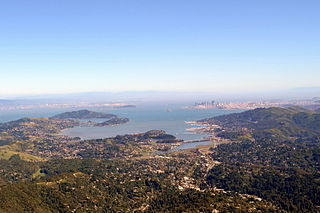
San Francisco Bay is a shallow estuary in the US state of California. It is surrounded by a contiguous region known as the San Francisco Bay Area, and is dominated by the large cities of San Francisco, San Jose, and Oakland.

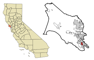
Strawberry, California is a census-designated place (CDP) and an unincorporated district of Marin County, California, United States. Strawberry shares a zip code (94941) with Mill Valley and falls within its school districts, however, it is considered within the sphere of influence of the Town of Tiburon. It is separated from Mill Valley by U.S. Route 101. The population was 5,393 at the 2010 census.

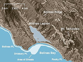
Bolinas Lagoon is a tidal estuary, approximately 1,100 acres (4.5 km2) in area, located in the West Marin region of Marin County, California, United States, adjacent to the town of Bolinas. It is a part of the Greater Farallones National Marine Sanctuary and is considered to be among the possible landing spots of Sir Francis Drake on the west coast of North America in 1579.

Point Reyes (re-ʝes) is a prominent cape and popular Northern California tourist destination on the Pacific coast. It is located in Marin County, and approximately 30 miles (50 km) west-northwest of San Francisco. The term is often applied to the Point Reyes Peninsula, the region bounded by Tomales Bay on the northeast and Bolinas Lagoon on the southeast. The headland is protected as part of Point Reyes National Seashore.

Bodega Harbor is a small, shallow, natural harbor on the Pacific coast of northern California in the United States, approximately 40 mi (64 km) northwest of San Francisco. The harbor is approximately 2 sq mi (5.2 km2) in area.

Humboldt Bay is a natural bay and a multi-basin, bar-built coastal lagoon located on the rugged North Coast of California, entirely within Humboldt County, United States. It is the largest protected body of water on the West Coast between San Francisco Bay and Puget Sound, the second-largest enclosed bay in California, and the largest port between San Francisco and Coos Bay, Oregon. The largest city adjoining the bay is Eureka, the regional center and county seat of Humboldt County, followed by the town of Arcata. These primary cities, together with adjoining unincorporated communities and several small towns, comprise a Humboldt Bay Area total population of nearly 80,000 people. This comprises nearly 60% of the population of Humboldt County. The bay is home to more than 100 plant species, 300 invertebrate species, 100 fish species, and 200 bird species. In addition, the bay and its complex system of marshes and grasses support hundreds of thousands of migrating and local shore birds. Commercially, this second-largest estuary in California is the site of the largest oyster production operations on the West Coast, producing more than half of all oysters farmed in California.

Richardson Bay is a shallow, ecologically rich arm of San Francisco Bay, managed under a Joint Powers Agency of four northern California cities. The 911-acre (369 ha) Richardson Bay Sanctuary was acquired in the early 1960s by the National Audubon Society. The bay was named for William A. Richardson, early 19th century sea captain and builder in San Francisco. It contains both Strawberry Spit and Aramburu Island.

Bay Farm Island is a district of the city of Alameda, California, though it is separated from the rest of the city on Alameda Island by an estuary of San Leandro Bay. Its ZIP code is 94502. The location was originally an island in San Francisco Bay, but due to land reclamation it has become a peninsula and is now connected to the mainland of Oakland and Oakland International Airport. Marshes and other areas of the island were also reclaimed.

The Pacific Flyway is a major north-south flyway for migratory birds in America, extending from Alaska to Patagonia. Every year, migratory birds travel some or all of this distance both in spring and in fall, following food sources, heading to breeding grounds, or travelling to overwintering sites.

The Homer Spit is a geographical landmark located in Homer, Alaska on the southern tip of the Kenai Peninsula. The spit is a 4.5-mile (7.2 km) long piece of land jutting out into Kachemak Bay. The spit is also home to the Homer Boat Harbor. The harbor contains both deep and shallow water docks and serves up to 1500 commercial and pleasure boats at its summer peak. Additional features and attractions include The Nick Dudiak Fishing Lagoon, which is an artificial "fishing hole", campgrounds, hotels, and restaurants and the Salty Dawg Saloon, which is constructed out of several historic buildings from Homer. Hundreds of eagles formerly gathered there in winter to be fed by Jean Keene, the "Eagle Lady". The Spit features the longest road into ocean waters in the entire world, taking up 10–15 minutes to cover by car.

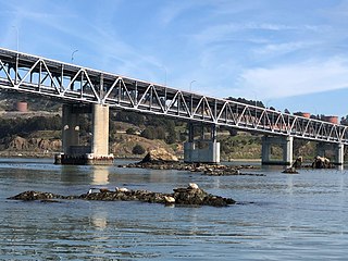
The Castro Rocks are several rocks in Richmond, California protruding from the waters in San Francisco Bay between Castro Point and Red Rock Island.The rocks lie almost directly under the Richmond-San Rafael Bridge (I-580).

Mowry Slough is a 5.8-mile-long (9.3 km) slough in Don Edwards San Francisco Bay National Wildlife Refuge and is the primary breeding ground for San Francisco Bay harbor seals. It is situated among the salt marshes and salt evaporation ponds in the city of Fremont.

Strawberry Lagoon is an inlet within Richardson Bay, Marin County, California, United States. This location, particularly on Strawberry Spit, is a winter haul-out area for the Harbor seal. Pressures of urban development at Strawberry Point along with increases in small boat traffic have diminished the use of this lagoon for seal haul out, noted as early as 1990.

Belvedere Island is a rocky island in the San Francisco Bay in Marin County, California which was formerly separated by a marsh from the mainland, though has since been linked by two spits. Part of the town of Belvedere, California is located on the island.

Belvedere Lagoon is an artificial lagoon on San Francisco Bay in Belvedere in Marin County, California. Narrow strips of land separate it from Richardson Bay and Raccoon Strait.

Triangle Marsh is a wetland of the San Francisco Bay, situated at the base of Ring Mountain at the north end of the Tiburon Peninsula in Marin County, California.

The harborseal, also known as the common seal, is a true seal found along temperate and Arctic marine coastlines of the Northern Hemisphere. The most widely distributed species of pinniped, they are found in coastal waters of the northern Atlantic, Pacific Oceans, Baltic and North Seas.
Guadalupe Creek or Guadalupe Valley Creek is a short eastward-flowing stream whose watershed originates just east of the highest peak of San Bruno Mountain in San Mateo County, California, United States. It courses through San Bruno Mountain State and County Park and Brisbane before entering the Brisbane Lagoon.

Greco Island is a wetland island in Redwood City, California. Greco Island is part of the larger Don Edwards San Francisco Bay National Wildlife Refuge. Westpoint Slough follows the South side of the island while Redwood Creek is along the West. The San Francisco Bay bounds the North and East sides of the island.

Aramburu Island (ah-ram-boo-ru) is a 17-acre (6.9 ha) island in Richardson Bay, Marin County, California. Its coordinates are 37°53′29″N122°30′8″W. It was created in the early 1960s using dredged material, and later turned into "sustainable bird habitat".


