Strzelce Leśne

Last updated
Strzelce Leśne
Village
Country Flag of Poland.svg  Poland
Voivodeship Kuyavian-Pomeranian
County Bydgoszcz County
Gmina Osielsko
Population 8

Strzelce Leśne [ˈstʂɛlt͡sɛ ˈlɛɕnɛ] (German : Forsthaus Strelitz) is a village in the administrative district of Gmina Osielsko, within Bydgoszcz County, Kuyavian-Pomeranian Voivodeship, in north-central Poland. [1]

German language West Germanic language

German is a West Germanic language that is mainly spoken in Central Europe. It is the most widely spoken and official or co-official language in Germany, Austria, Switzerland, South Tyrol (Italy), the German-speaking Community of Belgium, and Liechtenstein. It is also one of the three official languages of Luxembourg and a co-official language in the Opole Voivodeship in Poland. The languages which are most similar to German are the other members of the West Germanic language branch: Afrikaans, Dutch, English, the Frisian languages, Low German/Low Saxon, Luxembourgish, and Yiddish. There are also strong similarities in vocabulary with Danish, Norwegian and Swedish, although those belong to the North Germanic group. German is the second most widely spoken Germanic language, after English.

Gmina Osielsko Gmina in Kuyavian-Pomeranian, Poland

Gmina Osielsko is a rural gmina in Bydgoszcz County, Kuyavian-Pomeranian Voivodeship, in north-central Poland. Its seat is the village of Osielsko, which lies approximately 9 kilometres (6 mi) north-east of Bydgoszcz.
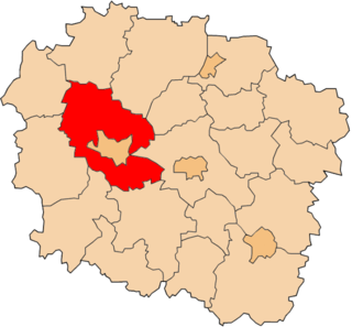
Bydgoszcz County County in Kuyavian-Pomeranian, Poland

Bydgoszcz County is a unit of territorial administration and local government (powiat) in Kuyavian-Pomeranian Voivodeship, north-central Poland. It was created on 1 January 1999 as a result of the Polish local government reforms passed in 1998. Its administrative seat is the city of Bydgoszcz, although the city is not part of the county. The only towns in Bydgoszcz County are Solec Kujawski, which lies 17 km (11 mi) east of Bydgoszcz, and Koronowo, 23 km (14 mi) north of Bydgoszcz.

The village has a population of 8.

Related Research Articles

Zeya River river in Russia

Zeya River, 1,242 km long, is a northern tributary of the Amur River. It rises in the Tokiysky Stanovik mountain ridge, a part of the Stanovoy Range. The first Russian to enter the area was Vassili Poyarkov.

Brąchnówko Village in Kuyavian-Pomeranian, Poland

Brąchnówko is a village in the administrative district of Gmina Chełmża, within Toruń County, Kuyavian-Pomeranian Voivodeship, in north-central Poland. It lies approximately 7 kilometres (4 mi) south of Chełmża and 14 km (9 mi) north of Toruń.

Bieszewo is a village in the administrative district of Gmina Cekcyn, within Tuchola County, Kuyavian-Pomeranian Voivodeship, in north-central Poland.

Brzozie, Tuchola County Village in Kuyavian-Pomeranian, Poland

Brzozie is a village in the administrative district of Gmina Cekcyn, within Tuchola County, Kuyavian-Pomeranian Voivodeship, in north-central Poland. It lies approximately 7 kilometres (4 mi) east of Cekcyn, 17 km (11 mi) east of Tuchola, and 53 km (33 mi) north of Bydgoszcz.

Wysoka is a village in the administrative district of Gmina Cekcyn, within Tuchola County, Kuyavian-Pomeranian Voivodeship, in north-central Poland.

Zielonka, Gmina Cekcyn Village in Kuyavian-Pomeranian, Poland

Zielonka is a village in the administrative district of Gmina Cekcyn, within Tuchola County, Kuyavian-Pomeranian Voivodeship, in north-central Poland.

Woodhall Junction railway station


Woodhall Junction railway station is a former station in Woodhall, Lincolnshire. It served as a junction where several different lines met, none of which are still open.

Olszanka is a village in the administrative district of Gmina Szypliszki, within Suwałki County, Podlaskie Voivodeship, in north-eastern Poland, close to the border with Lithuania.

Łąg-Kolonia is a village in the administrative district of Gmina Czersk, within Chojnice County, Pomeranian Voivodeship, in northern Poland.

Dương Sơn Commune and village in Bắc Kạn Province, Vietnam

Dương Sơn is a commune () and village in Na Rì District, Bắc Kạn Province, in Vietnam.

Gaúcha do Norte is a municipality in the state of Mato Grosso in the Central-West Region of Brazil.

Vera Cruz do Oeste is a municipality in the state of Paraná in the Southern Region of Brazil.

Sanmen County railway station is a railway station of Yongtaiwen Railway located in Zhejiang, People's Republic of China.

Lincolnshire loop line

The Lincolnshire loop line was a 58-mile (93 km) double-track railway built by the Great Northern Railway, that linked Peterborough to Lincoln via Spalding and Boston.

Lower Hartshay village in United Kingdom

Lower Hartshay is a very small village in the Amber Valley District, in the English county of Derbyshire. It is on Hartshay Brook and near the A38 road. The nearest town is Ripley. There is the corresponding hamlet of Upper Hartshay just south.

Hacıbeyli is a village in the District of İhsaniye, Afyonkarahisar Province, Turkey.

Pobretići is a village in Bijelo Polje Municipality, in northern Montenegro. According to the 2003 census, the village had a population of 182 people.

Tomaševo is a village in Bijelo Polje Municipality, in northern Montenegro. According to the 2003 census, the village had a population of 282 people. The village was formerly known as Šahovići (Шаховићи), until 1952.

Hseiniyeh - Tell Kalba is a Syrian village located in Abu al-Duhur Nahiyah in Idlib District, Idlib. According to the Syria Central Bureau of Statistics (CBS), Hseiniyeh - Tell Kalba had a population of 2419 in the 2004 census.

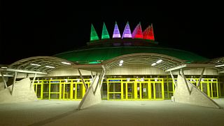
Tüskecsarnok

Tüskecsarnok is a multi-purpose indoor arena in Budapest, Hungary. It is primarily used for ice sports and is the home arena of Hungarian top division ice hockey club MAC Budapest.

References


Coordinates: 53°14′31″N18°03′28″E / 53.2419°N 18.0578°E / 53.2419; 18.0578

Geographic coordinate system Coordinate system

A geographic coordinate system is a coordinate system that enables every location on Earth to be specified by a set of numbers, letters or symbols. The coordinates are often chosen such that one of the numbers represents a vertical position and two or three of the numbers represent a horizontal position; alternatively, a geographic position may be expressed in a combined three-dimensional Cartesian vector. A common choice of coordinates is latitude, longitude and elevation. To specify a location on a plane requires a map projection.