
Sianki is a former village in the administrative district of Gmina Lutowiska, within Bieszczady County, Subcarpathian Voivodeship, in south-eastern Poland, on the border with Ukraine. It lies approximately 30 kilometres (19 mi) south-east of Lutowiska, 51 km (32 mi) south-east of Ustrzyki Dolne, and 130 km (81 mi) south-east of the regional capital Rzeszów.

Caryńskie is a village in the administrative district of Gmina Lutowiska, within Bieszczady County, Subcarpathian Voivodeship, in south-eastern Poland, close to the border with Ukraine. It lies approximately 11 kilometres (7 mi) south-west of Lutowiska, 30 km (19 mi) south of Ustrzyki Dolne, and 106 km (66 mi) south-east of the regional capital Rzeszów.
Chmiel is a village in the administrative district of Gmina Lutowiska, within Bieszczady County, Subcarpathian Voivodeship, in south-eastern Poland, close to the border with Ukraine. It lies approximately 8 kilometres (5 mi) south-west of Lutowiska, 24 km (15 mi) south of Ustrzyki Dolne, and 100 km (62 mi) south-east of the regional capital Rzeszów.
Dwerniczek is a village in the administrative district of Gmina Lutowiska, within Bieszczady County, Subcarpathian Voivodeship, in south-eastern Poland, close to the border with Ukraine. It lies approximately 7 kilometres (4 mi) north of Lutowiska, 17 km (11 mi) south-east of Ustrzyki Dolne, and 96 km (60 mi) south-east of the regional capital Rzeszów.
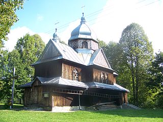
Dwernik is a village in the administrative district of Gmina Lutowiska, within Bieszczady County, Subcarpathian Voivodeship, in south-eastern Poland, close to the border with Ukraine. It lies approximately 8 kilometres (5 mi) south-west of Lutowiska, 26 km (16 mi) south of Ustrzyki Dolne, and 102 km (63 mi) south-east of the regional capital Rzeszów.
Dydiowa is a former village in the administrative district of Gmina Lutowiska, within Bieszczady County, Subcarpathian Voivodeship, in south-eastern Poland, on the border with Ukraine. It lies approximately 9 kilometres (6 mi) south-east of Lutowiska, 30 km (19 mi) south of Ustrzyki Dolne, and 109 km (68 mi) south-east of the regional capital Rzeszów.
Hulskie is a village in the administrative district of Gmina Lutowiska, within Bieszczady County, Subcarpathian Voivodeship, in south-eastern Poland, close to the border with Ukraine. It lies approximately 12 kilometres (7 mi) west of Lutowiska, 22 km (14 mi) south of Ustrzyki Dolne, and 96 km (60 mi) south-east of the regional capital Rzeszów.
Krywe is a village in the administrative district of Gmina Lutowiska, within Bieszczady County, Subcarpathian Voivodeship, in south-eastern Poland, close to the border with Ukraine. It lies approximately 13 kilometres (8 mi) west of Lutowiska, 22 km (14 mi) south of Ustrzyki Dolne, and 95 km (59 mi) south-east of the regional capital Rzeszów.
Krywka is a former village in the administrative district of Gmina Lutowiska, within Bieszczady County, Subcarpathian Voivodeship, in south-eastern Poland, close to the border with Ukraine. It lies approximately 3 kilometres (2 mi) east of Lutowiska, 22 km (14 mi) south-east of Ustrzyki Dolne, and 101 km (63 mi) south-east of the regional capital Rzeszów.
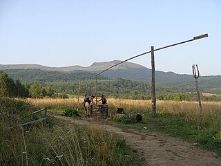
Łokieć is a former village in the administrative district of Gmina Lutowiska, within Bieszczady County, Subcarpathian Voivodeship, in south-eastern Poland, on the border with Ukraine. It lies approximately 12 kilometres (7 mi) south of Lutowiska, 33 km (21 mi) south of Ustrzyki Dolne, and 112 km (70 mi) south-east of the regional capital Rzeszów.
Nasiczne is a village in the administrative district of Gmina Lutowiska, within Bieszczady County, Subcarpathian Voivodeship, in south-eastern Poland, close to the border with Ukraine. It lies approximately 11 kilometres (7 mi) south-west of Lutowiska, 29 km (18 mi) south of Ustrzyki Dolne, and 105 km (65 mi) south-east of the regional capital Rzeszów.
Pszczeliny is a village in the administrative district of Gmina Lutowiska, within Bieszczady County, Subcarpathian Voivodeship, in south-eastern Poland, close to the border with Ukraine. It lies approximately 10 kilometres (6 mi) south of Lutowiska, 31 km (19 mi) south of Ustrzyki Dolne, and 109 km (68 mi) south-east of the regional capital Rzeszów.

Skorodne is a village in the administrative district of Gmina Lutowiska, within Bieszczady County, Subcarpathian Voivodeship, in south-eastern Poland, close to the border with Ukraine. It lies approximately 6 kilometres (4 mi) north-west of Lutowiska, 18 km (11 mi) south of Ustrzyki Dolne, and 96 km (60 mi) south-east of the regional capital Rzeszów.
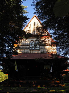
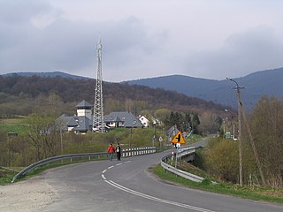
Smolnik is a village in the administrative district of Gmina Lutowiska, within Bieszczady County, Subcarpathian Voivodeship, in south-eastern Poland, close to the border with Ukraine. It lies approximately 3 kilometres (2 mi) south of Lutowiska, 24 km (15 mi) south of Ustrzyki Dolne, and 103 km (64 mi) south-east of the regional capital Rzeszów.
Sokoliki Górskie is a former village in the administrative district of Gmina Lutowiska, within Bieszczady County, Subcarpathian Voivodeship, in south-eastern Poland, close to the border with Ukraine. It lies approximately 23 kilometres (14 mi) south-east of Lutowiska, 44 km (27 mi) south-east of Ustrzyki Dolne, and 123 km (76 mi) south-east of the regional capital Rzeszów.
Tarnawa Niżna is a village in the administrative district of Gmina Lutowiska, within Bieszczady County, Subcarpathian Voivodeship, in south-eastern Poland, close to the border with Ukraine. It lies approximately 16 kilometres (10 mi) south-east of Lutowiska, 37 km (23 mi) south-east of Ustrzyki Dolne, and 116 km (72 mi) south-east of the regional capital Rzeszów.
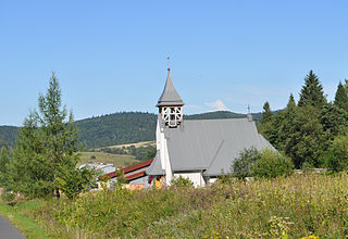
Ustrzyki Górne is a village in the administrative district of Gmina Lutowiska, within Bieszczady County, Subcarpathian Voivodeship, in south-eastern Poland, close to the border with Ukraine. It lies approximately 17 kilometres (11 mi) south of Lutowiska, 37 km (23 mi) south of Ustrzyki Dolne, and 114 km (71 mi) south-east of the regional capital Rzeszów.
Wołosate is a village in the administrative district of Gmina Lutowiska, within Bieszczady County, Subcarpathian Voivodeship, in south-eastern Poland, close to the border with Ukraine. It lies approximately 22 kilometres (14 mi) south of Lutowiska, 43 km (27 mi) south of Ustrzyki Dolne, and 120 km (75 mi) south-east of the regional capital Rzeszów. It is also the southernmost inhabited village in Poland.
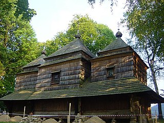
Zatwarnica is a village in the administrative district of Gmina Lutowiska, within Bieszczady County, Subcarpathian Voivodeship, in south-eastern Poland, close to the border with Ukraine. It lies approximately 11 kilometres (7 mi) west of Lutowiska, 24 km (15 mi) south of Ustrzyki Dolne, and 98 km (61 mi) south-east of the regional capital Rzeszów.


