
Africa is a continent comprising 63 political territories, representing the largest of the great southward projections from the main mass of Earth's surface. Within its regular outline, it comprises an area of 30,368,609 km2 (11,725,385 sq mi), excluding adjacent islands. Its highest mountain is Mount Kilimanjaro, its largest lake is Lake Victoria.

Lake Michigan is one of the five Great Lakes of North America. It is the second-largest of the Great Lakes by volume and the third-largest by surface area, after Lake Superior and Lake Huron. To the east, its basin is conjoined with that of Lake Huron through the narrow Straits of Mackinac, giving it the same surface elevation as its easterly counterpart; the two are technically a single lake.

The Mississippi River is the second-longest river and chief river of the second-largest drainage system in North America, second only to the Hudson Bay drainage system. From its traditional source of Lake Itasca in northern Minnesota, it flows generally south for 2,340 miles (3,770 km) to the Mississippi River Delta in the Gulf of Mexico. With its many tributaries, the Mississippi's watershed drains all or parts of 32 U.S. states and two Canadian provinces between the Rocky and Appalachian mountains. The main stem is entirely within the United States; the total drainage basin is 1,151,000 sq mi (2,980,000 km2), of which only about one percent is in Canada. The Mississippi ranks as the thirteenth-largest river by discharge in the world. The river either borders or passes through the states of Minnesota, Wisconsin, Iowa, Illinois, Missouri, Kentucky, Tennessee, Arkansas, Mississippi, and Louisiana.

The Chicago River is a system of rivers and canals with a combined length of 156 miles (251 km) that runs through the city of Chicago, including its center. Though not especially long, the river is notable because it is one of the reasons for Chicago's geographic importance: the related Chicago Portage is a link between the Great Lakes and the Mississippi River Basin, and ultimately the Gulf of Mexico.

The Illinois River is a principal tributary of the Mississippi River and is approximately 273 miles (439 km) long. Located in the U.S. state of Illinois, the river drains a large section of central Illinois, with a drainage basin of 28,756.6 square miles (74,479 km2). The drainage basin extends into Wisconsin, Indiana, and a very small area of southwestern Michigan.

New Berlin is a city located along the Milwaukee/Waukesha County Border in the U.S. State of Wisconsin. The population was 40,451 at the 2020 census, making it the second-largest community in Waukesha County after the city of Waukesha.

A drainage basin is any area of land where precipitation collects and drains off into a common outlet, such as into a river, bay, or other body of water. The drainage basin includes all the surface water from rain runoff, snowmelt, hail, sleet and nearby streams that run downslope towards the shared outlet, as well as the groundwater underneath the earth's surface. Drainage basins connect into other drainage basins at lower elevations in a hierarchical pattern, with smaller sub-drainage basins, which in turn drain into another common outlet.

An endorheic basin is a drainage basin that normally retains water and allows no outflow to other external bodies of water, such as rivers or oceans, but drainage converges instead into lakes or swamps, permanent or seasonal, that equilibrate through evaporation. They are also called closed or terminal basins, internal drainage systems, or simply basins. Endorheic regions contrast with exorheic regions. Endorheic water bodies include some of the largest lakes in the world, such as the Caspian Sea, the world's largest inland body of water.

The Kankakee River is a tributary of the Illinois River, approximately 133 miles (214 km) long, in the Central Corn Belt Plains of northwestern Indiana and northeastern Illinois in the United States. At one time, the river drained one of the largest wetlands in North America and furnished a significant portage between the Great Lakes and the Mississippi River. Significantly altered from its original channel, it flows through a primarily rural farming region of reclaimed cropland, south of Lake Michigan.

The Fox–Wisconsin Waterway is a waterway formed by the Fox and Wisconsin Rivers. First used by European settlers in 1673 during the expedition of Marquette & Joliet, it was one of the principal routes used by travelers between the Great Lakes and the Mississippi River until the completion of the Illinois and Michigan Canal in 1848 and the arrival of railroads. The western terminus of the Fox–Wisconsin Waterway was at the Mississippi at Prairie du Chien, Wisconsin. It continued up the Wisconsin River about 116 miles (187 km) until reaching Portage, Wisconsin. There travelers would portage to the Upper Fox River, or eventually, use the Portage Canal. It continued about 160 miles (260 km) down the Fox River, following it through Lake Winnebago and continuing on the Lower Fox over 170 feet of falls to the eastern terminus of Green Bay.
The Driftless Area, a topographical and cultural region in the American Midwest, comprises southwestern Wisconsin, southeastern Minnesota, northeastern Iowa, and the extreme northwestern corner of Illinois.

Lake Michigan–Huron is the body of water combining both Lake Michigan and Lake Huron, which are joined through the 5-mile-wide (8.0 km), 20-fathom-deep, open-water Straits of Mackinac. Huron and Michigan are hydrologically a single lake because the flow of water through the straits keeps their water levels in overall equilibrium. Although the flow is generally eastward, the water moves in either direction depending on local conditions. Combined, Lake Michigan–Huron is the largest freshwater lake by area in the world. However, Lake Superior is larger than either individually, and so is counted as the largest lake when Lake Huron and Lake Michigan are considered separately.
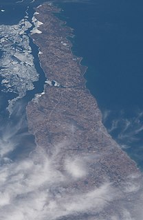
The Door Peninsula is a peninsula in eastern Wisconsin, separating the southern part of the Green Bay from Lake Michigan. The peninsula includes northern Kewaunee County, northeastern Brown County, and the mainland portion of Door County. It is on the western side of the Niagara Escarpment. Well known for its cherry and apple orchards, the Door Peninsula is a popular tourism destination. With the 1881 completion of the Sturgeon Bay Ship Canal, the northern half of the peninsula became an island.

The Kinnickinnic River is one of three primary rivers that flows into the harbor of Milwaukee, Wisconsin, at Lake Michigan, along with the Menomonee River and Milwaukee River. It is locally called the "KK River".

Lake Duluth was a proglacial lake that formed in the Lake Superior drainage basin as the Laurentide Ice Sheet retreated. The oldest existing shorelines were formed after retreat from the Greatlakean advance, sometime around 11,000 years B.P. Lake Duluth formed at the western end of the Lake Superior basin. Lake Duluth overflowed south through outlets in Minnesota and Wisconsin at an elevation of around 331 m above sea level.
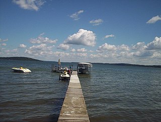
Green Lake — also known as Big Green Lake — is a lake in Green Lake County, Wisconsin, United States. Green Lake has a maximum depth of 237 ft (72 m), making it the deepest natural inland lake in Wisconsin and the second largest by volume. The lake covers 29.72 km2 and has an average depth of 30.48 m (100.0 ft). Green Lake has 43.94 km (27.30 mi) of diverse shoreline, ranging from sandstone bluffs to marshes.

The Great Lakes Basin consists of the Great Lakes and the surrounding lands of the states of Illinois, Indiana, Michigan, Minnesota, New York, Ohio, Pennsylvania, and Wisconsin in the United States, and the province of Ontario in Canada, whose direct surface runoff and watersheds form a large drainage basin that feeds into the lakes. It is generally considered to also include a small area around and beyond Wolfe Island, Ontario, at the east end of Lake Ontario, which does not directly drain into the Great Lakes, but into the Saint Lawrence River.

The Valparaiso Moraine is a recessional moraine that forms an immense U around the southern Lake Michigan basin in North America. It is the longest moraine. It is a band of hilly terrain composed of glacial till and sand. The Valparaiso Moraine forms part of the Saint Lawrence River Divide, bounding the Great Lakes Basin. It begins near the border of Wisconsin and Illinois and extends south through Lake, McHenry, Cook, DuPage and Will counties in Illinois, and then turns southeast, going through northwestern Indiana. From this point, the moraine curves northeast through Lake, Porter, and LaPorte counties of Indiana into Michigan. It continues into Michigan as far as Montcalm County.

The Great Lakes–St. Lawrence River Basin Water Resources Compact is a legally binding interstate compact among the U.S. states of Illinois, Indiana, Michigan, Minnesota, New York, Ohio, Pennsylvania and Wisconsin. The compact details how the states manage the use of the Great Lakes Basin's water supply and builds on the 1985 Great Lakes Charter and its 2001 Annex. The compact is the means by which the states implement the governors' commitments under the Great Lakes–St. Lawrence River Basin Sustainable Water Resources Agreement that also includes the Premiers of Ontario and Quebec.