Landforms are categorized by characteristic physical attributes such as their creating process, shape, elevation, slope, orientation, rock exposure, and soil type.

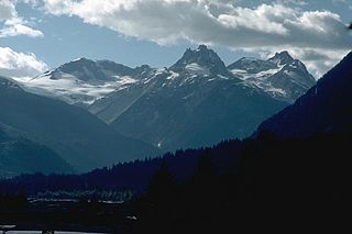
The Garibaldi Volcanic Belt is a northwest–southeast trending volcanic chain in the Pacific Ranges of the Coast Mountains that extends from Watts Point in the south to the Ha-Iltzuk Icefield in the north. This chain of volcanoes is located in southwestern British Columbia, Canada. It forms the northernmost segment of the Cascade Volcanic Arc, which includes Mount St. Helens and Mount Baker. Most volcanoes of the Garibaldi chain are dormant stratovolcanoes and subglacial volcanoes that have been eroded by glacial ice. Less common volcanic landforms include cinder cones, volcanic plugs, lava domes and calderas. These diverse formations were created by different styles of volcanic activity, including Peléan and Plinian eruptions.

A subglacial volcano, also known as a glaciovolcano, is a volcanic form produced by subglacial eruptions or eruptions beneath the surface of a glacier or ice sheet which is then melted into a lake by the rising lava. Today they are most common in Iceland and Antarctica; older formations of this type are found also in British Columbia and Yukon Territory, Canada.

Hyaloclastite is a volcanoclastic accumulation or breccia consisting of glass fragments (clasts) formed by quench fragmentation of lava flow surfaces during submarine or subglacial extrusion. It occurs as thin margins on the lava flow surfaces and between pillow lavas as well as in thicker deposits, more commonly associated with explosive, volatile-rich eruptions as well as steeper topography. Hyaloclastites form during volcanic eruptions under water, under ice or where subaerial flows reach the sea or other bodies of water. It commonly has the appearance of angular flat fragments sized between a millimeter to few centimeters. The fragmentation occurs by the force of the volcanic explosion, or by thermal shock and spallation during rapid cooling.

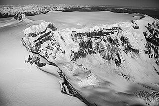
A tuya is a flat-topped, steep-sided volcano formed when lava erupts through a thick glacier or ice sheet. They are rare worldwide, being confined to regions which were covered by glaciers and had active volcanism during the same period.

Hoodoo Mountain, sometimes referred to as Hoodoo Volcano, is a potentially active stratovolcano in the Northern Interior of British Columbia, Canada. It is located 25 kilometres northeast of the Alaska–British Columbia border on the north side of the Iskut River opposite of the mouth of the Craig River. With a summit elevation of 1,850 metres and a topographic prominence of 900 metres, Hoodoo Mountain is one of many prominent peaks within the Boundary Ranges of the Coast Mountains. Its flat-topped summit is covered by an ice cap more than 100 metres thick and at least 3 kilometres in diameter. Two valley glaciers surrounding the northwestern and northeastern sides of the mountain have retreated significantly over the last hundred years. They both originate from a large icefield to the north and are the sources of two meltwater streams. These streams flow along the western and eastern sides of the volcano before draining into the Iskut River.

Mount Edziza is a volcanic mountain in Cassiar Land District of northwestern British Columbia, Canada. It is located on the Big Raven Plateau of the Tahltan Highland which extends along the western side of the Stikine Plateau. Mount Edziza has an elevation of 2,786 metres, making it the highest point of the Mount Edziza volcanic complex and one of the highest volcanoes in Canada. However, it had an elevation of at least 3,396 metres before its formerly cone-shaped summit was likely destroyed by a violent eruption in the geologic past; its current flat summit contains an ice-filled, 2-kilometre-in diameter (1.2-mile) crater. The mountain contains several lava domes, cinder cones and lava fields on its flanks, as well as an ice cap containing several outlet glaciers which extend to lower elevations. All sides of Mount Edziza are drained by tributaries of Mess Creek and Kakiddi Creek which are situated within the Stikine River watershed.

Subglacial eruptions, those of ice-covered volcanoes, result in the interaction of magma with ice and snow, leading to meltwater formation, jökulhlaups, and lahars. Flooding associated with meltwater is a significant hazard in some volcanic areas, including Iceland, Alaska, and parts of the Andes. Jökulhlaups have been identified as the most frequently occurring volcanic hazard in Iceland, with major events where peak discharges of meltwater can reach 10,000 – 100,000 m3/s occurring when there are large eruptions beneath glaciers. It is important to explore volcano-ice interactions to improve the effectiveness of monitoring these events and to undertake hazard assessments. This is particularly relevant given that subglacial eruptions have demonstrated their ability to cause widespread impact, with the ash cloud associated with Iceland's Eyjafjallajökull eruption in 2010 resulting in significant impacts to aviation across Europe.

The geology of the Pacific Northwest includes the composition, structure, physical properties and the processes that shape the Pacific Northwest region of North America. The region is part of the Ring of Fire: the subduction of the Pacific and Farallon Plates under the North American Plate is responsible for many of the area's scenic features as well as some of its hazards, such as volcanoes, earthquakes, and landslides.

Ice Peak is the prominent south peak of Mount Edziza in Cassiar Land District of northwestern British Columbia, Canada. It has an elevation of 2,500 metres and protrudes through Mount Edziza's ice cap, which is roughly 70 square kilometres in area. The peak is a pyramid-shaped horn formed by glacial erosion and is completely flanked by steep-walled, active cirques. Tencho Glacier on the southern flank is the largest outlet glacier of Mount Edziza's ice cap. The summit of Ice Peak is about 280 metres lower than that of Mount Edziza, but it still rises well above the general level of the Big Raven Plateau. Ice Peak and the surrounding area are in Mount Edziza Provincial Park, which also includes the Spectrum Range to the south.

The Silverthrone Caldera is a potentially active caldera complex in southwestern British Columbia, Canada, located over 350 kilometres (220 mi) northwest of the city of Vancouver and about 50 kilometres (31 mi) west of Mount Waddington in the Pacific Ranges of the Coast Mountains. The caldera is one of the largest of the few calderas in western Canada, measuring about 30 kilometres (19 mi) long (north-south) and 20 kilometres (12 mi) wide (east-west). Mount Silverthrone, an eroded lava dome on the caldera's northern flank, which is 2,864 metres (9,396 ft) high, may be the highest volcano in Canada.

Pillow Ridge is a ridge of the Tahltan Highland in northern British Columbia, Canada, located southeast of Telegraph Creek. It extends northwest from Mount Edziza in Mount Edziza Provincial Park.

The Wells Gray-Clearwater volcanic field, also called the Clearwater Cone Group, is a potentially active monogenetic volcanic field in east-central British Columbia, Canada, located approximately 130 km (81 mi) north of Kamloops. It is situated in the Cariboo Mountains of the Columbia Mountains and on the Quesnel and Shuswap Highlands. As a monogenetic volcanic field, it is a place with numerous small basaltic volcanoes and extensive lava flows.

Tennena Cone, alternatively Icebridge Cone, is a small volcanic cone in Cassiar Land District of northwestern British Columbia, Canada. It has an elevation of 2,390 metres and lies on the upper western flank of Ice Peak, the prominent south peak of Mount Edziza. The cone is almost completely surrounded by Mount Edziza's ice cap and is one of several volcanoes in the Snowshoe Lava Field on the Big Raven Plateau. Tennena Cone is 200 metres high, 1,200 metres long and up to 600 metres wide, its symmetrical structure resembling a black pyramid. The cone and the surrounding area are in Mount Edziza Provincial Park which also includes the Spectrum Range to the south.

The volcanic history of the Northern Cordilleran Volcanic Province presents a record of volcanic activity in northwestern British Columbia, central Yukon and the U.S. state of easternmost Alaska. The volcanic activity lies in the northern part of the Western Cordillera of the Pacific Northwest region of North America. Extensional cracking of the North American Plate in this part of North America has existed for millions of years. Continuation of this continental rifting has fed scores of volcanoes throughout the Northern Cordilleran Volcanic Province over at least the past 20 million years and occasionally continued into geologically recent times.

The Canadian Cascade Arc, also called the Canadian Cascades, is the Canadian segment of the North American Cascade Volcanic Arc. Located entirely within the Canadian province of British Columbia, it extends from the Cascade Mountains in the south to the Coast Mountains in the north. Specifically, the southern end of the Canadian Cascades begin at the Canada–United States border. However, the specific boundaries of the northern end are not precisely known and the geology in this part of the volcanic arc is poorly understood. It is widely accepted by geologists that the Canadian Cascade Arc extends through the Pacific Ranges of the Coast Mountains. However, others have expressed concern that the volcanic arc possibly extends further north into the Kitimat Ranges, another subdivision of the Coast Mountains, and even as far north as Haida Gwaii.

The Mount Cayley volcanic field (MCVF) is a remote volcanic zone on the South Coast of British Columbia, Canada, stretching 31 km (19 mi) from the Pemberton Icefield to the Squamish River. It forms a segment of the Garibaldi Volcanic Belt, the Canadian portion of the Cascade Volcanic Arc, which extends from Northern California to southwestern British Columbia. Most of the MCVF volcanoes were formed during periods of volcanism under sheets of glacial ice throughout the last glacial period. These subglacial eruptions formed steep, flat-topped volcanoes and subglacial lava domes, most of which have been entirely exposed by deglaciation. However, at least two volcanoes predate the last glacial period and both are highly eroded. The field gets its name from Mount Cayley, a volcanic peak located at the southern end of the Powder Mountain Icefield. This icefield covers much of the central portion of the volcanic field and is one of the several glacial fields in the Pacific Ranges of the Coast Mountains.

Overdeepening is a characteristic of basins and valleys eroded by glaciers. An overdeepened valley profile is often eroded to depths which are hundreds of metres below the lowest continuous surface line along a valley or watercourse. This phenomenon is observed under modern day glaciers, in salt-water fjords and fresh-water lakes remaining after glaciers melt, as well as in tunnel valleys which are partially or totally filled with sediment. When the channel produced by a glacier is filled with debris, the subsurface geomorphic structure is found to be erosionally cut into bedrock and subsequently filled by sediments. These overdeepened cuts into bedrock structures can reach a depth of several hundred metres below the valley floor.

Helgafell is a mountain on Reykjanes peninsula, Iceland. The height of the mountain is 338 m.

The Mount Edziza volcanic complex (MEVC) in British Columbia, Canada, has a history of volcanism that spans more than 7 million years. It has taken place during five cycles of magmatic activity, each producing less volcanic material than the previous one. Volcanism during these cycles has created several types of volcanoes, including cinder cones, stratovolcanoes, subglacial volcanoes, shield volcanoes and lava domes. The roughly 1,000-square-kilometre (400-square-mile) volcanic plateau forming the base of the MEVC originated from the successive eruptions of highly mobile lava flows. Volcanic rocks such as basalt, trachybasalt, benmoreite, tristanite, mugearite, trachyte and rhyolite were deposited by multiple eruptions of the MEVC; the latter six rock types are products of varying degrees of magmatic differentiation in underground magma reservoirs. Renewed effusive volcanism could block local streams with lava flows whereas renewed explosive volcanism could disrupt air traffic with volcanic ash across parts of northwestern Canada. At least 10 distinct flows of obsidian were produced by volcanism of the MEVC, some of which were exploited by indigenous peoples in prehistoric times to make tools and weaponry.


