Alberta is one of the thirteen provinces and territories of Canada. It is a part of Western Canada and is one of the three prairie provinces. Alberta borders British Columbia to the west, Saskatchewan to the east, the Northwest Territories to the north, and the U.S. state of Montana to the south. It is one of the only two landlocked provinces in Canada, with Saskatchewan being the other. The eastern part of the province is occupied by the Great Plains, while the western part borders the Rocky Mountains. The province has a predominantly continental climate but experiences quick temperature changes due to air aridity. Seasonal temperature swings are less pronounced in western Alberta due to occasional Chinook winds.

Crown land, also known as royal domain, is a territorial area belonging to the monarch, who personifies the Crown. It is the equivalent of an entailed estate and passes with the monarchy, being inseparable from it. Today, in Commonwealth realms, crown land is considered public land and is apart from the monarch's private estate.

The British Army Training Unit Suffield (BATUS) is a British Army unit located at the vast training area of Canadian Forces Base Suffield near Suffield, Alberta, Canada. BATUS is the British Army's largest armoured training facility, and it can accommodate live-firing and tactical effect simulation (TES) exercises up to battle group level. CFB Suffield is seven times the size of the Salisbury Plain Training Area in England and 19% of the size of Northern Ireland, offering the British Army the ability to conduct large exercises that UK military bases cannot accommodate.

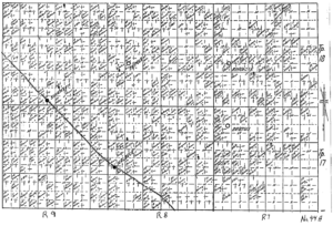
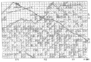
Canadian Forces Base Suffield is the largest army training area in Canada. The CFB is in southeastern Alberta, 3 nautical miles north-northwest of Suffield, 50 km (31 mi) northwest of Medicine Hat and 250 km (160 mi) southeast of Calgary. It is accessible via Highway 884, a public road that bisects the main hub section of the base.

Suffield National Wildlife Area (SNWA) is a National Wildlife Area located within the boundaries of CFB Suffield in Alberta, Canada.
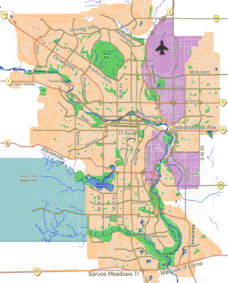
Tsuu T'ina Nation 145 is an Indian reserve of the Tsuut'ina Nation in southern Alberta, Canada, created by Treaty 7.
Highway 1 is a major east–west highway in southern Alberta that forms the southern mainline of the Trans-Canada Highway. It runs from the British Columbia border near Lake Louise through Calgary to the Saskatchewan border east of Medicine Hat. It continues as Highway 1 into both provinces. It spans approximately 534 km (332 mi) from Alberta's border with British Columbia in the west to its border with Saskatchewan in the east. Highway 1 is designated as a core route in Canada's National Highway System and is a core part of the developing Alberta Freeway Network.
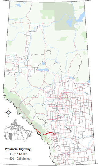
Highway 1A is the designation of two alternate routes off the Alberta portion of Trans-Canada Highway 1. However, it is not the only name used for spurs off Highway 1 - Highway 1X is another such designation. Despite these highways being suffixed routes of Highway 1, they are not part of the Trans-Canada Highway network, and are signed with Alberta's provincial primary highway shields instead of the Trans-Canada shields used for Highway 1.

Chestermere, originally named Chestermere Lake is a city in the Canadian province of Alberta, within Rocky View County. It is largely a commuter town of Calgary and is a member municipality of the Calgary Region. The city, which surrounds Chestermere Lake, was known as Chestermere Lake from 1977 to 1993.
The Peace River Block is a 3,500,000-acre (14,000 km2) area of land in northeastern British Columbia, in the Peace River Country. In exchange for building a rail line across Canada to British Columbia, the Canadian Pacific Railway was given the Railway Belt, 20 miles (32 km) of land on each side of the railway. To compensate the CPR for alienated or non-arable land in the 40-mile-wide (64 km) strip, the province allowed the Government of Canada to take control of 3,500,000 acres within B.C., northeast of the Rocky Mountains. This arrangement passed the provincial Legislature on December 19, 1883, and passed the Parliament of Canada on March 21, 1884, as the Settlement Act. All the land northeast of the Rocky Mountains became a provincial reserve pending the government of Canada's decision on what land to select, which prevented homesteading and land claims. After several surveys of the land the government took possession in 1907. The land the government chose was an approximately square-shaped block of land 72.4 miles (116.5 km) north-south and 75.7 miles (121.8 km) east-west. The south boundary begins at the intersection of the Alberta-British Columbia border and the Twentieth Baseline of the Dominion Land Survey, and the north boundary begins at the Twenty-third Baseline; however, both boundaries are run at right angles to the Alberta-British Columbia Border without accounting for meridian convergence and thus deviate south of each baseline. Land within the block was initially surveyed using the 3rd and 4th Systems of the Dominion Land Survey; however, much of the south and west parts of the block were eventually surveyed into district lots similar to other parts of British Columbia.
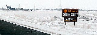
Cypress County is a municipal district in southeastern Alberta, Canada that surrounds the City of Medicine Hat and the Town of Redcliff. The municipality is part of Census Division 1, Alberta. The first farm in the area was settled in 1890.
Alberta Municipal Affairs is a ministry of the Executive Council of Alberta. Its major responsibilities include assisting municipalities in the provision of local government, administering the assessment of linear property in Alberta, administering a safety system for the construction and maintenance of buildings and equipment, and managing Alberta's network of municipal and library system boards.

The Alberta Sheriffs Branch is a provincial law enforcement agency overseen by the Ministry of Public Safety and Emergency Services of the province of Alberta, Canada. Under the authority of the Peace Officer Act, Alberta Sheriffs are provincial peace officers with jurisdiction over the province of Alberta. The premier of Alberta has the authority to grant emergency police powers to all Alberta sheriffs during major emergencies within the province. The Alberta Sheriffs Branch is the largest sheriff service in Canada.
Suffield is a hamlet in southern Alberta, Canada within Cypress County. It is located on the Trans-Canada Highway approximately 32 km (20 mi) northwest of Medicine Hat, and just south of CFB Suffield.
Land is owned in Canada by governments, Indigenous groups, corporations, and individuals. Canada is the second-largest country in the world by area; at 9,093,507 km2 or 3,511,085 mi2 of land. It occupies more than 6% of the Earth's surface.
The Crown Village of Ralston is east of Highway 884 on CFB Suffield within Cypress County in southern Alberta, Canada. It is approximately 3 km (1.9 mi) north of the Hamlet of Suffield and the Trans-Canada Highway.
The Palliser Region is an area in the southeast corner of the province of Alberta, Canada that has been delineated and is serviced by the Palliser Economic Partnership. It borders the Canadian province of Saskatchewan to the east, and the US state of Montana to the south. It covers an area of 43,504 km2 (16,797 sq mi) The total population of the area stood at 112,314 in 2009. The city of Medicine Hat, with a population of 61,097, is the area's largest urban centre.
Wawaskesy National Park was created north and west of the South Saskatchewan River, north of the city of Medicine Hat in southeastern Alberta, Canada, on May 31, 1922. It was closed on June 24, 1938, and delisted in 1947.
Military Camp Ipperwash is a former Canadian Forces training facility located in Lambton County, Ontario, near Kettle Point. On April 14, 2016, it was returned to the Chippewas of Kettle and Stony Point First Nation.