Related Research Articles

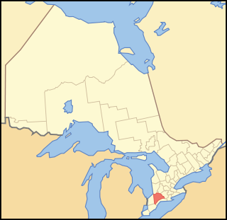
Middlesex County is located in the north-central part of the U.S. state of New Jersey, extending inland from the Raritan Valley region to the northern portion of the Jersey Shore. As of the 2020 United States census, the county was the state's third-most populous county with a population of 863,162, its highest decennial count ever and an increase of 53,304 (+6.6%) from the 2010 census count of 809,858, which in turn reflected an increase of 59,696 (8.0%) from the 750,162 counted in the 2000 census. Middlesex is part of the New York metropolitan area. Many communities within the county serve as commuter towns to and from New York City and other points north. The county is part of the Central Jersey region of the state.

Monroe Township is a township located in southern Middlesex County, in the U.S. state of New Jersey. The township is centrally located within the Raritan Valley region and is an outer-ring suburb of New York City within the New York metropolitan area. As of the 2020 United States census, the township's population was 48,594, its highest decennial count ever and an increase of 9,462 (+24.2%) from the 39,132 recorded at the 2010 census, which in turn reflected an increase of 11,133 (+39.8%) from the 27,999 counted in the 2000 census. Monroe Township also comprises the largest land area of any municipality in Middlesex County, at approximately 42 square miles (110 km2).
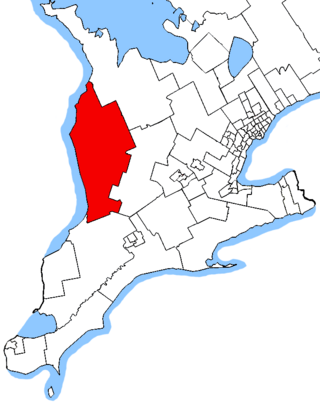
Middlesex County is a primarily rural county in Southwestern Ontario, Canada. Landlocked, the county is bordered by Huron and Perth counties on the north, Oxford County on the east, Elgin County on the south, and Chatham-Kent and Lambton County on the west.
The Canadian province of Ontario has several historic counties, which are past census divisions that no longer exist today. Most historic counties either merged with other counties, or became regional municipalities or single-tier municipalities. Although counties had existed prior to 1849, after 1849 they replaced the district systems in administering local government and courts in Ontario.

Elgin County is a county of the Canadian province of Ontario with a 2016 population of 50,069. Its population centres are St. Thomas, Aylmer, Port Stanley, Belmont, Dutton and West Lorne. The county seat is St. Thomas, which is separated from the county but within its geographic boundary.
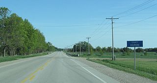
Huron County is a county of the province of Ontario, Canada. It is located on the southeast shore of its namesake, Lake Huron, in the southwest part of the province. The county seat is Goderich, also the county's largest community.
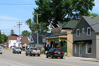
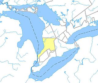
Middlesex Centre is a township in Middlesex County, in southwestern Ontario, Canada, north and west of London. The Corporation of the Township of Middlesex Centre formed on January 1, 1998, with the amalgamation of the former Townships of Delaware, Lobo, and London. It is part of the London census metropolitan area.
Highbury Avenue is an arterial road located in the Canadian province of Ontario. In addition to serving as a primary north–south thoroughfare in eastern London – through which part of it is a limited-access freeway – the road also provides access to Highway 401 and continues south to St. Thomas. The southern terminus of Highbury Avenue is an intersection with South Edgeware Road, just north of Highway 3 and the eastern end of the St. Thomas Expressway. From there, it travels 45.6 kilometres (28.3 mi) north to Highway 7, east of Elginfield. Outside of London and St. Thomas, the road also passes through the communities of Ballymote and Bryanston. It is designated as Elgin County Road 30 within Central Elgin, and as Middlesex County Road 23 within Middlesex Centre, the two rural municipalities through which the route passes.
Westminster refers to both a neighbourhood in the City of London, Ontario, Canada, and a much larger area within which the neighbourhood lands have been situated.

Lambton—Kent—Middlesex is a federal electoral district in Ontario, Canada, that has been represented in the House of Commons of Canada since 1997.
Huron—Bruce is a federal electoral district in Ontario, Canada, that has been represented in the House of Commons of Canada since 1953.
Middlesex East was a former federal electoral district in Ontario, Canada, represented in the House of Commons of Canada from 1867 to 1968. It was created by the British North America Act of 1867, which divided the County of Middlesex into three ridings: Middlesex North, Middlesex West and Middlesex East.
Middlesex West was a federal electoral district represented in the House of Commons of Canada from 1867 to 1968. It was located in the province of Ontario. It was created by the British North America Act of 1867 which divided the County of Middlesex into three ridings: Middlesex North, Middlesex West and Middlesex East.

Strathroy-Caradoc is a municipality located in Southwestern Ontario, Canada. It is 35 kilometres (22 mi) west of London.

The Home District was one of four districts of the Province of Quebec created in 1788 in the western reaches of the Montreal District and detached in 1791 to create the new colony of Upper Canada. It was abolished with the adoption of the county system in 1849.

West Perth is a municipality in Ontario, Canada, situated in Western Perth County, just west of the city of Stratford. In 2016, its population was 8,865 in a land area of 579.36 square kilometers. The former town of Mitchell and townships of Logan, Hibbert, and Fullarton all amalgamated into this single large municipality on January 1, 1998. Municipal offices, administration, and services are based in Mitchell. Its mayor is Walter McKenzie.
Tempo is an unincorporated place in the city of London in Southwestern Ontario, Canada. It is located just south of the community of Lambeth at interchange 177 of Ontario Highway 401 with the former Ontario Highway 4.
The Huron Tract Purchase also known as the Huron Block, registered as Crown Treaty Number 29, is a large area of land in southwestern Ontario bordering on Lake Huron to the west and Lake Erie to the east. The area spans the counties of Huron, Perth, Middlesex and present day Lambton County, Ontario in the province of Ontario.
King's Highway 81, also known as Highway 81, was a provincially maintained highway in the Canadian province of Ontario. The winding north–south route connected Highway 2 in Delaware with Highway 21 in Grand Bend, passing through Mount Brydges, Strathroy and Parkhill en route. Highway 81 was first designated in 1936 and extended in 1937, and retained generally the same route throughout its existence until it was transferred to the responsibility of Middlesex County and Huron County in 1997 and 1998. Today the entire route is known as Middlesex County Road 81 and Huron County Road 81.
References
- ↑ "The Changing Shape of Ontario: Early Districts and Counties 1788-1899". www.archives.gov.on.ca. Retrieved 2024-05-13.
- ↑ "Timeline of Middlesex County". Middlesex County Ontario Genweb. Archived from the original on 2009-02-06.