Sobek was an ancient Egyptian deity with a complex and fluid nature. He is associated with the Nile crocodile or the West African crocodile and is represented either in its form or as a human with a crocodile head. Sobek was also associated with pharaonic power, fertility, and military prowess, but served additionally as a protective deity with apotropaic qualities, invoked particularly for protection against the dangers presented by the Nile.
Montu was a falcon-god of war in ancient Egyptian religion, an embodiment of the conquering vitality of the pharaoh. He was particularly worshipped in Upper Egypt and in the district of Thebes.
[Ramesses II] whom victory was foretold as he came from the womb,
Whom valor was given while in the egg,
Bull firm of heart as he treads the arena,
Godly king going forth like Montu on victory day.

Tanis is the Greek name for ancient Egyptian ḏꜥn.t, an important archaeological site in the north-eastern Nile Delta of Egypt, and the location of a city of the same name. It is located on the Tanitic branch of the Nile, which has long since silted up. The first study of Tanis dates to 1798 during Napoléon Bonaparte's expedition to Egypt. Engineer Pierre Jacotin drew up a map of the site in the Description de l'Égypte. It was first excavated in 1825 by Jean-Jacques Rifaud, who discovered the two pink granite sphinxes now in the Musée du Louvre, and then by François Auguste Ferdinand Mariette between 1860 and 1864, and subsequently by William Matthew Flinders Petrie from 1883 to 1886. The work was taken over by Pierre Montet from 1929 to 1956, who discovered the royal necropolis dating to the Third Intermediate Period in 1939. The Mission française des fouilles de Tanis (MFFT) has been studying the site since 1965 under the direction of Jean Yoyotte and Philippe Brissaud, and François Leclère since 2013.

In Ancient Egyptian religion, Taweret is the protective ancient Egyptian goddess of childbirth and fertility. The name "Taweret" (Tȝ-wrt) means "she who is great" or simply "great one", a common pacificatory address to dangerous deities. The deity is typically depicted as a bipedal female hippopotamus with feline attributes, pendulous female human breasts, the limbs and paws of a lion, and the back and tail of a Nile crocodile. She commonly bears the epithets "Lady of Heaven", "Mistress of the Horizon", "She Who Removes Water", "Mistress of Pure Water", and "Lady of the Birth House".

Akhmim is a city in the Sohag Governorate of Upper Egypt. Referred to by the ancient Greeks as Khemmis or Chemmis and Panopolis, it is located on the east bank of the Nile, four miles (6.4 km) to the northeast of Sohag.

Heracleopolis Magna or Heracleopolis, is the Roman name of the capital of the 20th nome of ancient Upper Egypt, known in Ancient Egyptian as Het-Nesut. The site is located approximately 15 km (9.3 mi) west of the modern city of Beni Suef, in the Beni Suef Governorate of Egypt.

Cusae was a city in Upper Egypt, known to the Ancient Egyptians as Qis or Kis. Today, the town is known as El Quseyya, and is located on the west bank of the Nile in the Asyut Governorate.

Armant (Egyptian jwnj, jwnj šm'j "Southern Heliopolis" or jwnj-mntw "the Heliopolis of the Nomad": and known in Koine Greek as Hermonthis, is a town located about 12 miles south of Thebes. It was an important Middle Kingdom town, which was enlarged during the Eighteenth Dynasty. It is located today in the Luxor Governorate on the west bank of the Nile.

Hawara is an archaeological site of Ancient Egypt, south of the site of Crocodilopolis at the entrance to the depression of the Fayyum oasis. It is the site of a pyramid built by the Pharaoh Amenemhat III in the 19th century BC.

Faiyum is a city in Middle Egypt. Located 100 kilometres southwest of Cairo, in the Faiyum Oasis, it is the capital of the modern Faiyum Governorate. Originally called Shedet in Egyptian, the Greeks called it Koinē Greek: Κροκοδειλόπολις, romanized: Krokodilópolis, and later Byzantine Greek: Ἀρσινόη, romanized: Arsinoë. It is one of Egypt's oldest cities due to its strategic location.

Girga is a city in the Sohag Governorate of Upper Egypt. It is located on the west bank of the Nile River.

The Faiyum Oasis is a depression or basin in the desert immediately to the west of the Nile south of Cairo in Egypt. The extent of the basin area is estimated at between 1,270 km2 (490 mi2) and 1700 km2 (656 mi2). The basin floor comprises fields watered by a channel of the Nile, the Bahr Yussef, as it drains into a desert hollow to the west of the Nile Valley. The Bahr Yussef veers west through a narrow neck of land north of Ihnasya, between the archaeological sites of El Lahun and Gurob near Hawara; it then branches out, providing rich agricultural land in the Faiyum basin, draining into the large saltwater Lake Moeris. The lake was freshwater in prehistory but is today a saltwater lake. It is a source for tilapia and other fish for the local area.
The Egyptian hieroglyph representing gold, phonetic value nb, is important due to its use in the Horus-of-Gold name, one of the Fivefold Titulary names of the Egyptian pharaoh.
In ancient Egyptian art, the Set animal, or sha, is the totemic animal of the god Set. Because Set was identified with the Greek Typhon, the animal is also commonly known as the Typhonian animal or Typhonic beast.

El-Tod was the site of an ancient Egyptian town and a temple to the Egyptian god Monthu. It is located 20 kilometres (12 mi) southwest of Luxor, Egypt, near the settlement of Hermonthis. A modern village now surrounds the site.
The Book of the Faiyum is an ancient Egyptian "local monograph" celebrating the Faiyum region of Egypt and its patron deity, the crocodile god Sobek. It has also been classified generically as a "cult topographical priestly manual." The text is known from multiple sources dating to Ptolemaic and Roman Egypt. It primarily functioned as a mythologized map of the Faiyum.

Behbeit El Hagar is an archaeological site in Lower Egypt that contains the remains of an ancient Egyptian temple to the goddess Isis, known as the Iseion. The site lies along the Damietta branch of the Nile, 7 kilometers northeast of Sebennytos and 8 kilometers west of Mansoura. In ancient times it was part of the nome of Sebennytos, the Twelfth Lower Egyptian Nome. Ancient Egyptian texts refer to the site as early as the New Kingdom, but it may have been simply an offshoot of Sebennytos rather than a full-fledged town.

Tell Nebesha or Nebesheh is an archaeological site in Egypt, and the location of the ancient city of Imet. It is found around 10km south of Tanis in the Eastern Nile Delta. This was the ancient capital of the 19th Nome of Lower Egypt. By the Assyrian period, it was succeeded by Tanis.

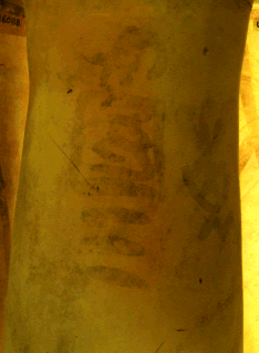
Crocodile is the provisional name of a predynastic ruler, who might have ruled during the late Naqada III epoch. The few alleged ink inscriptions showing his name are drawn very sloppily, and the reading and thus whole existence of king "Crocodile" are highly disputed. His tomb is unknown.

Per-Wadjet was an Ancient Egyptian town in the 10th Upper Egyptian nome. The ancient town is identical with the modern village Kom Ishqau. Per-Wadjet is known from Egyptian sources since the New Kingdom. It was a cult place for Hathor, who was here identified with Wadjet. The Greeks identified Hathor with Aphrodite and called the town Aphroditopolis or Aphrodito. In Greek and Roman times the town was sometimes the nome capital. In Kom Ishqau were found the papyri of Dioscorus of Aphrodito, who lived there in the 6th century A.D. These papyri are an important source for life in Byzantine Egypt. A long-lost 2.200 year-old temple with words linked to Ptolemy IV Philopator was accidentally found during drilling work on a sewage project by the Egyptian archaeological mission in the village in early September 2019. Temple stones for installing the sewage pumps, limestone wall remnants and ground floor were also revealed during the excavation. Inscriptions described Hapi, the God of the Nile, presenting offerings of varied animal and birds in the walls of the temple.


