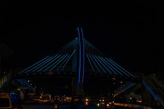
Kwimba District is one of the seven districts of the Mwanza Region of Tanzania. It is bordered to the north by the Magu District, to the east by Maswa District and Kishapu District, to the south by Shinyanga Rural District, and to the west by Misungwi District. The district seat is at Ngudu. Sumve is another important settlement in Kwimba District, hosting a hospital and large church.

Mwanza Region is one of Tanzania's 31 administrative regions. The region covers a land area of 25,233 km2 (9,743 sq mi). The region is comparable in size to the combined land area of the nation state of North Macedonia. Mwanza Region is bordered to the north through Lake Victoria by the Kagera Region and Mara Region, to the east by Simiyu Region, to the south by the Shinyanga Region and to the west by Geita Region. The regional capital is the city of Mwanza. According to the 2022 national census, the region had a population of 3,699,872 and national census of 2012 had 2,772,509. Mwanza Region is the second region with high population in Tanzania after Dar es Salaam Region.

Sengerema District is one of seven districts in the Mwanza Region of Tanzania, East Africa. Its administrative headquarter is located in Sengerema city. It is bordered to the north and east by Lake Victoria, to the south by Geita Region and to the southeast by the Misungwi District. Sengerema district is known for having numerous lake islands in its territory the largest are Maisome Island and Kome Island.

Ilemela District is one of the seven districts of the Mwanza Region of Tanzania with a postcode number 33200. It is bordered to the north and west by Lake Victoria, to the east by Magu District, and to the south by Nyamagana District. Part of the region's capital, the town of Mwanza, is within Ilemela District. The district commission's office is located in Buswelu area of Mwanza town.
Misungwi or Missungwi or Isungwi is a ward in Misungwi District, Mwanza Region, Tanzania. It is the biggest town on the trunk road from Mwanza to Shinyanga. In 2016 the Tanzania National Bureau of Statistics report there were 34,612 people in the ward, from 30,728 in 2012.
Igurusi is an administrative ward in the Mbarali district of the Mbeya Region of Tanzania. In 2022 the Tanzania National Bureau of Statistics report there were more than 28,000 people in the ward, from 24,573 in 2016.

Kondoa is a town and administrative ward in the Kondoa District of the Dodoma Region of Tanzania.

Geita Region is one of Tanzania's 31 administrative regions. The region covers an area of 20,054 km2 (7,743 sq mi)."Geita Region Size". The region is comparable in size to the combined land area of the nation state of Slovenia. Geita Region is bordered to the east by Lake Victoria, Mwanza Region and Shinyanga Region. The region is bordered by Tabora Region and Kigoma Region to the south and south west respectively. Lastly, Gieta is borders Kagera Region to the west.
Ngudu is a town in the Kwimba District of the Mwanza Region in northwestern Tanzania. The town is the location of the district headquarters of Kwimba District. In 2016 the Tanzania National Bureau of Statistics report there were 31,123 people in the ward, from 27,630 in 2012.
Katunguru, also Katungulu is an administrative ward in Sengerema District, Mwanza Region, Tanzania. In 2016 the Tanzania National Bureau of Statistics report there were 22,848 people in the ward, from 20,284 in 2012.
Kisesa is an administrative ward in the Magu District of the Mwanza Region of Tanzania. In 2016 the Tanzania National Bureau of Statistics report there were 9,889 people in the ward, from 30,486 in 2012.
Bugogwa is an administrative ward in Ilemela District, Mwanza Region, Tanzania with a postcode number 33207. In 2016 the Tanzania National Bureau of Statistics report there were 32,925 people in the ward, from 37,312 in 2012.
Buswelu is an administrative ward in Ilemela District in Mwanza Region, Tanzania with a postcode number 33204. In 2016 the Tanzania National Bureau of Statistics report there were 18,363 people in the ward, from 22,897 in 2012.
Ilemela is an Ward and the headquarter of the Ilemela District in the Mwanza Region of Tanzania with a postcode number 33205. In 2016 the Tanzania National Bureau of Statistics report there were 25,240 people in the ward, from 43,244 in 2012.
Kurumba is an administrative ward in Ilemela District, Mwanza Region, Tanzania. In 2016 the Tanzania National Bureau of Statistics report there were 31,656 people in the ward, from 28,103 in 2012.

Kitangiri is an administrative ward in Ilemela District, Mwanza Region, Tanzania. In 2002, the ward had a total population of 14,282 according to the national Census of 2002 this was before split from Nyamagana District on 1 October 2012 as Ilemela becomes a District Council where given total of 20 wards. In 2016 the Tanzania National Bureau of Statistics report there were 23,432 people in the ward, from 20,802 in 2012.
Mecco is an administrative ward in Ilemela District, Mwanza Region, Tanzania. In 2016 the Tanzania National Bureau of Statistics report there were 15,746 people in the ward.
Nyamhongolo is an Ward in Ilemela District, Mwanza Region, Tanzania.In 2016 the Tanzania National Bureau of Statistics report there were 7,429 people in the ward.
Pasiansi is an Ward in Ilemela District, Mwanza Region, Tanzania with a postcode 33206. In 2016 the Tanzania National Bureau of Statistics report there were 17,713 people in the ward, from 35,723 in 2012.

Msalala District is a district council in the Shinyanga Region of Tanzania's lake zone established in 2012. The district lies in the middle of the region just north-east of the town of Kahama.


