The Tule Lake National Wildlife Refuge is a National Wildlife Refuge of the United States in northern California near the Oregon border. It covers 39,116 acres (15,830 ha) in the Tule Lake basin. It is part of the Klamath Basin National Wildlife Refuge Complex, and is a crucial part of the Pacific Flyway corridor for migratory birds.

Browne Lake Provincial Park is a provincial park in British Columbia, Canada, located 22 km east-southeast of Kelowna in the Okanagan Highland, near Big White Ski Resort and between the heads of Hydraulic and Grouse Creeks.
Bridge Lake Provincial Park is a provincial park in British Columbia, Canada. It is located at the eastern end of the lake of the same name, adjacent to the community of the same name, which is the largest community on the Interlakes Highway. It was established in 1956, and a merge with the nearby Bridge Lake Centennial Park in 2004 and another expansion in 2013 brought the park to its current size.

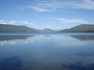
Tā Chʼilā Provincial Park, formerly Boya Lake Provincial Park, is a provincial park located in the Stikine Region of British Columbia, Canada. The park located 120 km north-by-northwest of the community of Dease Lake near BC Highway 37. Boya Lake is named for Charlie Boya, a First Nations man from the area.
Christina Lake Provincial Park is a provincial park in British Columbia, Canada. The lake it's on, Christina Lake, is renowned as the warmest lake in Canada.

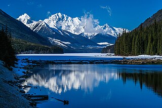
Duffey Lake Provincial Park is a provincial park in British Columbia, Canada, located at the lake of the same name, which lies along BC Highway 99 just east of the summit of Cayoosh Pass. The lake's inflow and outflow are Cayoosh Creek. The park's highest point is Mount Rohr at the westernmost boundary.

Davis Lake Provincial Park is a 185 acres (0.75 km2) park in British Columbia, Canada, established as a protected provincial park in October 1963. It is located east of the southern end of Stave Lake, northeast of Mission, British Columbia, approximately 18 km north on Sylvester Rd from BC Highway 7. There are campgrounds and beaches at the south end of the lake, access is walk-in only via a 1 km unmaintained gravel road.

Darke Lake Provincial Park is a provincial park in British Columbia, Canada located west of Okanagan Lake, southwest of the town of Peachland in that province's Okanagan region. The park is approximately 1,470 hectares in size and was established in 1968 as a provincial park Darke Lake, also mapped historically as Fish Lake, is northwest of Summerland and is named after Silas Robert Darke, an early settler in the 1890s. In 1941 Howard Clark bought Fish Lake from Clyde Stewart. He was a hunting and fishing guide that ran the camp, as well as raised four children with his wife Hazel. The children were Betty, Roger, Dale & Audrey. In 1959 he sold it to Jake and Betty Enns.
Eneas Lakes Provincial Park is a provincial park in British Columbia, Canada, located west of the town of Peachland, to the south of Peachland Creek. The park is approximately 1036 ha. in size and was established in 1968. The Eneas Lakes lie at the head of Finlay Creek.
Inland Lake Provincial Park is a provincial park in British Columbia, Canada, located on the southeast side of Powell Lake, just to the northeast of the city of Powell River in that province's northern Sunshine Coast region. Inland Lake is located between the south end of Powell Lake (W) and Haslam Lake (E).

Kinaskan Lake Provincial Park is a provincial park in British Columbia, Canada, located at the south end of Kinaskan Lake along the Stewart-Cassiar Highway near Mowdade Lake and southeast of Mount Edziza. At the south end of the park, the Iskut River, of which the lake is an expansion, spills over 12.2-metre Cascade Falls. The park is approximately 800 ha. in size.
Mabel Lake Provincial Park is a provincial park in the Monashee Mountains of British Columbia, Canada, located on the east side of Mabel Lake, which is part of the Shuswap River system. Created on December 21, 1972, at approximately 182 hectares, the park was expanded in 2000 to approximately 187 hectares.
Mud Lake Delta Provincial Park is a provincial park in British Columbia, Canada, located in the North Thompson Country due east of Blue River, 230 km from Kamloops on BC Highway 5.
Purden Lake Provincial Park is a provincial park in British Columbia, Canada. It is located east of Prince George. It encompasses the north and east sides of Purden Lake. It was established in August 1971 and covers 2,521 hectares. In 2018, Purden became the first accessible park in British Columbia, adding wheelchair ramps and specialist playground equipment.
Tsintsunko Lakes Provincial Park is a 333-hectare provincial park in British Columbia, Canada, located south of the Deadman River between Kamloops (SE) and Bonaparte Lake (NW). It is located on the Bonaparte Plateau. It was established April 30, 1996.
Tyhee Lake Provincial Park is a provincial park in British Columbia, Canada, located near the town of Smithers in the Bulkley Valley.
The Red Ocher people were an indigenous people of North America. A series of archaeological sites located in the Upper Great Lakes, the Greater Illinois River Valley, and the Ohio River Valley in the American Midwest have been discovered to be a Red Ocher burial complex, dating from 1000 BC to 400 BC, the Terminal Archaic – Early Woodland period. Characterized as shallow burials located in sandy ridges along river valleys, covered in red ochre or hydrated iron oxide (FeH3O), they contain diagnostic artifacts that include caches of flint points, turkey-tails, and various forms of worked copper. Turkey-tails are large flint blades of a distinct type. It is believed that Red Ocher people spoke an ancestral form of the Algonquian languages.

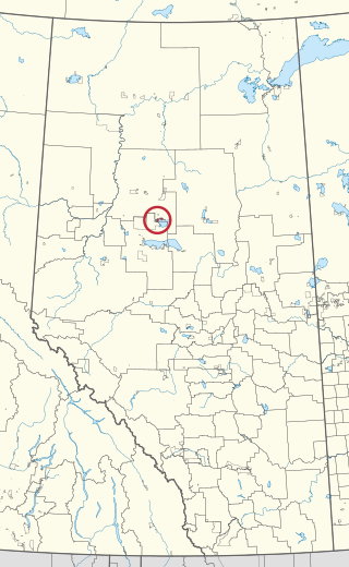
Utikoomak Lake 155 is an Indian reserve of the Whitefish Lake First Nation in Alberta, located within Northern Sunrise County and Big Lakes County. It is 61 kilometers north of High Prairie. In the 2016 Canadian Census, it recorded a population of 723 living in 158 of its 193 total private dwellings.
Columbia Lake Ecological Reserve is a nature reserve on Columbia Lake in the East Kootenay region of British Columbia, Canada, located on the east side of Columbia Lake just north of the village of Canal Flats.


