
Interstate 17 (I-17) is a north–south Interstate Highway entirely within the US state of Arizona. I-17's southern terminus lies in Phoenix, at I-10, and its northern terminus is in Flagstaff, at Milton Road north of I-40.
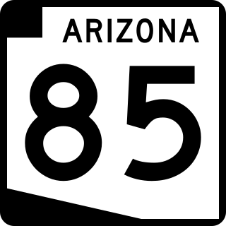
State Route 85 is a 128.86-mile-long (207.38 km) state highway in the U.S. state of Arizona. The highway runs from the United States–Mexico border near Lukeville to the north ending at Interstate 10 (I-10) in Buckeye. The highway also intersects I-8 in Gila Bend and serves as a connector between I-8 and I-10 and for travelers between Phoenix and Yuma as well as San Diego. SR 85 between I-10 and I-8, as well as I-8 between SR 85 and I-10 in Casa Grande, is touted as a bypass of the Phoenix area for long-distance travelers on I-10.
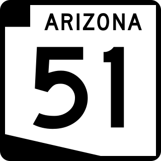
Arizona State Route 51 (SR 51), also known as the Piestewa Freeway, is a numbered state highway in Phoenix, Arizona. It connects Interstate 10 just outside Downtown Phoenix with Loop 101 on the north side of Phoenix, making it one of the area's major freeways. It is a largely north–south route and is known for traversing the Piestewa Peak Recreation Area. The peak was named after Lori Piestewa, the first Native American woman to die in combat in the U.S. military. Prior to this time, the freeway was known as the Squaw Peak Parkway, a name considered offensive by Native Americans. Rapid growth and increased traffic demand on the east side of Metro Phoenix made the Piestewa Freeway necessary.

State Route 87 is a 272.66-mile (438.80 km) north–south highway that travels from I-10 near Picacho northward to State Route 264 near Second Mesa.

Arizona State Route 101 or Loop 101 is a semi-beltway looping around the Phoenix Metropolitan Area in central Arizona. It connects several suburbs of Phoenix, including Tolleson, Glendale, Peoria, Scottsdale, Mesa, Tempe, and Chandler. Construction began in the late-1980s and was completed in 2002.

Arizona State Route 202 (SR 202) or Loop 202 is a semi-beltway circling the eastern and southern areas of the Phoenix metropolitan area in central Arizona. It traverses the eastern end and the southern end of the city of Phoenix, in addition to the cities of Tempe, Mesa, Chandler, and Gilbert, and is a vital route in the metropolitan area freeway system. Loop 202 has three officially designated sections along its route; the Red Mountain Freeway, the SanTan Freeway, and the Congressman Ed Pastor Freeway, previously named the South Mountain Freeway. The Red Mountain Freeway runs from the Mini Stack Interchange with Interstate 10 (I-10) and State Route 51 (SR 51) in Phoenix to the SuperRedTan Interchange with U.S. Route 60 (US 60) in Mesa. The SanTan Freeway runs from there to an interchange with Interstate 10 (I-10) in Chandler. The Congressman Ed Pastor Freeway runs from there to I-10 in western Phoenix.
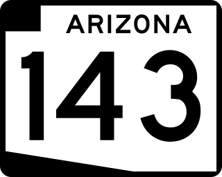
Arizona State Route 143, also known as SR 143 and the Hohokam Expressway, is a north–south and access-controlled freeway in Maricopa County, Arizona, that runs from a junction with Interstate 10 at 48th Street in Phoenix to McDowell Road. The only other major junction along the 3.93-mile (6.32 km) route is with Loop 202, which is located one half-mile south of McDowell Road and the northern terminus.

In the U.S. state of Arizona, Interstate 10 (I‑10), the major east–west Interstate Highway in the United States Sun Belt, runs east from California, enters Arizona near the town of Ehrenberg and continues through Phoenix and Tucson and exits at the border with New Mexico near San Simon. The highway also runs through the cities of Casa Grande, Eloy, and Marana. Segments of the highway are referred to as either the Papago Freeway, Inner Loop, or Maricopa Freeway within the Phoenix area and the Pearl Harbor Memorial Highway outside metro Phoenix.

State Route 153, also known as SR 153 and the Sky Harbor Expressway, is a former state highway in Maricopa County, in the U.S. state of Arizona, that ran from the intersection of 44th Street and Washington Street in Phoenix south to University Drive. It was a controlled access arterial expressway, with a speed limit of 45 mph (72 km/h), lower than the standard freeway speed of 65 mph (105 km/h). Route 153 was a north–south route that skirted the eastern edge of Sky Harbor International Airport, and along with SR 143, SR 153 served a portion of East Valley residents with access to the airport. Many motorists used SR 143 instead, because of its quick access to and from Interstate 10 and Loop 202. The freeway did, however, provide a direct link to office developments in the Southbank commercial project in east Phoenix with the city of Tempe.

Arizona State Route 303 or Loop 303, also known as the Bob Stump Memorial Parkway, is a freeway that serves the west part of the Phoenix metropolitan area. The freeway, originally a two-lane rural highway, was maintained by Maricopa County until 2004 when the Arizona Department of Transportation again took control of upgrading the interim road to a freeway.

The Stack is a colloquialism used to describe the symmetrical, four-level stack interchange in Phoenix, Arizona that facilitates movements between Interstate 17/U.S. Route 60 and Interstate 10.

State Route 30, also known as the Tres Rios Freeway, is a planned freeway in the southwest part of the Phoenix metropolitan area. It is planned as a reliever for Interstate 10 five miles to the south and will run through the communities of Buckeye, Goodyear, Avondale, and Phoenix.

State Route 24, also known as the Gateway Freeway or the Williams Gateway Freeway, is a freeway in the extreme southeastern region of the Phoenix Metropolitan Area. The roadway is planned as a controlled-access highway to move traffic from the southeastern suburbs of Phoenix to planned ones in northwestern Pinal County. It is the lowest-numbered state route in Arizona. The first mile from Loop 202 to Ellsworth Road opened on May 4, 2014. An extension to Ironwood Drive opened in 2022, with the completion of "Interim Phase II"; the first mile of this extension from Ellsworth Road to Williams Field Road opened on April 1, 2022, with the remainder following on August 11. Planning for future sections has been halted until studies for the Pinal North-South Freeway are completed to confirm how the two freeways will intersect.

U.S. Route 60 (US 60) is an east–west United States Highway within Arizona. The highway runs for 369 miles (594 km) from a junction with Interstate 10 near Quartzsite to the New Mexico State Line near Springerville. As it crosses the state, US 60 overlaps at various points: I-17, I-10, SR 77, SR 260, US 191, and US 180. Between Wickenburg and Phoenix, the route is known as Grand Avenue. From Tempe to Apache Junction, it is known as the Superstition Freeway.

U.S. Route 93 in the state of Arizona is a United States Numbered Highway that begins in Wickenburg and heads north to the Nevada state line at the Mike O'Callaghan–Pat Tillman Memorial Bridge.
The metropolitan area of Phoenix in the U.S. state of Arizona contains one of the nation's largest and fastest-growing freeway systems, with over 1,405 lane miles (2,261 km) as of 2005.

The Mini Stack is the freeway interchange among Interstate 10, State Route 51, and Loop 202 in Phoenix, Arizona, United States, located northeast of downtown. Reconstructed in 2004 to its current setup, the interchange, which is the busiest in the state of Arizona with over 300,000 vehicles per day, provides full directional access between the three freeways, as well as HOV lane connections for southbound SR 51 to eastbound I-10, westbound I-10 to northbound SR 51, westbound Loop 202 to westbound I-10, and eastbound I-10 to eastbound Loop 202.
Transportation in Phoenix, Arizona is primarily via private cars. Public transport is run under the brand Valley Metro, and consists of buses and a light rail system.
Many arterial roads in the Phoenix metropolitan area have the same name in multiple cities or towns. Some roads change names or route numbers across town borders, resulting in occasional confusion. For example, the road known as Apache Boulevard in Tempe continues east as Main Street in neighboring Mesa and then as Apache Trail in Apache Junction. Although Broadway Road maintains the same name through Goodyear, Avondale, Phoenix, Tempe, Mesa, and Apache Junction, each town uses a different reference point for address numbers.
Northern Parkway is a limited-access road in Maricopa County, Arizona that serves the west part of the Phoenix metropolitan area. Northern Parkway was first opened in December 2013. Northern Parkway currently ends at the Agua Fria River but is planned to extend to the US 60.

