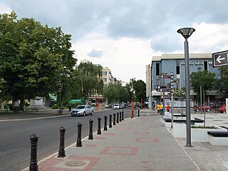
Svinčany is a village in the Pardubice Region of the Czech Republic. It has around 370 inhabitants.

Niemce is a village in Lublin County, Lublin Voivodeship, in eastern Poland. It is the seat of the gmina called Gmina Niemce. It lies approximately 14 km (9 mi) north of the regional capital Lublin.
Doły is a village in the administrative district of Gmina Śniadowo, within Łomża County, Podlaskie Voivodeship, in north-eastern Poland.

Marianówek is a village in the administrative district of Gmina Jeżów, within Brzeziny County, Łódź Voivodeship, in central Poland. It lies approximately 8 kilometres (5 mi) south of Jeżów, 17 km (11 mi) east of Brzeziny, and 36 km (22 mi) east of the regional capital Łódź.

Not to be confused with Geok Tepe in Turkmenistan.

Shalgyakh is a village in the Khizi Rayon of Azerbaijan.

Sułkowice is a village in the administrative district of Gmina Andrychów, within Wadowice County, Lesser Poland Voivodeship, in southern Poland. It lies approximately 5 kilometres (3 mi) south of Andrychów, 12 km (7 mi) south-west of Wadowice, and 50 km (31 mi) south-west of the regional capital Kraków.

Gracuch is a village in the administrative district of Gmina Końskie, within Końskie County, Świętokrzyskie Voivodeship, in south-central Poland. It lies approximately 6 kilometres (4 mi) north-west of Końskie and 43 km (27 mi) north-west of the regional capital Kielce.

Miłkowska Karczma is a village in the administrative district of Gmina Kunów, within Ostrowiec County, Świętokrzyskie Voivodeship, in south-central Poland. It lies approximately 8 kilometres (5 mi) north-east of Kunów, 9 km (6 mi) north of Ostrowiec Świętokrzyski, and 54 km (34 mi) east of the regional capital Kielce.

Przychód is a village in the administrative district of Gmina Szczawin Kościelny, within Gostynin County, Masovian Voivodeship, in east-central Poland. It lies approximately 2 kilometres (1 mi) south-west of Szczawin Kościelny, 12 km (7 mi) south-east of Gostynin, and 97 km (60 mi) west of Warsaw.

Rzęszyce is a village in the administrative district of Gmina Kampinos, within Warsaw West County, Masovian Voivodeship, in east-central Poland. It lies approximately 7 kilometres (4 mi) west of Kampinos, 31 km (19 mi) west of Ożarów Mazowiecki, and 45 km (28 mi) west of Warsaw.

Józefowo is a village in the administrative district of Gmina Rząśnik, within Wyszków County, Masovian Voivodeship, in east-central Poland. It lies approximately 6 kilometres (4 mi) north of Rząśnik, 19 km (12 mi) north of Wyszków, and 64 km (40 mi) north of Warsaw.
Główczyn is a village in the administrative district of Gmina Szczytniki, within Kalisz County, Greater Poland Voivodeship, in west-central Poland.
Nowa Ruda is a village in the administrative district of Gmina Wierzbinek, within Konin County, Greater Poland Voivodeship, in west-central Poland.

Leśnia is a village in the administrative district of Gmina Dębnica Kaszubska, within Słupsk County, Pomeranian Voivodeship, in northern Poland. It lies approximately 8 kilometres (5 mi) east of Dębnica Kaszubska, 21 km (13 mi) south-east of Słupsk, and 88 km (55 mi) west of the regional capital Gdańsk.

Skórzyno is a village in the administrative district of Gmina Główczyce, within Słupsk County, Pomeranian Voivodeship, in northern Poland. It lies approximately 2 kilometres (1 mi) north-west of Główczyce, 29 km (18 mi) north-east of Słupsk, and 88 km (55 mi) west of the regional capital Gdańsk.

Staro Korito is a village in the municipality of Knjaževac, Serbia. According to the 2002 census, the village has a population of 51 people.

Luka is a village in the municipality of Srebrenica, Bosnia and Herzegovina.

Skenderovići is a village in the municipality of Srebrenica, Bosnia and Herzegovina.

Alıbəyli is a village in the Kalbajar Rayon of Azerbaijan.


