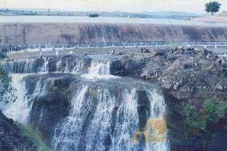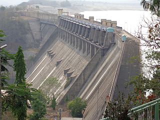
The Wainganga is a river in India originating in the Mahadeo Hills in Mundara in Gondwana region near the village Gopalganj in Seoni, Madhya Pradesh. It is a key tributary of the Godavari. The river flows south in a winding course through the states of Madhya Pradesh and Maharashtra, roughly 580 km (360 mi). After joining the Wardha River, the united stream, which is known as the Pranahita River, empties into the Godavari River at Kaleshwaram, Telangana.

Nagpur district is a district in the Vidarbha region of Maharashtra state in central India. The city of Nagpur is the district administrative centre. The district is part of Nagpur Division.

Bhatsa Dam, is an earthfill and gravity dam on Bhatsa river near Shahapur, Thane district in state of Maharashtra in India.

Ujjani Dam, also known as Bhima Dam or Bhima Irrigation Project, on the Bhima River, a tributary of the Krishna River, is an earthfill cum Masonry gravity dam located near Ujjani village of Madha Taluk in Solapur district of the state of Maharashtra in India.

Mandohol Dam, is an earth-fill dam on Mandohol River in Karjule Hareshwar village of Parner taluka in Ahmednagar district of state of Maharashtra in India.

Totladoh dam, is a gravity dam on the Pench river near Ramtek in Nagpur district in the state of Maharashtra and adjoining Madhya Pradesh in India.
Mahamadwadi Dam, is an earthfill dam on Gad river near Nardave in Kankavli taluka of Sindhudurg district, in the state of Maharashtra in India.

Ramtek Dam, is an earthfill dam on Sur River near Ramtek, Nagpur district in the state of Maharashtra in India.
Chandpur Dam, is an earthfill dam on Chandpur river near Tumsar, Bhandara district in the state of Maharashtra in India.
Pandherbodi Dam, is an earthfill dam on local river near Umred, Nagpur district in the state of Maharashtra in India.
Upper Pus Dam, also called Pus Dam is an earthfill dam on Pus river near Pusad, Yavatmal district in the state of Maharashtra in India. There is another downstream dam near Mahagaon called Lower Pus Dam which was built in 1983. Other nearby dams are Arunawati Dam in Digras built in 1994 and Isapur Dam built in 1982.
Saikheda Dam, is an earthfill dam on Khuni river near Pandharkawada, Yavatmal district in state of Maharashtra in India.Saikheda Dam was constructed as part of irrigation projects by Government of Maharashtra in the year 1972. Nearest city to dam is Pandharkawada and the Dam is situated in Kelapur Taluka of Yavatmal District of Maharashtra. It is built on and impounds Khuni River,.
Kanholibara Dam is an earthfill dam on a local river Krishna near Hingana, Nagpur district in state of Maharashtra in India.
Kamthikhairy Dam, also called Pench Dam, is on the Pench river near Parshivni in the state of Maharashtra, India. The dam was constructed for irrigation, and supplies water to two districts of Maharashtra, Nagpur and Bhandara. The dam is located in the West Pench National Park Range, surrounded by forested hills, and is 54 km north of Nagpur.
Ozarkhed Dam is an earthfill dam on Unanda River near Dindori, Nashik district in the state of Maharashtra in India. It was constructed in Krishnagaon village which was later moved near Vani. The dam has a canal from which the water is released for irrigational purposes for the east region of Nashik district.
Jam Dam, is an earthfill dam on Jam river near Katol, Nagpur district in state of Maharashtra in India.
Punegaon Dam, is an earthfill dam on Unanda river near Punegaon, Vani, Nashik district in the state of Maharashtra in India.

Ghod River is located in Pune District, Maharashtra, western India. It is a tributary of the Bhima River. The Ghod originates on the eastern slopes of the Western Ghats at 1,090 metres (3,580 ft) above sea level. It flows in an east-southeast direction for approximately 200 kilometres (120 mi) before its confluence with the Bhima. It flows from the northern side of the Sahyadri Hills.

The Kolar River is a river of Nagpur district, Maharashtra, India, flowing southeast from above the town of Saoner to its juncture with the Kanhan River. It is in the Godavari river basin. The Kolar River forms the boundary between Saoner taluka and Ramtek taluka.

The Pench River is an Indian tributary of the Kanhan River. It originates in the Chhindwara district of Madhya Pradesh and flows across Pench National Park, which is a reserve for the Tiger Project of India.


