Related Research Articles

Geophysics is a subject of natural science concerned with the physical processes and physical properties of the Earth and its surrounding space environment, and the use of quantitative methods for their analysis. Geophysicists, who usually study geophysics, physics, or one of the Earth sciences at the graduate level, complete investigations across a wide range of scientific disciplines. The term geophysics classically refers to solid earth applications: Earth's shape; its gravitational, magnetic fields, and electromagnetic fields ; its internal structure and composition; its dynamics and their surface expression in plate tectonics, the generation of magmas, volcanism and rock formation. However, modern geophysics organizations and pure scientists use a broader definition that includes the water cycle including snow and ice; fluid dynamics of the oceans and the atmosphere; electricity and magnetism in the ionosphere and magnetosphere and solar-terrestrial physics; and analogous problems associated with the Moon and other planets.
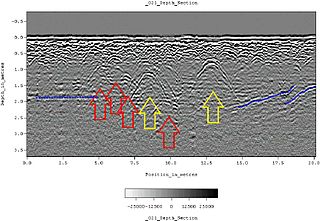
Ground-penetrating radar (GPR) is a geophysical method that uses radar pulses to image the subsurface. It is a non-intrusive method of surveying the sub-surface to investigate underground utilities such as concrete, asphalt, metals, pipes, cables or masonry. This nondestructive method uses electromagnetic radiation in the microwave band of the radio spectrum, and detects the reflected signals from subsurface structures. GPR can have applications in a variety of media, including rock, soil, ice, fresh water, pavements and structures. In the right conditions, practitioners can use GPR to detect subsurface objects, changes in material properties, and voids and cracks.
Radioglaciology is the study of glaciers, ice sheets, ice caps and icy moons using ice penetrating radar. It employs a geophysical method similar to ground-penetrating radar and typically operates at frequencies in the MF, HF, VHF and UHF portions of the radio spectrum. This technique is also commonly referred to as "Ice Penetrating Radar (IPR)" or "Radio Echo Sounding (RES)".
Susan Elizabeth Werner Kieffer is an American physical geologist and planetary scientist. Kieffer is known for her work on the fluid dynamics of volcanoes, geysers, and rivers, and for her model of the thermodynamic properties of complex minerals. She has also contributed to the scientific understanding of meteorite impacts.

Geophysical imaging is a minimally destructive geophysical technique that investigates the subsurface of a terrestrial planet. Geophysical imaging is a noninvasive imaging technique with a high parametrical and spatio-temporal resolution. It can be used to model a surface or object understudy in 2D or 3D as well as monitor changes.
Induced polarization (IP) is a geophysical imaging technique used to identify the electrical chargeability of subsurface materials, such as ore.

The Environmental and Engineering Geophysical Society (EEGS) is an international, applied scientific organization that has 700 members. One of the society’s major activities is producing its annual meeting, the Application of Geophysics to Engineering and Environmental Problems (SAGEEP). It develops and distributes a peer-reviewed scientific journal, the Journal of Environmental and Engineering Geophysics (JEEG), as well as an electronic quarterly newsletter, FastTIMES. It publishes, markets, and distributes books and CD-ROMs on the application and use of near-surface geophysical technologies, both in print and electronically.

Sean Carl Solomon is the director of the Lamont–Doherty Earth Observatory of Columbia University, where he is also the William B. Ransford Professor of Earth and Planetary Science. Before moving to Columbia in 2012, he was the director of the Department of Terrestrial Magnetism at the Carnegie Institution in Washington, D.C. His research area is in geophysics, including the fields of planetary geology, seismology, marine geophysics, and geodynamics. Solomon is the principal investigator on the NASA MESSENGER mission to Mercury. He is also a team member on the Gravity Recovery and Interior Laboratory mission and the Plume-Lithosphere Undersea Melt Experiment (PLUME).

Near-surface geophysics is the use of geophysical methods to investigate small-scale features in the shallow subsurface. It is closely related to applied geophysics or exploration geophysics. Methods used include seismic refraction and reflection, gravity, magnetic, electric, and electromagnetic methods. Many of these methods were developed for oil and mineral exploration but are now used for a great variety of applications, including archaeology, environmental science, forensic science, military intelligence, geotechnical investigation, treasure hunting, and hydrogeology. In addition to the practical applications, near-surface geophysics includes the study of biogeochemical cycles.
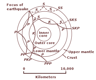
The following outline is provided as an overview of and topical guide to geophysics:
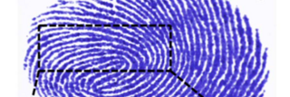
Forensic geophysics is a branch of forensic science and is the study, the search, the localization and the mapping of buried objects or elements beneath the soil or the water, using geophysics tools for legal purposes. There are various geophysical techniques for forensic investigations in which the targets are buried and have different dimensions. Geophysical methods have the potential to aid the search and the recovery of these targets because they can non-destructively and rapidly investigate large areas where a suspect, illegal burial or, in general, a forensic target is hidden in the subsoil. When in the subsurface there is a contrast of physical properties between a target and the material in which it is buried, it is possible to individuate and define precisely the concealing place of the searched target. It is also possible to recognize evidences of human soil occupation or excavation, both recent and older. Forensic geophysics is an evolving technique that is gaining popularity and prestige in law enforcement.
Hydrogeophysics is a cross-disciplinary area of research that uses geophysics to determine parameters and monitor processes for hydrological studies of matters such as water resources, contamination, and ecological studies. The field uses knowledge and researchers from geology, hydrology, physics, geophysics, engineering, statistics, and rock physics. It uses geophysics to provide quantitative information about hydrogeological parameters, using minimally invasive methods. Hydrogeophysics differs from geophysics in its specific uses and methods. Although geophysical knowledge and methods have existed and grown over the last half century for applications in mining and petroleum industries, hydrogeological study sites have different subsurface conditions than those industries. Thus, the geophysical methods for mapping subsurface properties combine with hydrogeology to use proper, accurate methods to map shallow hydrological study sites.
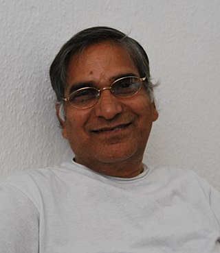
Sri Niwas (1946–2012) was an Indian geophysicist and a professor at the Department of Earth Sciences of the Indian Institute of Technology, Roorkee. He was known for his researches on the Inversion of Geophysical Data. He was an elected fellow of all the three major Indian science academies viz. Indian National Science Academy, Indian Academy of Sciences, National Academy of Sciences, India as well as Indian Geophysical Union and was an elected member of the Association of Exploration Geophysicists. The Council of Scientific and Industrial Research, the apex agency of the Government of India for scientific research, awarded him the Shanti Swarup Bhatnagar Prize for Science and Technology, one of the highest Indian science awards for his contributions to Earth, Atmosphere, Ocean and Planetary Sciences in 1991.
Hrvoje Tkalčić is an Australian and Croatian scientist (geophysicist) and Professor E2 at the Australian National University in Canberra.
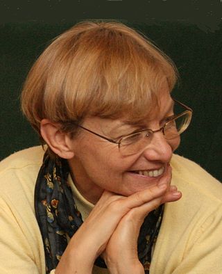
Barbara A. Romanowicz is a French geophysicist and an expert on imaging the Earth's interior.

Estella Atekwana is a geophysicist studying biogeophysics and tectonophysics. She is currently Dean of the College of Letters and Science, and also a Professor in the Department of Earth and Planetary Sciences at University of California, Davis. She previously served as Dean of the College of Earth, Ocean and Environment at the University of Delaware. She is also an adjunct professor at both the University of Waterloo and the Missouri University of Science and Technology. Before joining the University of Delaware in 2017, she was the Department Head of the Boone Pickens School of Geology at Oklahoma State University. She maintains an adjunct appointment. Atekwana has also been a faculty member at Missouri University of Science & Technology, Indiana University-Purdue University Indianapolis, and Western Michigan University. Atekwana has been a part of helping write many journals and has earned many awards and honors throughout her career. She's an elected member of American Academy of Arts and Sciences.

Kamini Singha is a professor in the department of Geology and Geological Engineering at the Colorado School of Mines, where she works on questions related to hydrogeology.
Alexander Peter Annan is an engineer whose research focuses on near-surface geophysics. He has made significant contributions to the development of ground-penetrating radar (GPR) technology. Annan is the CEO of Sensors & Software, a company he founded to commercialize GPR technology. He has been working on the development of GPR since the 1970s and was one of the lead researchers on the surface electrical properties experiment conducted on the Moon during the Apollo 17 mission.
Jerry M. Harris is an American geophysicist and the Cecil and Ida Green Professor of Geophysics at Stanford University. Harris established the Stanford Wave Physics Lab, which investigate the physics of seismic and electromagnetic waves in complex media. He was co-founder of the Stanford Global Climate and Energy Project and the Center for Computational Earth and Environmental Science.
References
- 1 2 "Women @ The Lab - Susan Hubbard, Ph.D." sites.google.com. Retrieved 2020-03-14.
- ↑ Hubbard, Susan Sharpless (1990). Paleozoic and Grenvillian structures in the southern Appalachians: extended interpretation from seismic reflection data (Thesis). OCLC 21766837.
- ↑ Hubbard, Susan Sharpless (1998). Stochastic characterization of hydrogeological properties using geophysical data (Thesis). OCLC 42667414.
- ↑ "Academy of Distinguished Alumni | Civil and Environmental Engineering". ce.berkeley.edu. Retrieved 2020-09-11.
- ↑ https://www.geol.ucsb.edu/sites/default/files/sitefiles/news/newsletters/Earth%20Science%20newsletter%20Fall2019-120419-web.pdf [ bare URL PDF ]
- ↑ Sharpless, Susan. "A compilation of ages of mineralization of metallic mineral deposits in the western conterminous Cordillera as determined through 1985" (PDF). United States Geological Survey.
- ↑ "News & Events - Berkeley Lab Earth Sciences Division". earthsciences.typepad.com. Retrieved 2020-03-14.
- ↑ "Susan Hubbard Appointed Associate Laboratory Director, Earth and Environmental Sciences". today.lbl.gov. Retrieved 2020-10-27.
- ↑ "'Visionary scientist' looks to inspire new generation". www.tnledger.com. Retrieved 2022-08-22.
- ↑ "Susan S Hubbard". Our Environment at Berkeley. Retrieved 2020-03-14.
- ↑ "Dr. Susan S. Hubbard". NAE Website. Retrieved 2020-03-14.
- ↑ "Hydrogeophysics". Earth and Environmental Sciences Area. Retrieved 2020-03-14.
- ↑ Hubbard, Susan (2008-06-01). "The evolution of hydrogeophysics". The Leading Edge. 27 (6): 824. Bibcode:2008LeaEd..27..824H. doi:10.1190/tle27060824.1. ISSN 1070-485X. S2CID 140631202.
- ↑ Binley, Andrew; Hubbard, Susan S.; Huisman, Johan A.; Revil, André; Robinson, David A.; Singha, Kamini; Slater, Lee D. (2015). "The emergence of hydrogeophysics for improved understanding of subsurface processes over multiple scales". Water Resources Research. 51 (6): 3837–3866. Bibcode:2015WRR....51.3837B. doi:10.1002/2015WR017016. ISSN 0043-1397. PMC 4744786 . PMID 26900183.
- 1 2 "Birdsall Dreiss Distinguished Lecturer" (PDF). GSA Hydrogeology Division. Retrieved 2020-03-14.
- 1 2 3 4 Williams, Sarah C. P. (2013-04-23). "Imaging permafrost". Proceedings of the National Academy of Sciences. 110 (17): 6611. Bibcode:2013PNAS..110.6611W. doi: 10.1073/pnas.1306167110 . ISSN 0027-8424. PMC 3637787 . PMID 23613572.
- ↑ Fauchald, Nick (December 12, 2013). "A New Blip on the Winemaking Radar". Wine Spectator.
- 1 2 "Geophysical Imaging of Permafrost Dynamics". Earth and Environmental Sciences Area. Retrieved 2020-03-14.
- ↑ "The Hidden Perils of Permafrost". KQED. 2 December 2014. Retrieved 2020-03-14.
- ↑ Dafflon, Baptiste; Hubbard, Susan; Ulrich, Craig; Peterson, John; Wu, Yuxin; Wainwright, Haruko; Kneafsey, Timothy J. (2016). "Geophysical estimation of shallow permafrost distribution and properties in an ice-wedge polygon-dominated Arctic tundra region" (PDF). Geophysics. 81 (1): WA247 –WA263. Bibcode:2016Geop...81A.247D. doi:10.1190/geo2015-0175.1. ISSN 0016-8033. OSTI 1563927. S2CID 130758289.
- ↑ Trader, Tiffany (27 December 2021). "Susan Hubbard named Deputy for Science and Technology at ORNL". HPCwire. Retrieved 2022-08-22.
- ↑ "Susan Hubbard Archives". Oak Ridge Today. Retrieved 2022-08-22.
- ↑ "Awards". www.eegs.org. Retrieved 2020-03-14.
- ↑ "GSA Fellowship". www.geosociety.org. Retrieved 2020-03-14.
- ↑ "Academy of Distinguished Alumni Announces 2014 Class | Civil and Environmental Engineering". ce.berkeley.edu. Retrieved 2020-03-14.
- ↑ "Susan Hubbard, 2016 Harold Mooney Award Recipient". Society of Exploration Geophysicists. Retrieved 2020-10-27.
- ↑ Wong, Kristine (2017-07-27). "Susan Hubbard Named 2017 American Geophysical Union Fellow". Earth and Environmental Sciences Area. Retrieved 2020-03-14.
- ↑ "Susan S. Hubbard". American Academy of Arts & Sciences. Retrieved 2020-03-14.
- ↑ "Susan Hubbard Honored by Alameda County Women's Hall of Fame". Earth and Environmental Sciences Area. 2019-02-21. Retrieved 2020-03-14.
- ↑ "National Academy of Engineering Elects 87 Members and 18 International Members". NAE Website. Retrieved 2020-03-14.
- ↑ Kovner, Aliyah (2020-02-07). "Associate Lab Director Susan Hubbard Joins the National Academy of Engineering". News Center. Retrieved 2020-03-14.
- ↑ "A Watershed Moment for Critical Zone Geophysics". www.knowledgette.com. Retrieved 2022-08-22.
- ↑ "HL Susan Hubbard". Society of Exploration Geophysicists. Retrieved 2022-08-22.
- ↑ "10.16.2003 - Radar and Fine Wine: Innovative research uses radar to map soil moisture, create better wine grapes". www.berkeley.edu. Retrieved 2020-03-14.
- ↑ "CNN.com - Military tool helps make classier wines - Oct. 31, 2003". www.cnn.com. Retrieved 2020-03-14.
- ↑ "Geotimes — August 2004 — The Quest for Better Wine Using Geophysics". www.geotimes.org. Retrieved 2020-03-14.
- ↑ "Hydrogeophysicist to discuss grape growing Sept. 22 | Announce | University of Nebraska-Lincoln". newsroom.unl.edu. Retrieved 2020-03-14.
- ↑ "Precision Viticulture Research". Earth and Environmental Sciences Area. Retrieved 2020-03-14.
- ↑ "A New Blip on the Winemaking Radar". Wine Spectator. Retrieved 2020-03-14.
- ↑ "Estate". Mila Family Vineyards. Retrieved 2020-03-14.