The Japanese Alps is a series of mountain ranges in Japan which bisect the main island of Honshu. The peaks that tower over central Honshu have long been the object of veneration and pilgrimage. These mountains had long been exploited by local people for raw materials, including timber, fuel, fertilizer, fodder, meat, minerals, and medicines. Most visitors came to the mountain for pilgrimage, especially to the Buddhist temple and the sacred peak of Mount Tate.

Yunoyama Onsen (湯の山温泉), or Yunoyama Hot Springs, is a hot springs resort located near Mount Gozaisho in the town of Komono, Mie Prefecture, Japan. The area is within the borders of the Suzuka Quasi-National Park.

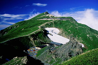
Mount Yari is one of the 100 Famous Japanese Mountains. The 3,180-metre-high (10,433 ft) peak lies in the southern part of the Hida Mountains of Japan, on the border of Ōmachi and Matsumoto in Nagano Prefecture and Takayama in Gifu Prefecture. The priest Banryū (1786–1840) founded a temple there.

Mount Aino, or Ainodake, is a peak of the Akaishi Mountains−Southern Alps, in Minami Alps National Park, Japan. At 3,189 m (10,463 ft), it is the fourth tallest peak in Japan and the second highest in the Akaishi Mountains.

Ōdaigahara-san or Ōdaigahara-yama (大台ヶ原山), also Hinode-ga-take or Hide-ga-take (日出ヶ岳) is a mountain in the Daikō Mountain Range on the border between the prefectures of Mie and Nara, Japan. It is the highest in Mie at 1,695 metres (5,561 ft). Walking trails from the Nara side start from a car park at about 1400 metres. The mountain is famous for wild deer, and also for wild birds, especially wrens and Japanese robins, as well as treecreepers and woodpeckers. In 1980, an area of 36,000 hectares in the region of Mount Ōdaigahara and Mount Ōmine was designated a UNESCO Man and the Biosphere Reserve.

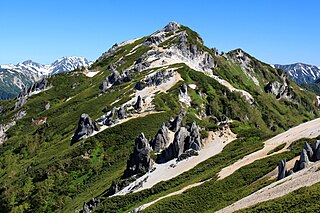
Mount Tsubakuro is a 2,763-metre-high (9,065 ft) mountain in Azumino, Nagano Prefecture, Japan. It is situated in Japan's Hida Mountains in Nagano Prefecture. It was specified for Chūbu-Sangaku National Park on December 4, 1934. Granite forms the unique body with white sands and sharp rocks exposed at the top. Kassen One (ridge) is a steep trail challenging to climbers ascending from Nakabusa Hot Springs.

The Gozaisho Ropeway is the name of a Japanese aerial lift line, as well as its operator. Opened in 1959, the line climbs Mount Gozaisho in Komono, Mie. Riders can see a view of Yokkaichi and Ise Bay. The mountain itself is known for its scenery and Yunoyama Onsen. The line links to a chairlift line that goes to the summit.

Mount Gozaisho is a Japanese mountain located on the border of Komono, Mie Prefecture and Higashi-Ōmi, Shiga Prefecture.
The Ryōhaku Mountains are a mountain range spanning Gifu, Toyama, Ishikawa, Fukui and Shiga prefectures in Japan. It is divided into the Kaetsu Mountains, whose major peak is Mount Haku, and the Etsumi Mountains, whose major peak is Mount Nōgōhaku. The range derives its name from the two major peaks, which both have "haku" in their names. Most of the Ryōhaku Mountains are within Hakusan National Park.

The Ibuki Mountains are a mountain range straddling the border between Gifu and Shiga prefectures in Japan. After lowering and nearly disappearing in Shiga Prefecture, the range continues as the Suzuka Mountains. During the winter, the winds from the Ibuki Mountains are a cause of much of the snowfall on the Nōbi Plain covering Gifu and Aichi prefectures.

The Yōrō Mountains are a mountain range straddling the border between Gifu and Mie prefectures in Japan. They form part of the western border of the Nōbi Plain.

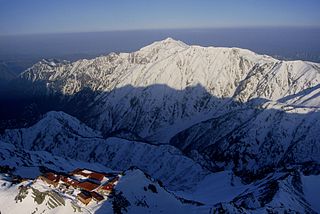
Mt. Shirouma is a peak in the Hida Mountains range of the Japanese Alps, located in Nagano Prefecture and Toyama Prefecture, central Honshu, Japan.

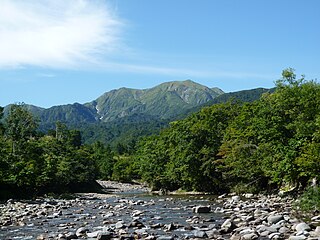
Mount Echigo-Komagatake or Uonuma-Komagatake is a mountain located on the border of Uonuma and Minamiuonuma, Niigata Prefecture, Japan, with an elevation of 2,002.7 m (6,571 ft) It is one of the 100 famous mountains in Japan. Mount Echigo-Komagatake, along with Nakanodake and Mount Hakkai, is also one of the three great mountains of Echigo, the old name for this area of Niigata Prefecture.

Mount Norikura is a potentially active volcano located on the borders of Gifu and Nagano prefectures in Japan. It is part of the Hida Mountains and is listed among the 100 Famous Japanese Mountains and the New 100 Famous Japanese Mountains.

Mount Kasa is one of the 100 Famous Japanese Mountains, reaching the height of 2,897 m (9,505 ft). It is situated in Japan's Hida Mountains in Gifu Prefecture and in Chūbu-Sangaku National Park. The shape of the mountain looks like the Umbrella("Kasa"-笠) in the triangle. Therefore, it became this name. There are many mountains with same name in Japan and this is the tallest.

Mount Jōnen is one of the 100 Famous Japanese Mountains, reaching the height of 2,857 m (9,373 ft). It is situated in Japan's Hida Mountains in Nagano Prefecture and in Chūbu-Sangaku National Park. The shape of the mountain looks like the triangle. It can be seen from Azumi Basin.

Mount Kurobegorō is one of the 100 Famous Japanese Mountains, reaching the height of 2,839.58 m (9,316 ft). It is situated in Japan's Hida Mountains in Gifu Prefecture and Toyama Prefecture. It was specified for Chūbu-Sangaku National Park on December 4, 1934.

Suzuka Quasi-National Park is a Quasi-National Park in Mie and Shiga Prefectures, Japan. It was established in 1968.

Mount Iyogatake is a mountain on the border of the city of Minamibōsō, Chiba Prefecture, Japan with an altitude of 336.6 m (1,104 ft). Mount Iyogatake is at the west of the Mineoka Mountain District of the Bōsō Hill Range, in close proximity to Mount Tomi. The mountain takes its name from its resemblance to Mount Ishizuchi in Ehime Prefecture, formerly in Iyo Province.

Mount Oike is a mountain with an altitude of 1,247 m in the Suzuka Mountains in Higashiōmi, Shiga Prefecture. The northeastern side of the hillside is located on the border with Inabe, Mie Prefecture. It is the highest peak in the Suzuka Mountains and Higashiōmi.


