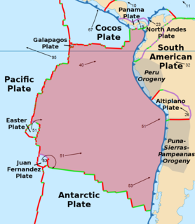
The Nazca Plate or Nasca Plate, named after the Nazca region of southern Peru, is an oceanic tectonic plate in the eastern Pacific Ocean basin off the west coast of South America. The ongoing subduction, along the Peru–Chile Trench, of the Nazca Plate under the South American Plate is largely responsible for the Andean orogeny. The Nazca Plate is bounded on the west by the Pacific Plate and to the south by the Antarctic Plate through the East Pacific Rise and the Chile Rise respectively. The movement of the Nazca Plate over several hotspots has created some volcanic islands as well as east-west running seamount chains that subduct under South America. Nazca is a relatively young plate both in terms of the age of its rocks and its existence as an independent plate having been formed from the break-up of the Farallon Plate about 23 million years ago. The oldest rocks of the plate are about 50 million years old.

The Northland Peninsula, called the North Auckland Peninsula in earlier times, is in the far north of the North Island of New Zealand. It is joined to the rest of the island by the Auckland isthmus, a narrow piece of land between the Waitematā Harbour and the Manukau Harbour in the middle of the Auckland metropolitan area. The peninsula is not conterminous with the local government area of Northland Region, which occupies the northern 80% of the peninsula. The southern section of the peninsula is administratively part of the Auckland Region.

The Far North District is the northernmost territorial authority district of New Zealand, consisting of the northern part of the Northland Peninsula in the North Island. It stretches from North Cape and Cape Reinga / Te Rerenga Wairua in the north, down to the Bay of Islands, the Hokianga and the town of Kaikohe.

North Cape is located at the northern end of the Northland Peninsula in the North Island of New Zealand. It is the northeastern tip of the Aupouri Peninsula and lies 30 kilometres (19 mi) east and 3 kilometres (1.9 mi) north of Cape Reinga. The name North Cape is sometimes used to refer just to the cape that is known in Māori as Otou and which overlooks Murimotu Island, and sometimes just to the eastern point of Murimotu Island. It is also used to refer to the whole larger headland stretching about five km from Murimotu Island westwards to Kerr Point (Ngatuatata) and including the Surville Cliffs. This wider North Cape, and specifically the Surville Cliffs, is the northernmost point of mainland New Zealand, being about three km further north than Cape Reinga. This article covers the wider North Cape. Statistics New Zealand uses a much larger statistical area called North Cape, extending south to the Houhora Heads in the 2018 New Zealand census. That area is covered by the article on Aupouri Peninsula.
Spirits Bay, officially named Piwhane / Spirits Bay, is a remote bay at the northern end of the Aupouri Peninsula, which forms the northern tip of New Zealand's North Island. It lies between Cape Reinga / Te Rerenga Wairua in the west and Ngataea / Hooper Point in the east. It is one of two bays in the short length of coast at the top of the North Island.

The Aupouri Peninsula is a tombolo at the northern tip of the North Island of New Zealand. It projects between the Tasman Sea to the west and the Pacific Ocean to the east. It constitutes the northern part of the Far North District, incorporating North Cape, Houhora and the northern half of Awanui.

Parengarenga Harbour is a natural harbour close to the northernmost point on the North Island of New Zealand. Located at the northern end of the Aupouri Peninsula, it extends inland for over 10 kilometres, almost severing the northern tip of the island from the rest of the peninsula. The harbour's mouth is towards the norther end of Great Exhibition Bay. The island's northernmost point, at the Surville Cliffs is only about 10 kilometres north of the harbour. Te Hapua is a settlement at the western side of the harbour.
The Maungataniwha Range is a volcanic mountain range located in Northland Region of New Zealand. The Mangamukas, as it is known by the local residents and many Northlanders because of the name of the settlement and river on the southern side, separates Kaitaia and the Aupouri Peninsula from the rest of Northland. The highest point in the Maungataniwha Ranges is Raetea at 744m. The range is home to many kauri trees and part of the range is a part of Northland Forest Park.

Tōtaranui is a 1 km long beach and the site of a large campsite in the Tasman Region of New Zealand administered by the Department of Conservation (DOC).
The Okanagan Indian Band is a First Nations government in the Canadian province of British Columbia, located in the city of Vernon in the northern Okanagan Valley. The band is a member government of the Okanagan Nation Alliance.

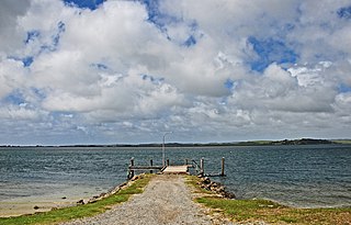
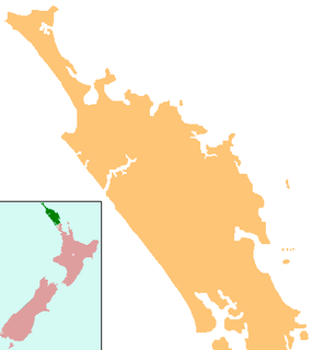
Herekino is a locality in Northland, New Zealand. It lies 26 km south west of Kaitaia. The Herekino Harbour, also called the Herekino River, is an estuary and inlet from the Tasman Sea to the west. The Herekino Forest, which contains a stand of large kauri, is to the north, and the Tauroa Peninsula lies to the north west.

Ngataki is a community on the Aupouri Peninsula in Northland, New Zealand. State Highway 1 runs through the area. To the east is Rarawa Beach, a mile-long strip of clean silver sand, gently shelving and backed by sand dunes. To the north-east is the Great Exhibition Bay and Rarawa Bay and to the south-west is the long Ninety Mile Beach coastline.

Houhora is a locality and harbour on the east side of the Aupouri Peninsula of Northland, New Zealand. It is 41 km (25 mi) north of Kaitaia. Waihopo, Te Raupo, Pukenui, Raio and Houhora Heads are associated localities on the southern shores of the harbour. State Highway 1 passes through all these localities except for Houhora Heads. Te Kao is 24 km north west, and Waiharara is 22 km south east.

Lake Kihona is a dune lake in the Northland Region of New Zealand. It is located to the northwest of Te Kao on the Aupouri Peninsula.

Lake Ngakapua is a dune lake in the Northland Region of New Zealand. It is located to the northwest of Awanui, near Waipapakauri on the Aupouri Peninsula.

Lake Rotokawau is a dune lake on the Aupouri Peninsula the Far North, New Zealand. The name is also used for lakes in the Kaipara District, Chatham Islands, in Bay of Plenty and near Lake Waikare in Waikato.

Lake Waiparera is a dune lake in the Northland Region of New Zealand.It is located immediately North-West of Waiharara on the Aupouri Peninsula. The lake is the largest of the Aupouri Lakes. The catchment is predominately pasture, with the remainder scrub or wetland. The lake has several inflows (drains), with no obvious outflows. The lake is easily accessed from SH1.

Henderson Bay is a bay on the Aupouri Peninsula, near the very top of the North Island in New Zealand. It is on the eastern side of the peninsula next to the Pacific Ocean and 7 km off New Zealand State Highway 1, 66 km south of Cape Reinga and 10 km north of Houhora. A gravel road connects the bay to the highway.
Great Exhibition Bay is a 30-kilometre (19 mi) wide embayment close to the northernmost tip of New Zealand's North Island. It lies on the east coast of the Aupouri Peninsula in the Northland Region. The large natural inlet of Parengarenga Harbour lies at the northern end of the bay.
Waipapakauri is a small settlement in the Far North District of New Zealand. It is located on State Highway 1 at the isthmus of the Aupouri Peninsula. The larger settlement of Awanui lies to the southeast. Waipapakauri is some 12 kilometres to the north of Kaitaia, the nearest town.


