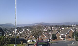
Glamorgan, or sometimes Glamorganshire, was one of the thirteen historic counties of Wales in the south of Wales. Originally an early medieval petty kingdom of varying boundaries known in Welsh as Morgannwg, which was then invaded and taken over by the Normans as the Lordship of Glamorgan. The area that became known as Glamorgan was both a rural, pastoral area, and a conflict point between the Norman lords and the Welsh princes. It was defined by a large concentration of castles.

Gower or the Gower Peninsula is in South West Wales and is the most westerly part of the historic county of Glamorgan, Wales. It projects towards the Bristol Channel. In 1956, the majority of Gower became the first area in the United Kingdom to be designated an Area of Outstanding Natural Beauty.

Loughor is a town in Swansea, Wales. Historically in Glamorgan, it lies on the estuary of the River Loughor. The town has a community council under the name Llwchwr. The town is bordered by the communities of Bynea in Carmarthenshire, Grovesend, Gowerton, and Gorseinon. Loughor is part of the built-up area of Gorseinon.

Gaer is a community and electoral district ("ward") of the city of Newport, South Wales.
The history of Swansea covers a period of continuous occupation stretching back a thousand years, while there is archaeological evidence of prehistoric human occupation of the surrounding area for thousands of years before that.

Candleston Castle is a 14th-century fortified manor house, in ruins since the 19th century. It is 0.75 miles (1.2 km) southwest of Merthyr Mawr, Glamorgan, Wales, now Bridgend County Borough and just 0.75 miles (1.2 km) northwest of Ogmore Castle, separated by the River Ogmore. Candleston's original long and narrow rectangular structure lay across the western end of a low narrow promontory, suggesting a defensive position. The castle is believed to be named after the Norman family of Cantilupe, thought to be its first feudal tenants.

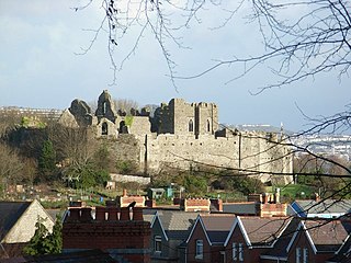
Oystermouth Castle is a Norman stone castle in Wales, overlooking Swansea Bay on the east side of the Gower Peninsula near the village of Mumbles. porfavor poned algun dato curioso

Bonvilston is a village in the Vale of Glamorgan, Wales. The village is situated on the A48 about four miles east of Cowbridge and near the Welsh capital city of Cardiff. The population in 2011 was 392.

Loughor Castle is a ruined, medieval fortification located in the town of Loughor, Wales. The castle was built around 1106 by the Anglo-Norman lord Henry de Beaumont, during the Norman invasion of Wales. The site overlooked the River Loughor and controlled a strategic road and ford running across the Gower Peninsula. The castle was designed as an oval ringwork, probably topped by wicker fence defences, and reused the remains of the former Roman fort of Leucarum.

Gower was an ancient marcher lordship of Deheubarth in South Wales.

Neath Castle is a Norman castle located in the town centre of Neath, Wales. Its construction was begun by Robert, Earl of Gloucester, the nominal Lord of Glamorgan, at a date estimated between 1114 and 1130. It is also referred to as "Granville's Castle", after Richard I de Grenville, Lord of Neath, who has also been credited with its construction. The town of Neath takes its Welsh name, "Castell-nedd", from the castle.

Penlle'r Castell is an historic ruin on the summit of Mynydd y Gwair in the far north of the City and County of Swansea. The Penlle'r Castell site was probably a late 13th-century stronghold garrisoned by one of the Marcher Lords.
Pen y Clawdd Castle is a ditched mound with a double moat, roughly circular in shape, with a diameter of approximately 28m to 30m and about 2.4m high. The castle is in Llanvihangel Crucorney, about five miles to the north of Abergavenny, Monmouthshire, in south east Wales and lies between the Usk and Monnow rivers. The mound was designated a scheduled monument in 1950 and described as a defensive medieval motte.

Wrinstone or Wrinston is a medieval hamlet, just east of Wenvoe, Vale of Glamorgan, south Wales. The Wrinstone estate was variously also known as Wrenston, Wrencheston or Wrenchester. The Barry Railway line ran past the hamlet and entered the Wenvoe Tunnel just to the north near Wenvoe Quarry. It closed after a fire in 1963.

Llanilid is a small settlement of in the county borough of Rhondda Cynon Taf, Wales. It is in the historic county of Glamorgan. Llanilid is part of the community of Llanharan along with the villages of Bryncae, Brynna, Ynysmaerdy, Peterston-super-Montem and Llanharan itself.

Maurice de Londres was an Anglo-Norman noble. He was a son of William de Londres, who was one of the Twelve Knights of Glamorgan, and his wife Matilda.

Twmpath Castle, also known as Twmpath Motte, is a medieval motte on the southern slope of Wenallt Hill near Rhiwbina in Cardiff, Wales, which is a scheduled monument.

Morganstown Castle Mound, also known as Morganstown Motte, is a medieval motte in the community of Morganstown in Cardiff, Wales, which is a scheduled monument.

Ruperra Motte, also known as Craig Ruperra Motte, is a medieval motte and bailey castle in the community of Rudry close to the village of Draethen in the Caerphilly County Borough on the border with Newport in south west Wales. It is a Scheduled Monument within the Grade II listed Registered Historic Park & Garden, which also includes Ruperra Castle.


