
Garrett County is the westernmost county of the U.S. state of Maryland completely within the Appalachian Mountains. As of the 2020 census, the population was 28,806, making it the third-least populous county in Maryland. Its county seat is Oakland. The county was named for John Work Garrett (1820–1884), president of the Baltimore and Ohio Railroad. Created from Allegany County in 1872, it was the last county to be formed in the state.

Deale is a census-designated place (CDP) in Anne Arundel County, Maryland, United States. The population was 4,945 at the 2010 census. It has a scenic view of Chesapeake Bay and is popular with boaters. Sudley was listed on the National Register of Historic Places in 1973.
Lanham is an unincorporated community and census-designated place in Prince George's County, Maryland. As of the 2020 United States Census it had a population of 11,282. The New Carrollton station as well as an Amtrak station are across the Capital Beltway in New Carrollton, Maryland. Doctors Community Hospital is located in Lanham.
Linganore is a census-designated place (CDP) in Frederick County, in the U.S. state of Maryland. It consists of the area around Lake Linganore, a residential community governed by a homeowners association, located east of the city of Frederick. As of the 2020 census the CDP had a population of 12,351. Prior to 2010, the area was part of the Linganore-Bartonsville CDP. The mailing address for the area is Lake Linganore, with a ZIP code of 21774.

Bloomington is an unincorporated community and census-designated place (CDP) locates in southeastern Garrett County, Maryland located at the confluence of the North Branch Potomac River and Savage River. It lies to the west of Luke on Maryland Route 135 and is bounded to the northwest by Savage River State Forest. As of the 2010 census the population of Bloomington was 305.
Williston is an unincorporated town and census-designated place on the Eastern Shore of the U.S. state of Maryland, in Caroline County. As of the 2010 census it had a population of 155. It is situated between Maryland Route 16 on its eastern edge and the Choptank River on its west. It was originally known as Potter's Landing for its first resident, Zabdiel Potter. His home, Potter Hall, was listed on the National Register of Historic Places in 1982.
Hemlock is a hamlet and census-designated place (CDP) in the town of Livonia, Livingston County, New York, United States. The population was 557 as of the 2010 census.

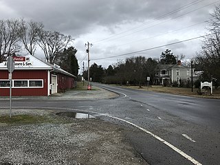
Flintstone is an unincorporated community and census-designated place (CDP) in Allegany County, Maryland, United States. As of the 2010 census it had a population of 177. It is part of the Cumberland, MD-WV Metropolitan Statistical Area.
Fairfield is a census-designated place (CDP) and unincorporated community in Hyde County, North Carolina, United States. As of the 2010 census it had a population of 258. The Fairfield Historic District was listed on the National Register of Historic Places in 1985.
Gulf is an unincorporated community and census-designated place (CDP) in southwestern Chatham County, North Carolina, United States, southeast of the town of Goldston. As of the 2010 census, the Gulf CDP had a population of 144. The community is home to a general store and several historic homes. It received its name from its location at a wide bend in the Deep River.

Moncure, founded in 1881, is a small rural unincorporated community in southeastern Chatham County, North Carolina, United States. Moncure and the neighboring community of Haywood form the Moncure census-designated place (CDP), which had a population of 711 at the 2010 census. The community is located near the confluence of the Deep and Haw rivers, which form the Cape Fear River. Moncure once served as the westernmost inland port in the state, linked to the Atlantic Ocean by steamships.

Taylors Island is an unincorporated community and census-designated place in Dorchester County, Maryland, United States, in the state's Eastern Shore region. The population was 173 at the 2010 census. It is known for hunting, crabbing and fishing. Ridgeton Farm was listed on the National Register of Historic Places in 1977. Bethlehem Methodist Episcopal Church and Grace Episcopal Church Complex were listed in 1979.

Fairplay is an unincorporated community and census-designated place (CDP) in Washington County, Maryland, United States. Its population was 580 as of the 2010 census. It is sometimes recognized, along with neighboring Tilghmanton, as Fairplay-Tilghmanton; the two communities share a post office as well as a fire company. Fairplay is located between Hagerstown and Sharpsburg, along Maryland Route 65 and is part of the Hagerstown Metropolitan Area. Marsh Mills was listed on the National Register of Historic Places in 1996.
Worton is an unincorporated community and census-designated place (CDP) in Kent County, Maryland, United States. As of the 2010 census it had a population of 249.

Kennedyville is an unincorporated community and census-designated place in Kent County, Maryland, United States. As of the 2010 census it had a population of 199.

Croom is an unincorporated community and census-designated place in Southern Prince George's County, Maryland, United States. As of the 2020 census it had a population of 2,720. Croom largely consists of former tobacco farms and forests converted to Washington bedroom subdivisions such as nearby Marlton. The main part of Patuxent River Park is in Croom.
West Denton is an unincorporated community and census-designated place (CDP) in Caroline County, Maryland, United States. As of the 2010 census it had a population of 52.

Libertytown is an unincorporated community and census-designated place (CDP) in Frederick County, in the U.S. state of Maryland. As of the 2010 census it had a population of 950. The Abraham Jones House was listed on the National Register of Historic Places in 1973.

Sabillasville is an unincorporated community and census-designated place in Frederick County, Maryland, United States. As of the 2010 census it had a population of 354.
Groveland Station is a census-designated place (CDP) in Livingston County, New York, United States. The CDP consists of the hamlet of Groveland and nearby residential areas. The CDP population was 281 as of the 2010 census. New York State Route 63 passes through the community.


