Sydney Markets

Last updated

Sydney Markets Plaza Flemington Markets 4 Plaza.JPG
Sydney Markets Plaza

The Sydney Markets (also known as the Flemington Markets or Homebush West Markets) are a group of wholesale and retail markets in Sydney, New South Wales, Australia. The Sydney Markets are located in the Inner West suburb of Flemington, New South Wales, 16 kilometres west of the Sydney central business district. Flemington is in the local government area of the Municipality of Strathfield. The market is the primary distribution hub of fresh produce, flowers and other food products for Sydney. The market has a wholesale sales section that caters to larger businesses and general sales to the public. The market is the central marketplace for Sydney's farmers to sell their products. It has a history dating back to 1788. [1] The operator of the markets is Sydney Markets Limited, formerly the Sydney Markets Authority, but privatised in 1997. As well as the markets at Flemington, Sydney Markets Limited also operates the inner city Paddy's Market in Haymarket.

Contents

Sydney Markets feature a number of divisions including Produce, Flowers, Growers, Fresh Food, Motor, Swap & Sell, Paddy's Markets and Sydney Markets Plaza. [2]

Paddy's Markets specialises in the sale of fruit, vegetables, fish, clothes, giftware and souvenirs to the general public. The Flower Market is the central provider of flowers to Sydney's florists. The Produce, Growers and Fresh Food Markets are the central provider to Sydney's grocery shops. The Swap & Sell market is a second hand market, where vendors set up a sales stand selling a range of second-hand goods. The Motor Market provides a site for private sellers to show their cars for sale.

Sydney Markets Plaza features a supermarket, hotel, post office and many specialty shops below an office building.

Sydney Markets has its own postcode, 2129, separate from the 2140 postcode used for the remainder of Flemington. The Sydney Markets post office was previously known as "Flemington Markets", but changed its name in the late 1990s. [3]

Transport

Flemington railway station is on the Inner West & Leppington Line of the Sydney Trains network, and the concourse is connected to the markets by a pedestrian overpass. Vehicle entrances to the markets are located on Homebush Bay Drive and Parramatta Road.

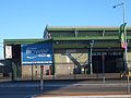
Goods sidings were originally provided for the market immediately to the north of Flemington station. These have been decommissioned, and the tracks to the north of the station are mainly used for freight train through-traffic travelling between the Main North railway line and the Enfield intermodal freight depot further south.

History

The site of the markets at Flemington was originally a land grant of 200 acres (0.81 km2) to John Fleming in 1806. The part of Fleming's estate south of the railway was acquired by the Underwood estate and subdivided for residential development in 1882. This suburb, called "Flemington", was incorporated into the Municipality of Strathfield in 1892, after which it was generally listed in directories under "Strathfield". This part of the estate is today partly in the suburb of Strathfield and partly in the modern suburb of Flemington. [4] North of the railway, the bush was turned into paddocks and from 1883 Fleming's estate north of the railway was the site of a cattle saleyard. [5] This area became part of the Municipality of Strathfield in 1947.

Sydney Markets Limited claims its origin from the informal markets formed at The Rocks with the first European settlement in 1788. [1] However, the first organised market was not formed until 1806, and the Sydney Central Markets were established in 1810, which is today the Queen Victoria Building. [6] In 1829, cattle and corn markets were established further south, below Brickfield Hill and immediately to the south of the Sydney Central Business District. The area became known as "the Haymarket". The cattle market was moved to successively sites further west, eventually moving to Flemington in 1883. The Corporation of Sydney, upon incorporation in 1842, took control of the markets. In 1869, the Belmore Markets was built on the old cattle market site at Haymarket as a fruit and vegetable market, supplemented by the Paddy's Market building on the old hay market site. In 1892-3 a new Belmore Markets building was erected, but was later turned into a circus and theatre, now the Capitol Theatre. Paddy's Market was redeveloped as Market City, completed in 1997. [7] After temporarily moving to Redfern to make way for the development works, Paddy's Market resumed trading at Market City in 1993. [1]

On 12 September 1975, Flemington Markets was opened by State Governor Roden Cutler relieve the Paddy's Markets at Haymarket. [8] After the relocation of the markets, "Flemington" was gazetted as an official suburb in 1977 (prior to this, the residential part of the suburb had been part of Strathfield). The suburb name was re-gazetted with a new official name of "Homebush West" in 1992, after which the name "Flemington" was officially limited to an urban place located in a small unpopulated strip of the suburb within Cumberland Council. [9] Nevertheless, the markets continue to be commonly known as "Flemington Markets" rather than "Homebush West Markets", and the suburb remains commonly referred to as "Flemington" rather than "Homebush West", even in official contexts. [10] Sydney Markets Limited purchased the land and infrastructure at Flemington from the New South Wales Government in 2002. [1]

Paddy's Market was redeveloped as Market City, completed in 1997. [11] After temporarily moving to Redfern to make way for the development works, Paddy's Market resumed trading at Market City in 1993. The Sydney Markets Authority, privatised in 1997 as Sydney Markets Limited, continues to operate both the Flemington and Haymarket markets. [1]

See also

Related Research Articles

<span class="mw-page-title-main">Homebush Bay</span> Suburb of Sydney, New South Wales, Australia

Homebush Bay is a bay on the south bank of the Parramatta River, in the west of Sydney, Australia. The name is also sometimes used to refer to an area to the west and south of the bay itself, which was formerly an official suburb of Sydney, and has now become the suburbs of Sydney Olympic Park, Wentworth Point and part of the neighbouring suburb of Lidcombe, all part of the City of Parramatta. Homebush Bay is located 13 kilometres (8.1 mi) west of the Sydney central business district.

<span class="mw-page-title-main">Homebush, New South Wales</span> Suburb of Sydney, New South Wales, Australia

Homebush is a suburb in the Inner West of Sydney in the state of New South Wales, Australia. It is located 12 kilometres west of the Sydney central business district, in the local government area of the Municipality of Strathfield.

<span class="mw-page-title-main">Haymarket, New South Wales</span> Suburb of Sydney, New South Wales

Haymarket is a suburb of Sydney, New South Wales, Australia. It is located at the southern end of the Sydney central business district in the local government area of the City of Sydney. Haymarket includes much of Sydney's Chinatown, Thaitown and Railway Square localities. Haymarket is adjacent to Darling Harbour and is surrounded by the suburbs of Ultimo, Chippendale, Surry Hills and the Sydney CBD.

<span class="mw-page-title-main">Municipality of Strathfield</span> Local government area in New South Wales, Australia

The Municipality of Strathfield, also known as Strathfield Council, is a local government area in the West of Sydney, in the state of New South Wales, Australia.

<span class="mw-page-title-main">Inner West</span> Region in New South Wales, Australia

The Inner West of Sydney is an area directly west of the Sydney central business district, New South Wales, Australia. The suburbs that make up the Inner West are predominantly located along the southern shore of Port Jackson, stretching south to the shores of the Cooks River. The western boundary of the Inner West is approximately the A3 arterial road, which divides the Inner West from the Greater Western Sydney region. The Inner West is much larger than the Inner West Council local government area. The Inner West roughly corresponds with the Parish of Petersham and Parish of Concord, two cadastral divisions used for land titles.

<span class="mw-page-title-main">Strathfield, New South Wales</span> Suburb of Sydney, New South Wales, Australia

Strathfield is a suburb in the Inner West of Sydney, in the state of New South Wales, Australia. It is located 12 kilometres west of the Sydney central business district and is the administrative centre of the Municipality of Strathfield. A small section of the suburb north of the railway line lies within the City of Canada Bay, while the area east of The Boulevard lies within the Municipality of Burwood. North Strathfield and Strathfield South are separate suburbs to the north and south, respectively.

<span class="mw-page-title-main">Homebush railway station</span> Railway station in Sydney, New South Wales

Homebush railway station is a heritage-listed railway station located on the Main Suburban line in Homebush in the Municipality of Strathfield local government area of New South Wales, Australia. It was designed and built by the New South Wales Government Railways and opened on 26 September 1855. In addition to being located on the Main Suburban line, the station is also located on the Main South and Main Western railway lines. The property was added to the New South Wales State Heritage Register on 2 April 1999.

<span class="mw-page-title-main">Strathfield railway station</span> Railway station in Sydney, New South Wales, Australia

Strathfield railway station is a heritage-listed railway station located on the Main Suburban line in the Sydney suburb of Strathfield in the Municipality of Strathfield local government area of New South Wales, Australia. The station is served by Sydney Trains T1 North Shore & Western Line, T9 Northern Line and T2 Inner West & Leppington Line suburban services as well as NSW TrainLink Intercity and regional services. The station is located on the Main Northern and Main Western railway lines, forming a major junction for regional and suburban rail services. The station and associated infrastructure was added to the New South Wales State Heritage Register on 2 April 1999.

<span class="mw-page-title-main">Flemington railway station</span> Railway station in Sydney, New South Wales, Australia

Flemington railway station is located on the Main Suburban line, serving the Sydney suburb of Flemington. It is served by Sydney Trains T2 Inner West & Leppington line services. Due to the naming dispute of the suburb and the importance of the neighbouring Sydney Markets, the station has been proposed to be renamed as Sydney Markets railway station.

<span class="mw-page-title-main">Strathfield South, New South Wales</span> Suburb of Sydney, New South Wales, Australia

Strathfield South is a suburb, in the Inner West of Sydney, Australia in the state of New South Wales, 13 kilometres west of the Sydney central business district, in the Strathfield local government area. The area was historically part of Druitt Town. Later it was part of Enfield, until Enfield Council was absorbed into Strathfield and Burwood councils, after which the part within Strathfield council was renamed Strathfield South.

<span class="mw-page-title-main">North Strathfield, New South Wales</span> Suburb of Sydney, New South Wales, Australia

North Strathfield is a suburb in the inner-west of Sydney, in the state of New South Wales, Australia. North Strathfield is located 15 kilometres west of the Sydney central business district, in the local government area of the City of Canada Bay. Strathfield and Strathfield South are separate suburbs, to the south.

<span class="mw-page-title-main">Flemington, New South Wales</span> Suburb of Sydney, New South Wales, Australia

Flemington, officially gazetted as "Homebush West" since 1992, is a suburb in the Inner West of Sydney, in the state of New South Wales, Australia. Flemington is located 13 kilometres west of the Sydney central business district, in the local government area of the Municipality of Strathfield, with a small unpopulated area in Cumberland Council.

<span class="mw-page-title-main">Sydney Olympic Park</span> Suburb of Sydney, New South Wales, Australia

Sydney Olympic Park is a suburb of Greater Western Sydney, located 13 kilometres west of the Sydney central business district, in the local government area of the City of Parramatta Council. It is commonly known as Olympic Park but officially named Sydney Olympic Park. The area was part of the suburb of Lidcombe and known as "North Lidcombe", but between 1989 and 2009 was named "Homebush Bay". The names "Homebush Bay" and, sometimes, "Homebush" are still used colloquially as a metonym for Stadium Australia as well as the Olympic Park precinct as a whole, but Homebush is an older, separate suburb to the southeast, in the Municipality of Strathfield.

<span class="mw-page-title-main">Paddy's Markets</span>

Paddy's Markets is a commercial enterprise that has two large markets in Sydney, New South Wales, Australia. Paddy's Markets are located in Haymarket and Flemington and specialise in the sale of fruit, vegetables, fish, clothes and giftware. Both markets are operated by Sydney Markets Limited, along with the rest of Sydney Markets located at Flemington.

<span class="mw-page-title-main">Sydney Freight Network</span> Railway line in Sydney, New South Wales, Australia

The Sydney Freight Network is a network of dedicated railway lines for freight in Sydney, Australia, linking the state's rural and interstate rail network with the city's main yard at Enfield and Port Botany. Its primary components are the Southern Sydney Freight Line (SSFL) and a line from Sefton to Enfield and Port Botany. The Network has been managed by the Australian Rail Track Corporation (ARTC) since 2012. Prior to the completion of the SSFL, it was managed by RailCorp as the Metropolitan Freight Network.

<span class="mw-page-title-main">Main Suburban railway line</span> Railway line in Sydney, New South Wales

The Main Suburban railway line is the technical name for the trunk railway line between Redfern railway station and Parramatta railway station in Sydney, Australia, but now generally refers to the section between Redfern and where the Old Main South Line branches off at Granville Junction. The railway line then continues on as the Main Western line towards the Blue Mountains. This term distinguished this trunk line from the Illawarra Line which branched south from the Illawarra Junction to Wollongong, and later the North Shore tracks which carried trains north over the Harbour Bridge.

Saleyards Creek is a canalised urban stream, acting as a stormwater channel, located in Sydney, Australia. Its upstream course follows approximately the boundary between the suburbs of Homebush and Homebush West. North of Parramatta Road, both sides of the creek fall within Homebush.

<span class="mw-page-title-main">Wentworth Point, New South Wales</span> Suburb of Sydney, New South Wales, Australia

Wentworth Point is a suburb of Sydney, in the state of New South Wales, Australia. It is located 13 kilometres west of the Sydney central business district, on the eastern edge of the local government area of City of Parramatta. It is on the western shore of Homebush Bay on the southern side of the Parramatta River. Wentworth Point is usually regarded as part of the Greater Western Sydney region, including in administrative contexts, but it is also regarded as part of the Inner West region of Sydney in some contexts, especially commercial contexts.

<span class="mw-page-title-main">Belmore Park</span>

Belmore Park is a public park at the southern end of the Sydney central business district in the Australian state of New South Wales. Adjacent to the Central railway station, the park is bounded by Hay Street, Eddy Avenue, Elizabeth Street and Pitt Street. The area was previously known as Police Paddock and was part of a section of Crown land which included the Police Barracks, Devonshire Street Cemetery, Female Refuge of the Good Samaritan, Benevolent Asylum and a common.

<span class="mw-page-title-main">Hay Street, Sydney</span> Street in Sydney, Australia

Hay Street is a 700 metre street in the Sydney central business district, New South Wales, Australia. It runs east to west from Elizabeth Street to Darling Drive. For much of its length it is traversed by the Inner West Light Rail line.

References

  1. 1 2 3 4 5 "Sydney Markets - History". Sydney Markets Limited. Retrieved 21 July 2021.
  2. "Sydney Markets". Sydney Markets Limited. Retrieved 6 June 2013.
  3. Geographical Names Board, "Sydney Markets"
  4. Strathfield Heritage - Homebush West and Flemington
  5. "Homebush Railway Station group". New South Wales State Heritage Register . Department of Planning & Environment. H01170. Retrieved 2 June 2018. CC-BY icon.svg Text is licensed by State of New South Wales (Department of Planning and Environment) under CC-BY 4.0 licence .
  6. Dictionary of Sydney - Central Markets
  7. Dictionary of Sydney - Haymarket
  8. Direct Rail Link to New Sydney Markets Network September 1975 page 3
  9. Geographical Names Board, "Flemington"
  10. "Centres and corridors — Inner West" (PDF). NSW Department of Planning. Archived from the original (PDF) on 19 July 2008. Retrieved 30 July 2008.
  11. Dictionary of Sydney - Haymarket

33°51′42″S151°04′13″E / 33.8616°S 151.0704°E / -33.8616; 151.0704