TLALOCNet

Last updated

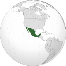
The Trans-boundary, Land, and Atmosphere Long-term Observational and Collaborative Network (TLALOCNet) is a network of continuous Global Positioning System (GPS) and meteorology stations in Mexico to study atmospheric and solid earth processes. This completed network spans most of Mexico with a strong coverage emphasis on southern and western Mexico. The network created a collection of continuous GPS meteorology or cGPS/Met sites based on the EarthScope Plate Boundary Observatory standards for the study of atmospheric and geological processes. [1]

Contents

The network's name is play with the name of an Aztec deity, Tlaloc, the god of rain. Discharge rain, hail and lightning over the earth were associated with this character in ancient Mexico. As the network has pointed in a presentation concerning the capabilities of scientific measurements and forecasts for rain, hail, and hail: [2]

Now, these elements are expected to be observed through the GPS network that is part of the "Long-Term Terrestrial and Atmospheric Transboundary Observatory and Collaboration Network".

Funding organizations

The network was funded by the following: [1]

Geophysics explored

The network is capable of analysis of the geophysics in the: [2]

Collaborations

TLALOCnet works with Mexico's National Seismological Service (Servicio Sismológico Nacional, SSN), which is part of the Geophysics Institute at the National Autonomous University of Mexico (UNAM), to provide the GPS data for the country's National Space Weather Laboratory (Laboratorio Nacional de Clima Espacial, LANCE) [3] for the creation of the Total Electron Content maps near to real time (AzTEC). [4] TEC maps can be used in real time to estimate the effect of the ionospheric electron content between a receiver and a GPS satellite on GPS signal delay. [5]

Related Research Articles

<span class="mw-page-title-main">Hail</span> Form of solid precipitation

Hail is a form of solid precipitation. It is distinct from ice pellets, though the two are often confused. It consists of balls or irregular lumps of ice, each of which is called a hailstone. Ice pellets generally fall in cold weather, while hail growth is greatly inhibited during low surface temperatures.

<span class="mw-page-title-main">Meteorology</span> Interdisciplinary scientific study of the atmosphere focusing on weather forecasting

Meteorology is a branch of the atmospheric sciences with a major focus on weather forecasting. The study of meteorology dates back millennia, though significant progress in meteorology did not begin until the 18th century. The 19th century saw modest progress in the field after weather observation networks were formed across broad regions. Prior attempts at prediction of weather depended on historical data. It was not until after the elucidation of the laws of physics, and more particularly in the latter half of the 20th century, the development of the computer that significant breakthroughs in weather forecasting were achieved. An important branch of weather forecasting is marine weather forecasting as it relates to maritime and coastal safety, in which weather effects also include atmospheric interactions with large bodies of water.

<span class="mw-page-title-main">Tláloc</span> Deity in Aztec religion; a god of rain, fertility, and water

Tláloc is the god of rain in Aztec religion. He was also a deity of earthly fertility and water, worshipped as a giver of life and sustenance. This came to be due to many rituals, and sacrifices that were held in his name. He was feared, but not maliciously, for his power over hail, thunder, lightning, and even rain. He is also associated with caves, springs, and mountains, most specifically the sacred mountain where he was believed to reside. Cerro Tláloc is very important in understanding how rituals surrounding this deity played out. His followers were one of the oldest and most universal in ancient Mexico.

<span class="mw-page-title-main">Thunderstorm</span> Storm characterized by lightning and thunder

A thunderstorm, also known as an electrical storm or a lightning storm, is a storm characterized by the presence of lightning and its acoustic effect on the Earth's atmosphere, known as thunder. Relatively weak thunderstorms are sometimes called thundershowers. Thunderstorms occur in a type of cloud known as a cumulonimbus. They are usually accompanied by strong winds and often produce heavy rain and sometimes snow, sleet, or hail, but some thunderstorms produce little precipitation or no precipitation at all. Thunderstorms may line up in a series or become a rainband, known as a squall line. Strong or severe thunderstorms include some of the most dangerous weather phenomena, including large hail, strong winds, and tornadoes. Some of the most persistent severe thunderstorms, known as supercells, rotate as do cyclones. While most thunderstorms move with the mean wind flow through the layer of the troposphere that they occupy, vertical wind shear sometimes causes a deviation in their course at a right angle to the wind shear direction.

<span class="mw-page-title-main">Space weather</span> Branch of space physics and aeronomy

Space weather is a branch of space physics and aeronomy, or heliophysics, concerned with the varying conditions within the Solar System and its heliosphere. This includes the effects of the solar wind, especially on the Earth's magnetosphere, ionosphere, thermosphere, and exosphere. Though physically distinct, space weather is analogous to the terrestrial weather of Earth's atmosphere. The term "space weather" was first used in the 1950s and popularized in the 1990s. Later, it prompted research into "space climate", the large-scale and long-term patterns of space weather.

The timeline of meteorology contains events of scientific and technological advancements in the area of atmospheric sciences. The most notable advancements in observational meteorology, weather forecasting, climatology, atmospheric chemistry, and atmospheric physics are listed chronologically. Some historical weather events are included that mark time periods where advancements were made, or even that sparked policy change.

<span class="mw-page-title-main">Mauna Loa Observatory</span> Atmospheric research station on island of Hawaii

The Mauna Loa Observatory (MLO) is an atmospheric baseline station on Mauna Loa, on the island of Hawaii, located in the U.S. state of Hawaii.

<span class="mw-page-title-main">Marambio Base</span> Antarctic Station

Marambio Station is a permanent, all year-round Argentine Antarctica station named after Vice-Commodore Gustavo Argentino Marambio, an Antarctic aviation pioneer. It is located in Marambio Island, Graham Land, Antarctic Peninsula, some 100 km (60 mi) from the coastal civilian village of Esperanza.

<span class="mw-page-title-main">Miguel José Yacamán</span> Mexican physicist (born 1946)

Miguel José Yacamán is a Mexican physicist who has made contributions to the fields of materials science, nanotechnology, and physics.

<span class="mw-page-title-main">Plate Boundary Observatory</span>

The Plate Boundary Observatory (PBO) was the geodetic component of the EarthScope Facility. EarthScope was an earth science program that explored the 4-dimensional structure of the North American Continent. EarthScope was a 15-year project (2003-2018) funded by the National Science Foundation (NSF) in conjunction with NASA. PBO construction took place from October 2003 through September 2008. Phase 1 of operations and maintenance concluded in September 2013. Phase 2 of operations ended in September 2018, along with the end of the EarthScope project. In October 2018, PBO was assimilated into a broader Network of the Americas (NOTA), along with networks in Mexico (TLALOCNet) and the Caribbean (COCONet), as part of the NSF's Geodetic Facility for the Advancement of Geosciences (GAGE). GAGE is operated by EarthScope Consortium.

TAMDAR is a weather monitoring system that consists of an in situ atmospheric sensor mounted on commercial aircraft for data gathering. It collects information similar to that collected by radiosondes carried aloft by weather balloons. It was developed by AirDat LLC, which was acquired by Panasonic Avionics Corporation in April 2013 and was operated until October 2018 under the name Panasonic Weather Solutions. It is now owned by FLYHT Aerospace Solutions Ltd.

<span class="mw-page-title-main">Agencia Espacial Mexicana</span> National space agency of Mexico

The Mexican Space Agency is the national space agency of Mexico, established in July 2010. The agency does not have infrastructure, and aims to promote and coordinate education, research and development of the space-related activities that are performed in the country.

Convective storm detection is the meteorological observation, and short-term prediction, of deep moist convection (DMC). DMC describes atmospheric conditions producing single or clusters of large vertical extension clouds ranging from cumulus congestus to cumulonimbus, the latter producing thunderstorms associated with lightning and thunder. Those two types of clouds can produce severe weather at the surface and aloft.

<span class="mw-page-title-main">VORTEX projects</span> Field experiments that study tornadoes

The Verification of the Origins of Rotation in Tornadoes Experiment are field experiments that study tornadoes. VORTEX1 was the first time scientists completely researched the entire evolution of a tornado with an array of instrumentation, enabling a greater understanding of the processes involved with tornadogenesis. A violent tornado near Union City, Oklahoma was documented in its entirety by chasers of the Tornado Intercept Project (TIP) in 1973. Their visual observations led to advancement in understanding of tornado structure and life cycles.

UNAVCO (University Navstar Consortium) was a non-profit university-governed consortium that facilitated geology research and education using geodesy.

<span class="mw-page-title-main">Google Public Alerts</span> Online notification service owned by Google.org

Google Public Alerts Site was an online notification service owned by Google.org that sends safety alerts and launched to the United States, Australia, Canada, Colombia, Japan, Taiwan, Indonesia, Mexico, and Brazil on October 30, 2012, and to the Philippines on November 12, 2014. It is part of the Google Crisis Response team and publishes content from its partners of each country. If you activate Google Now, you can see suitable weather and public safety on Google Search and Google Maps.

<span class="mw-page-title-main">NOAA-9</span> American weather satellite

NOAA-9, known as NOAA-F before launch, was an American weather satellite operated by the National Oceanic and Atmospheric Administration (NOAA) for use in the National Environmental Satellite Data and Information Service (NESDIS). It was the second of the Advanced TIROS-N series of satellites. The satellite design provided an economical and stable Sun-synchronous platform for advanced operational instruments to measure the atmosphere of Earth, its surface and cloud cover, and the near-space environment.

The Geodetic Facility for the Advancement of Geoscience (GAGE) is a geophysical facility for geoscience research and education. It focuses on research of our planet's surface deformation with unprecedented temporal and spatial resolution. GAGE is one of the two premier geophysical facilities in support of geoscience and geoscience education of the National Science Foundation (NSF). The other premiere geophysical facility is SAGE, the Seismological Facility for the Advancement of Geoscience.

Continuously Operating Caribbean GPS Observational Network (COCONet) was a global positioning system (GPS) observation network that spanned across the Caribbean and the neighboring area It was part of UNAVCO (University Navstar Corporation). UNAVCO and IRIS (Incorporated Research Institutions for Seismology) Consortium later merged to create EarthScope Consortium in 2023.

References

  1. 1 2 TLALOCNet continuous GPS-Met Array in Mexico supporting the 2017 NAM GPS Hydrometeorological Network. - NASA/ADS (harvard.edu)
  2. 1 2 Junior, Luiz Alberto Rasseli (2018-10-11). "TLALOC-Net, the research network applied to climate and physical processes that control earthquakes and volcanoes". redclara.net. Retrieved 2024-07-07.
  3. UANL. "Laboratorio Nacional de Clima Espacial". Universidad Autónoma de Nuevo León (in Mexican Spanish). Retrieved 2024-07-07.
  4. Aquino-Bautista, Juan Jose D.; De la Luz, Victor; Chavez-Dagostino, Miguel (2019-05-01). AzTEC: TEC Maps Near to Real Time in Mexico.
  5. "U.S. Total Electron Content | NOAA / NWS Space Weather Prediction Center". www.swpc.noaa.gov. Retrieved 2024-07-07.