
Table Head in Nova Scotia
Table Head is a Neighborhood in the Canadian province of Nova Scotia, located in Glace Bay in the Cape Breton Regional Municipality on Cape Breton Island.
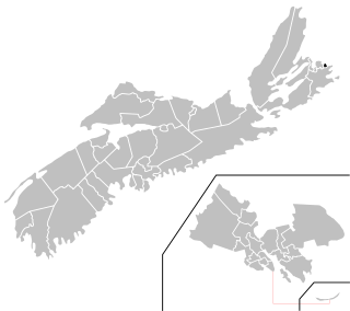
Table Head is a Neighborhood in the Canadian province of Nova Scotia, located in Glace Bay in the Cape Breton Regional Municipality on Cape Breton Island.
On December 15, 1902 Guglielmo Marconi established trans-Atlantic communication between Table Head in Glace Bay, Nova Scotia and Poldhu in Cornwall, England using a 60 kilowatt transmitter and four 210-foot (64 m) towers. The site of the Marconi Towers Station is now used to house a museum, the Marconi National Historic Site. [1]

Cape Breton Island is an island on the Atlantic coast of North America and part of the province of Nova Scotia, Canada.

The Gulf of St. Lawrence is the outlet of the North American Great Lakes via the St. Lawrence River into the Atlantic Ocean. The gulf is a semi-enclosed sea, covering an area of about 226,000 square kilometres (87,000 sq mi) and containing about 34,500 cubic kilometres (8,300 cu mi) of water, at an average depth of 152 metres (500 ft).

Cape Breton Regional Municipality is the Canadian province of Nova Scotia's second largest municipality and the economic heart of Cape Breton Island. As of 2016 the municipality has a population of 94,285. The municipality was created in 1995 through the amalgamation of eight municipalities located in Cape Breton County.
Glace Bay is a community in the eastern part of the Cape Breton Regional Municipality in Nova Scotia, Canada. It forms part of the general area referred to as Industrial Cape Breton.

The Marconi National Historic Site and the Marconi Wireless Station National Historic Site are two National Historic Sites located on Cape Breton Island, Nova Scotia. Both sites commemorate the efforts of Guglielmo Marconi to transmit transatlantic radio signals between North America and Europe in the first decade of the 20th century. The two sites are located within approximately 8 kilometres (5.0 mi) of one another, and are connected by the Marconi Trail.
Glace Bay-Dominion is a provincial electoral district in Nova Scotia, Canada, that elects one member of the Nova Scotia House of Assembly.

Reserve Mines is a community in Nova Scotia's Cape Breton Regional Municipality.
The Marconi Trail is a scenic roadway in the Canadian province of Nova Scotia.
Route 255 is a collector road in the Canadian province of Nova Scotia.

Broughton was a former town in the Cape Breton Regional Municipality about 19 kilometers from the city of Sydney, Nova Scotia. It was going to be one of Canada's first planned towns, designed to eventually accommodate 10,000 residents. In reality, it was mostly abandoned when mining operations failed.
Donkin is a Canadian rural village with a population of 532 as of 2021. Located on the picturesque coastline of Nova Scotia's Cape Breton Island, it is a part of the Cape Breton Regional Municipality. The smaller communities of Port Caledonia and Schooner Pond are directly adjacent to the village proper, connected by a single strip of road called the Donkin Highway.
Lingan is a Canadian suburban community in Nova Scotia's Cape Breton Regional Municipality.

The Wilkie Sugarloaf Trail is a hiking trail in northern Cape Breton Island in the Canadian province of Nova Scotia. The trail leads to the 411.8 metres (1,351 ft) summit of Wilkie Sugar Loaf in the Cape Breton Highlands.
Caledonia is a community that is part of the former town of Glace Bay in the Canadian province of Nova Scotia, located in the Cape Breton Regional Municipality.
Port Caledonia is a small community in the Canadian province of Nova Scotia, located in the Cape Breton Regional Municipality on Cape Breton Island. It is located on the Donkin Highway, between the town of Glace Bay and the village of Donkin.
Port Morien is a small fishing community of 700 people in the Canadian province of Nova Scotia, located in the southeastern Cape Breton Island near the rural community Donkin, and six miles from the town of Glace Bay.
Passchendaele is a community that is part of the former town of Glace Bay in the Canadian province of Nova Scotia, located in the Cape Breton Regional Municipality on Cape Breton Island.
Bridgeport is a neighbourhood that is part of the former town of Glace Bay, Nova Scotia in the Canadian province of Nova Scotia, located in the Cape Breton Regional Municipality on Cape Breton Island.

The Miners Museum is located in Glace Bay, Nova Scotia. The main building of the museum contains an exhibit area dedicated to the history of coal mining in Cape Breton. Underneath the museum is the Ocean Deeps Colliery which is a coal mine that visitors can tour with retired miners as guides. It also has a mine simulator that virtually transports visitors to the No. 24 colliery. Outside the museum is The Miners Village. The Village consists of a number of historical buildings depicting the homes and lives of miners.
Coordinates: 46°12′59.99″N59°57′17.57″W / 46.2166639°N 59.9548806°W
| | This Cape Breton County, Nova Scotia location article is a stub. You can help Wikipedia by expanding it. |