Marrakesh Menara Airport is an international airport serving Marrakesh, the capital city of the Marrakesh-Tensift-El Haouz region in Morocco. It is an international facility that receives several European flights as well as flights from Casablanca and some of the Arab world nations. The airport served over 4 million passengers in 2014.

Google Maps is a web mapping service developed by Google. It offers satellite imagery, aerial photography, street maps, 360° panoramic views of streets, real-time traffic conditions, and route planning for traveling by foot, car, bicycle and air, or public transportation.

Google Earth is a computer program that renders a 3D representation of Earth based on satellite imagery. The program maps the Earth by superimposing satellite images, aerial photography, and GIS data onto a 3D globe, allowing users to see cities and landscapes from various angles. Users can explore the globe by entering addresses and coordinates, or by using a keyboard or mouse. The program can also be downloaded on a smartphone or tablet, using a touch screen or stylus to navigate. Users may use the program to add their own data using Keyhole Markup Language and upload them through various sources, such as forums or blogs. Google Earth is able to show various kinds of images overlaid on the surface of the earth and is also a Web Map Service client.

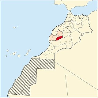
Marrakesh-Tensift-El Haouz was formerly one of the sixteen regions of Morocco from 1997 to 2015. It was situated in central Morocco. It covered an area of 31,160 km² and had a population of 3,576,673. The capital is Marrakesh. In 2015, the region annexed Safi and Youssoufia Provinces to become the Region of Marrakesh-Safi.

Yamama is a northern neighborhood of Marrakesh in the Marrakech-Tensift-Al Haouz region of Morocco. It belongs to the arrondissement of Gueliz.

The 2013 FIFA Club World Cup was the 10th edition of the FIFA Club World Cup, a FIFA-organised international club football tournament between the champion clubs from each of the six continental confederations, as well as the national league champion from the host country. It was hosted by Morocco, and played from 11 to 21 December 2013.

The 2014 FIFA Club World Cup was the 11th edition of the FIFA Club World Cup, a FIFA-organised international club football tournament between the champion clubs from each of the six continental confederations, as well as the national league champion from the host country. It was hosted by Morocco for the second year in a row, and played from 10 to 20 December 2014.
Tighedouine or Tighdouine is a small town and rural commune in Al Haouz Province of the Marrakech-Tensift-Al Haouz region of Morocco. At the time of the 2004 census, the commune had a total population of 22353 people living in 3143 households. The town lies in a fertile valley 29.8 kilometres (18.5 mi) by road to the southeast of Ait Ourir and 63.1 kilometres (39.2 mi) southeast of the city centre of Marrakesh.
Ouirgane is a small town and rural commune in Al Haouz Province of the Marrakesh-Tensift-El Haouz region of Morocco. At the time of the 2004 census, the commune had a total population of 6916 people living in 1281 households. It is a Berber village.

Sidi Boulaalam is a small town and rural commune in Essaouira Province, Marrakesh-Safi, Morocco. It is about 145 kilometres (90 mi) southwest of Casablanca, north of Route 207, along Route 2202 between Sidi Aissa Regragui to the northwest and Route 2200 to Tafetachte.

Apple Maps is a web mapping service developed by Apple Inc. It is the default map system of iOS, macOS, and watchOS. It provides directions and estimated times of arrival for automobile, pedestrian, and public transportation navigation. Apple Maps also features Flyover mode, a feature that enables a user to explore certain densely populated urban centers and other places of interest in a 3D landscape composed of models of buildings and structures.
Cadi Ayyad University is a university in Marrakesh and one of the largest universities in Morocco. One of its associated colleges, the École nationale des sciences appliquées de Marrakech, was created in 2000 by the Ministry of Higher Education and specializes in engineering and scientific research. Cadi Ayyad University was established in 1978 and operates 13 institutions in the Marrakesh-Safi region of Morocco in four main cities, including Kalaa of Sraghna, Essaouira and Safi in addition to Marrakesh.
Douar Lahna is a village in Al Haouz Province of the Marrakesh-Safi region of Morocco. It is a southern suburb of Marrakesh.
Lahebichate is a village in Al Haouz Province of the Marrakesh-Safi region of Morocco. It is a southern suburb of Marrakesh, just south of Douar Lahna.
Lagouassem is a village in Al Haouz Province of the Marrakesh-Safi region of Morocco. It is a southern suburb of Marrakesh, just south of Lahebichate.
Touggana is a village in Al Haouz Province of the Marrakesh-Safi region of Morocco. It is a southern suburb of Marrakesh, just east of Lahebichate.

Google Maps is a mapping mobile app developed by Google for the Android and iOS mobile operating systems; it uses Google Maps for its information.