Tajpur, West Bengal

Last updated
Sunset in the Tajpur beach. Sunset in Tajpur Beach.jpg
Sunset in the Tajpur beach.

Tajpur beach. May 2015. Tajpur Beach - East Midnapore 2015-05-02 9069.JPG
Tajpur beach. May 2015.

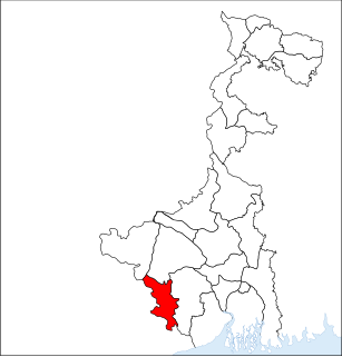
Tajpur is located in Purba Medinipur, in the state of West Bengal, India on the shore of Bay of Bengal (near Digha). Tajpur is set between Mandarmani and Shankarpur. Tajpur is 172.9 km via NH16 and NH116B from the state capital Kolkata. [1] It is located under Contai Sub division area.

West Bengal State in Eastern India

West Bengal is a state in the eastern region of India along the Bay of Bengal. With over 91 million inhabitants, it is India's fourth-most populous state. West Bengal is the thirteenth-largest Indian state, with an area of 88,752 km2 (34,267 sq mi). Part of the ethno-linguistic Bengal region of the Indian subcontinent, it borders Bangladesh in the east, and Nepal and Bhutan in the north. It also borders the Indian states of Odisha, Jharkhand, Bihar, Sikkim, and Assam. The state capital is Kolkata (Calcutta) the seventh-largest city in India, and center of the third-largest metropolitan area in the country. West Bengal includes the Darjeeling Himalayan hill region, the Ganges delta, the Rarh region, and the coastal Sundarbans. The main ethnic group is the Bengalis, with Bengali Hindus forming the demographic majority.

India Country in South Asia

India is a country in South Asia. It is the seventh-largest country by area, the second-most populous country, and the most populous democracy in the world. Bounded by the Indian Ocean on the south, the Arabian Sea on the southwest, and the Bay of Bengal on the southeast, it shares land borders with Pakistan to the west; China, Nepal, and Bhutan to the north; and Bangladesh and Myanmar to the east. In the Indian Ocean, India is in the vicinity of Sri Lanka and the Maldives; its Andaman and Nicobar Islands share a maritime border with Thailand and Indonesia.

Bay of Bengal Northeastern part of the Indian Ocean between India and the Andaman and Nicobar Islands

The Bay of Bengal is the northeastern part of the Indian Ocean, bounded on the west and northwest by India, on the north by Bangladesh, and on the east by Myanmar and the Andaman Islands of India and Myanmar and the Nicobar Islands of India. Its southern limit is a line between Sri Lanka and the north western most point of Sumatra (Indonesia). It is the largest water region called a bay in the world. There are countries dependent on the Bay of Bengal in South Asia and Southeast Asia.

Contents

Tajpur has also around 1400 acres of land dedicated to Pisciculture. There are a number of bheris or fish-ponds in the area. As a tourist attraction, it is relatively new as there are fewer hotels compared to Digha and Mandarmani. The beach is clean and home to numerous red crabs. The Government of West Bengal and Central Government decided to build the Tajpur Port in the area.

Government of West Bengal

The Government of West Bengal also known as the State Government of West Bengal, or locally as State Government, is the supreme governing authority of the Indian state of West Bengal and its 23 districts. It consists of an executive, led by the Governor of West Bengal, a judiciary and a legislative.

Tajpur Port is a proposed seaport in Tajpur, East Midnapore district of West Bengal. The government has proposed to build the port on the coast of the Bay of Bengal near Tajpur.

Transport

The nearest railway station is Contai or Ramnagar in Howrah-Digha railways and the nearest airport is Kolkata. There are also multiple buses running towards Digha via Balisai. (Nearer to Tazpur)

Contai City in West Bengal, India

Contai is a city and a municipality in Purba Medinipur district, West Bengal, India. It is the headquarters of the Contai subdivision. According to the geologists, the present geographical dimension of Contai, has formally came into existence, with the great natural disaster of the third century AD (flood) which created Chilka lake out of the Chilka Bay. Kanthi, that is Contai, means "Sand-bound reefs" or sand walls. The name Contai may thus be an English expression of the local jargon meaning "sand heaps".

Ramnagar, Purba Medinipur Village in West Bengal, India

Ramnagar is a village, in Ramnagar I CD block in Contai subdivision of Purba Medinipur district in the state of West Bengal, India.

Howrah Metropolitan City / Urban Agglomeration in West Bengal, India

Howrah is a metropolitan city and a municipal corporation of Howrah district in the Indian state of West Bengal. It is the headquarter of the Howrah Sadar subdivision. Howrah is located on the western bank of the Hooghly River. It is a part of the area covered by Kolkata Metropolitan Development Authority (KMDA). Howrah is an important transportation hub of West Bengal and a major gateway for its twin city of Kolkata.

By Car

From Kolkata, after crossing the Vidyasagar Setu, Kona Expressway leads to Mumbai Road. As the total drive takes almost 4 hours from Kolkata via Kolaghat and Nandakumar. From Nandakumar there is a right turn towards Contai. In the said Kolkata - Digha highway there is stoppage named Balisai where a left side village road finally meet the sea side village Tazpur.

Vidyasagar Setu cable-stayed bridge

Vidyasagar Setu, also known as the Second Hooghly Bridge, is a toll bridge over the Hooghly River in West Bengal, India, linking the cities of Kolkata and Howrah.

Related Research Articles

Purba Medinipur district District of West Bengal in India

Purba Medinipur district is an administrative unit in the Indian state of West Bengal. It is the southernmost district of Medinipur division – one of the five administrative divisions of West Bengal. The headquarters in Tamluk. It was formed on 1 January 2002 after the Partition of Medinipur into Purba Medinipur and Paschim Medinipur which lies at the northern and western border of it. The state of Odisha is at the southwest border; the Bay of Bengal lies in the south; the Hooghly river and South 24 Parganas district to the east; and Howrah district to the north-east.

Digha Town / Tourist Attraction in West Bengal, India

Digha is a seaside resort town in the state of West Bengal, India. It lies in Purba Medinipur district and at the northern end of the Bay of Bengal. It has a low gradient with a shallow sand beach. It is the most popular sea resort in West Bengal.

Mecheda Town in West Bengal, India

Mecheda is a town in Panskura II CD Block in West Bengal, India. The town is the entrance point of Purba Medinipur Dist. which lies upon the South Eastern Railway Zone and in proximity to Haldia, Tamluk, Digha and Contai, Egra.

Duttapukur Town in West Bengal, India

Duttapukur is a census town in Barasat I CD Block in Barasat Sadar subdivision in North 24 Parganas district in the Indian state of West Bengal. It is a part of Kolkata Urban Agglomeration.

Mandarmani Village in West Bengal, India

Mandarmani is a seaside resort village in the state of West Bengal, India, lies in East Midnapore district and at the northern end of the Bay of Bengal. It is one of the large and fast developing seaside resort of West Bengal.

Contai subdivision Subdivision in West Bengal, India

Contai subdivision is a subdivision of the Purba Medinipur district in the state of West Bengal, India.

Shankarpur Rural in West Bengal, India

Shankarpur is a beach village located 14 km east of Digha in West Bengal, India. It is also a regular fishing harbour. Shankarpur contains a number of temples.

The Mallabhum Institute of Technology (MIT) is located in Bishnupur, Bankura, West Bengal, India. The college is approved by the All India Council of Technical Education (AICTE), Ministry of Human Resource Development, Government of India and Directorate of Higher Education, Government of West Bengal.

Nandakumar (community development block) Community development block in West Bengal, India

Nandakumar is a community development block that forms an administrative division in Tamluk subdivision of Purba Medinipur district in the Indian state of West Bengal.

National Highway 116B (India) national highway in India

National Highway 116B starts from Nandakumar, Purba Medinipur district in West Bengal and ends at Chandaneswar, Balasore district in Orissa. The highway is 91 km (57 mi) long. The road passes through Contai and Digha.

Shipur Village in West Bengal, India

Shipur is a fast growing village under Egra I community development block of Purba Medinipur district in the state of West Bengal, India. Famous for its annual Charak Puja, this village has well-developed social facilities like schools, post office, market, telecommunication etc. A health centre is also proposed for this village. As per Constitution of India and Panchayati Raj Act, Shipur village is administrated by Sarpanch who is the elected representative of village. Shipur is under the administration of Sahara Gram Panchayat.

Sehakhala Village in West Bengal, India

Sehakhala is a village and a gram panchayat in Chanditala I community development block in Srirampore subdivision of Hooghly district in the state of West Bengal, India. It is under Chanditala police station.

Kapashanria Census Town in West Bengal, India

Kapashanria is a census town in Chanditala II CD Block in Srirampore subdivision of Hooghly district in the state of West Bengal, India.

Tisa, Hooghly Census Town in West Bengal, India

Tisa is a census town in Chanditala II CD Block in Srirampore subdivision of Hooghly district in the state of West Bengal, India.

Nandakumar, Purba Medinipur Village in West Bengal, India

Nandakumar is a village in Nandakumar CD block in Tamluk subdivision of Purba Medinipur district in the state of West Bengal, India.

Kamarda Village in West Bengal, India

Kamarda is a village, in Khejuri I CD block in Contai subdivision of Purba Medinipur district in the state of West Bengal, India.

Jhargram district District of West Bengal in India

Jhargram district is a district in the state of West Bengal, India. It is known for its "wooded beauty" and hill ranges of Belpahari, Kankrajhor to the north and Subarnarekha to the south. It is a destination for tourists who visit its forests, ancient temples, royal palaces, and folk music sites. The district was formed on 4 April 2017, after bifurcation from the Paschim Medinipur district as the 22nd district of West Bengal. The district has its headquarters at Jhargram.

Nachinda railway station is a railway station on the Tamluk-Digha branch line of South Eastern Railway zone of Indian Railways. The railway station is situated beside Contai-Nandakumar Road at Nachinda in Purba Medinipur district in the Indian state of West Bengal.

References

  1. "Tajpur, West Bengal". westbengaltourism.gov.in. Archived from the original on 21 April 2012.