The Waikato River is the longest river in New Zealand, running for 425 kilometres (264 mi) through the North Island. It rises in the eastern slopes of Mount Ruapehu, joining the Tongariro River system and flowing through Lake Taupō, New Zealand's largest lake. It then drains Taupō at the lake's northeastern edge, creates the Huka Falls, and flows northwest through the Waikato Plains. It empties into the Tasman Sea south of Auckland, at Port Waikato. It gives its name to the Waikato region that surrounds the Waikato Plains. The present course of the river was largely formed about 17,000 years ago. Contributing factors were climate warming, forest being reestablished in the river headwaters and the deepening, rather than widening, of the existing river channel. The channel was gradually eroded as far up river as Piarere, leaving the old Hinuera channel through the Hinuera Gap high and dry. The remains of the old river path can be clearly seen at Hinuera where the cliffs mark the ancient river edges. The river's main tributary is the Waipa River, which has its confluence with the Waikato at Ngāruawāhia.

The Clutha River / Mata-Au, also known as the Clutha River, is the second longest river in New Zealand and the longest in the South Island. It flows south-southeast 338 kilometres (210 mi) through Central and South Otago from Lake Wānaka in the Southern Alps / Kā Tiritiri o te Moana to the Pacific Ocean, 75 kilometres (47 mi) south west of Dunedin. It is the highest volume river in New Zealand, and the swiftest, with a catchment of 21,960 square kilometres (8,480 sq mi), discharging a mean flow of 614 cubic metres per second (21,700 cu ft/s). The river is known for its scenery, gold-rush history, and swift turquoise waters. A river conservation group, the Clutha Mata-Au River Parkway Group, is working to establish a regional river parkway, with a trail, along the entire river corridor.

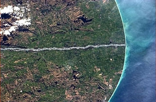
The Waitaki River is a large braided river that drains the Mackenzie Basin and runs some 209 kilometres (130 mi) south-east to enter the Pacific Ocean between Timaru and Oamaru on the east coast of the South Island of New Zealand. It starts at the confluence of the Ōhau River and the Tekapo River, now in the head of the artificial Lake Benmore, these rivers being fed by three large glacial lakes, Pukaki, Tekapo, and Ōhau at the base of the Southern Alps. The Waitaki flows through Lake Benmore, Lake Aviemore and Lake Waitaki, these lakes being contained by hydroelectric dams, Benmore Dam, Aviemore Dam and Waitaki Dam. The Waitaki has several tributaries, notably the Ahuriri River and the Hakataramea River. It passes Kurow and Glenavy before entering the Pacific Ocean. The River lends its name the Waitaki District on the south side of the river bank.

The Taieri River is the fourth-longest river in New Zealand and is in Otago in the South Island. Rising in the Lammerlaw Range, it initially flows north, then east around the Rock and Pillar range before turning southeast, reaching the sea 30 kilometres (19 mi) south of Dunedin.

The Clarence River is a major river which flows through the Kaikōura Ranges in the northeast of New Zealand's South Island. At roughly 209 kilometres (130 mi) long, it is the longest river in Canterbury and the eighth longest in New Zealand.

The Chinook salmon is the largest species of Pacific salmon as well as the largest in the genus Oncorhynchus. Its common name is derived from the Chinookan peoples. Other vernacular names for the species include king salmon, Quinnat salmon, Tsumen, spring salmon, chrome hog, Blackmouth, and Tyee salmon. The scientific species name is based on the Russian common name chavycha (чавыча).

The Manawatū River is a major river of the lower North Island of New Zealand. The river flows from the Ruahine Ranges, through both the Manawatū Gorge and the city of Palmerston North, and across the Manawatū Plains to the Tasman Sea at Foxton.

The Whanganui River is a major river in the North Island of New Zealand. It is the country's third-longest river, and has special status owing to its importance to the region's Māori people. In March 2017 it became the world's second natural resource to be given its own legal identity, with the rights, duties and liabilities of a legal person. The Whanganui Treaty settlement brought the longest-running litigation in New Zealand history to an end.

State Highway 1 is the longest and most significant road in the New Zealand road network, running the length of both main islands. It appears on road maps as SH 1 and on road signs as a white number 1 on a red shield, but it has the official designations SH 1N in the North Island, SH 1S in the South Island.
The Māori protest movement is a broad indigenous-rights movement in New Zealand. While there were a range of conflicts between Māori and European immigrants prior to the signing of the Treaty of Waitangi in 1840, the signing provided a legal context for protesting, as the Treaty of Waitangi made New Zealand a British colony with British law and governance applying. The British authorities had drafted the Treaty with the intention of establishing a British Governor of New Zealand, recognising Māori ownership of their lands, forests and other possessions, and giving Māori the rights of British subjects. However, the Māori and English texts of the Treaty differ in meaning significantly; particularly in relation to the meaning of having and ceding sovereignty. These discrepancies, and the subsequent colonisation by Pākehā settlers led to disagreements in the decades following the signing, including full-out warfare.

State Highway 7 is a major New Zealand state highway. One of the eight national highways, it crosses the Southern Alps to link the West Coast Region with Canterbury and to form a link between the South Island's two longest highways, State Highway 1 and State Highway 6. Distances are measured from east to west with the major junction list going from east to west.

Herekino is a locality in Northland, New Zealand. It lies 26 km south west of Kaitaia. The Herekino Harbour, also called the Herekino River, is an estuary and inlet from the Tasman Sea to the west. The Herekino Forest, which contains a stand of large kauri, is to the north, and the Tauroa Peninsula lies to the north west.

Broadwood is a town about 25 km to the north of the north side of the Hokianga harbour, in Northland, New Zealand. Herekino is 21 km to the west, and Mangamuka Bridge is the same distance to the east.

The Awanui River is a river in the far north of New Zealand, close to the point at which the Aupouri Peninsula joins the rest of the Northland Peninsula. The Awanui flows first west and then north, for a total of 30 kilometres (19 mi), before flowing into Rangaunu Harbour. The town of Kaitaia is along its banks.
The Hapuka River is a river of Westland District, New Zealand. It flows from near The Woolsack north-west to join the Okuru and Turnbull Rivers just before they enter the Tasman Sea. The river is slow-moving and drains swampy land. There are brown trout in the lagoon area.
The Maori River is a river of the West Coast Region of New Zealand's South Island. It flows from several sources in the Mataketake Range east of Haast, passing through the small Tawharekiri Lakes before becoming a tributary of the Waita River, which flows into the Tasman Sea 15 kilometres north of Haast.
The Rolleston River is a river of the West Coast Region of New Zealand's South Island. It flows north from its origins on the northern slopes of Mount Rolleston before turning northeast to reach the Otira River five kilometres north of Arthur's Pass.
The Taipo River is a river of the central West Coast Region of New Zealand's South Island. It flows north from its sources west of Mount Rolleston, fed by the waters of several mountain streams. After some 15 kilometres it turns northeast to flow past the Bald Range before reaching the valley of the Taramakau River into which it flows 35 kilometres east of Hokitika.

State Highway 12 is a New Zealand state highway in the far north of the North Island. It connects with SH 1 at both its northern and southern end. It runs close to the west coast of the Northland Region of New Zealand.
Takahue is a rural community in the Far North District and Northland Region of New Zealand's North Island, south of Kaitaia.


