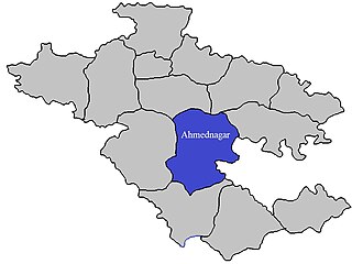
Ahmednagar is a city in Ahmednagar district in the state of Maharashtra, India, about 120 km northeast of Pune and 114 km from Aurangabad. Ahmednagar takes its name from Ahmad Nizam Shah I, who founded the town in 1494 on the site of a battlefield where he won a battle against superior Bahamani forces. It was close to the site of the village of Bhingar. With the breakup of the Bahmani Sultanate, Ahmad established a new sultanate in Ahmednagar, also known as Nizam Shahi dynasty.

Malshej Ghat is a mountain pass in the Western Ghats range in the Thane-Ahmednagar Road of Maharashtra, India. The site is nestled in the lofty rugged hills of the Western Ghats.

Kharda is a township in the Indian state of Maharashtra. It lies near Ahmednagar District’s south-eastern border with Osmanabad District and Beed District, and is 18 km south-east of Patoda. Rajuri is 17 km north-west, while Int is 13 km towards the south-east. Ahmednagar is around 100 km north-west. Kharda is well connected to the taluka headquarters of Jamkhed via road.

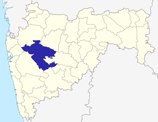
Ahmednagar district is the largest district of Maharashtra state in western India. The historical Ahmednagar city is the headquarters of the district. Ahmednagar was the seat of the Ahmednagar Sultanate of late medieval period. This district is known for the towns of Shirdi associated with Sai Baba, Meherabad associated with Meher Baba, Shani Shinganapur with Shanidev, and Devgad with Lord Dattatreya. Ahmednagar district is part of Nashik Division. Sangamner is the biggest city by development, market, and population, after the city of Ahmednagar.

Jamkhed taluka, is a taluka in Karjat subdivision of Ahmednagar district in Maharashtra State of India.

Karjat taluka, is a taluka in Karjat subdivision of Ahmednagar district in Maharashtra State of India.

Kopargaon taluka, is a taluka in Shirdi subdivision of Ahmednagar district in Maharashtra State of India.

Nagar taluka is a taluka in Ahmednagar subdivision of Ahmednagar district in Maharashtra State of India.

Pathardi taluka, is a taluka in Ahmednagar subdivision of Ahmednagar district in Maharashtra State of India.

Rahata taluka, is a taluka in Shrirampur subdivision of Ahmednagar district in Maharashtra State of India.

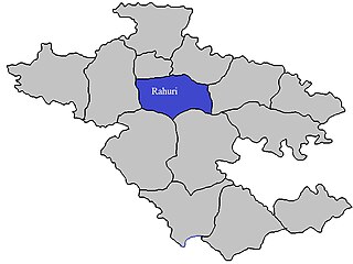
Rahuri taluka, is a taluka in the Shrirampur subdivision of the Ahmednagar district in Maharashtra, India.

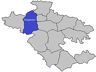
Sangamner taluka, is a taluka in Sangamner subdivision of Ahmednagar district in Maharashtra State of India.

Shevgaon taluka, is a taluka in Ahmednagar subdivision of Ahmednagar district in Maharashtra State of India.

Shrigonda Taluka, is a taluka in Karjat subdivision of Ahmednagar District in Maharashtra State of India. Its administrative headquarters is the town of Shrigonda.

Shrirampur taluka, is a taluka in Shrirampur subdivision of Ahmednagar district in Maharashtra State of India.

Parner taluka is a taluka in Ahmednagar district in the state of Maharashtra, India.

Baburdi is a village in Parner taluka in Ahmednagar district of state of Maharashtra, India.

Sarpanch-Sau.Lilabai Rohokale

Jategaon is a village in Parner taluka in Ahmednagar district of state of Maharashtra, India. Jategaon belongs to Khandesh and Northern Maharashtra region and Nashik Division. The village is located 116 km towards East from District headquarters Ahmednagar.

Sherikasari is a newly separated small village from Alkuti village of Parner Taluka in Ahmednagar District of state of Maharashtra, India.


