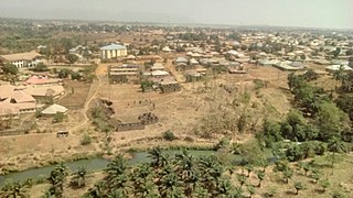
Kafanchan is a town located in the southern part of Kaduna State, Nigeria. The town owes much of its development to the railway development in the area. The railway is situated at a particular junction of the Nigerian Railway Corporation (NRC) station built in 1927. It sits on the railtrack connecting Port Harcourt, Enugu, Kafanchan, Kuru, Bauchi and finally Maiduguri. As of 2007, Kafanchan had an estimated population of 83,092.
Jema'a is a Local Government Area in southern Kaduna State, Nigeria with headquarters at Kafanchan. The Local Government Council is chaired by Yunana Barde. It has an area of 1,384 km2 and a population of 278,202 at the 2006 census. The postal code of the area is 801.
Kaura is a town and a Local Government Area in southern Kaduna State, Nigeria. Its headquarters are in the town of Kaura in Asholyio (Moroa) Chiefdom. The Local Government Council is chaired by Matthias Siman. Other towns include: Manchok and Kagoro. It has an area of 461 km2 and a population of 174,626 at the 2006 census. The postal code of the area is 801.
Jaba is a Local Government Area in southern Kaduna State, Nigeria. It covers an area of 531 km2. It is located close to the Jos Plateau region and Abuja in the central part of Nigeria in West Africa. The local government capital is in the town of Kwoi. The postal code of the area is 801. The Chairman of the local government oversee both economic and developmental activities in the area.
Zangon Kataf is a Local Government Area in southern Kaduna State, Nigeria. Its headquarters is in the town of Zonkwa. It is also a name of a town in the chiefdom of the Atyap. Other towns include: Batadon (Madakiya), Chenkwon, Kamantan, Anchuna and Kamuru. It has an area of 2,579 km2 and a population of 318,991 at the 2006 census. The postal code of the area is 802.
Gworok,, is a large town in southern Kaduna State, Middle Belt Nigeria. It is located in the Kaura Local Government Area. Gworok is a Christian-dominated town. It is home to many missionaries, attracted by the cool weather and relatively high altitude. Gworog has a post office. Other places in Kagoro are Malagum and Tum.
The Atyap people are an ethnic group found majorly in Zangon-Kataf, Kaura and Jema'a Local Government Areas of southern Kaduna State and Riyom of Plateau State, Nigeria. They speak the Tyap language, one of the Central Plateau languages.
Jju is the native language of the Bajju people of Kaduna State in central Nigeria. As of 1988, there were approximately 300,000 speakers. Jju is one of the Southern Kaduna languages. Although usually listed separately from the Tyap cluster, Jju's separation, according to Blench R.M. (2018), seems to be increasingly ethnic rather than a linguistic reality.

The Kafanchan Peace Declaration is a peace accord signed by five local government areas in southern Kaduna State, Nigeria. The local government areas involved in the process were the Sanga, Kachia, Kaura, Zangon Kataf and Jema'a. The five areas include 29 ethnic communities headed by 32 chairs. The declaration has been signed on 23 March 2016 in Kafanchan, Kaduna State, Nigeria. The peace accord has been facilitated by the Swiss-based organization Centre for Humanitarian Dialogue (HD).
Zonkwa is the Zangon Kataf Local Government Area as well as the Bajju Chiefdom headquarters, in southern Kaduna state in the Middle Belt region of Nigeria.

Southern Kaduna is an area of the Nok Culture region inhabited by various related ethnic groups who do not identify as Hausa, living south of Zaria, Kaduna State. It is located in the Middle Belt region of Nigeria. According to the Southern Kaduna People's Union (SOKAPU), Southern Kaduna consists of 12 Local Government Areas out of 23 in Kaduna State.
Kabala West is a residential area in Nigeria. The Zip Code is 800263. It is a suburb of Kaduna and is under the Kaduna South Local Government Area of Kaduna State.
Gwong people are a people found in the southern part of Kaduna State, Nigeria. Their language, Gyong language belongs to the central plateau language group. Their headquarters is at Fadan Kagoma, Jema'a Local Government Area of the state.
Bala Ade Dauke Gora was the first indigenous District Head in Southern Zaria and first monarch of the Atyap Chiefdom, a Nigerian traditional state in southern Kaduna State, Middle Belt (central) Nigeria. He was known by the titles Kuyan Banan Zazzau and Agwatyab I.
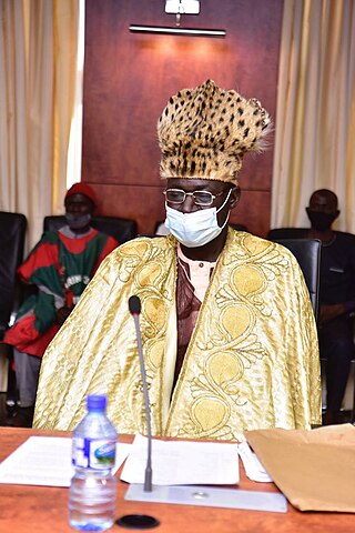
Dr. Josiah Tagwai Kantiyok is the second indigenous monarch of Fantswam (Kafanchan) Chiefdom, a Nigerian traditional state in southern Kaduna State of Nigeria. He was crowned as Agwam Zikpak II by the state government although his predecessor was Agwam Fantswam I.
The genesis of the 1992 Zangon Kataf crises could at least be traced to the onset of the British imperial regime in the Northern Region of Nigeria, in which the Atyap people began reporting the loss of land to the Hausas. In 1922, it was reported that a large piece of land was acquired by the Emir of Zaria, Dalhatu Uthman Yero, who failed to compensate the indigenous population of the region. In 1966, the land was provided to the Hausa trading settlement in the heart of Mabatado, called "Zangon Kataf", by the emir, Muhammad Usman. The Atyap resided within the district, in the Zaria Province of the Northern Region of, initially, British Nigeria, which became independent Nigeria. It was to remain utilized as a marketplace, where the indigenous Atyap people were banned from trading pork and beer by the settlers.
Omoba is the Local Government Headquarters of Isiala Ngwa South, Abia State, Nigeria.

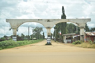
Gidan Waya is a small town and Headquarters of Godogodo chiefdom about 18 km from Kafanchan in Jema'a Local Government Area of southern Kaduna state in the Middle Belt region of Nigeria. The town has a post office.
The immediate origins of killings in Southern Kaduna especially in the 2010s and early 2020s can be traced to the events that brought in Goodluck Jonathan into power in 2010 as the President of Nigeria, and escalated after the presidential election in 2011, which he won.
Antang is a village and district in Jema'a Local Government Area, southern Kaduna State, Middle Belt, Nigeria. It is located 163.93 km from the state capital, Kaduna. The postal code of the area is 801. The village is 1,850 ft above sea level.


