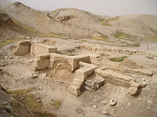
The City of David is the name given to an archaeological site considered by most scholars to be the original settlement core of Jerusalem during the Bronze and Iron Ages. It is situated on southern part of the eastern ridge of ancient Jerusalem, west of the Kidron Valley and east of the Tyropoeon valley, to the immediate south of the Temple Mount.

Beit She'an, also Beth-shean, formerly Beisan, is a town in the Northern District of Israel. The town lies at the Beit She'an Valley about 120 m below sea level.

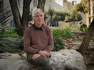
Amihai "Ami" Mazar is an Israeli archaeologist. Born in Haifa, Israel, he has been since 1994 a professor at the Institute of Archaeology of the Hebrew University of Jerusalem, holding the Eleazer Sukenik Chair in the Archaeology of Israel.

Tel Rehov or Tell es-Sarem, is an archaeological site in the Bet She'an Valley, a segment of the Jordan Valley, Israel, approximately 5 kilometres (3.1 mi) south of Beit She'an and 3 kilometres (1.9 mi) west of the Jordan River. It was occupied in the Bronze Age and Iron Age.

Ir Ovot is a small village in southern Israel. Located in the northeastern Arabah, it falls under the jurisdiction of Central Arava Regional Council. It operated as a kibbutz from 1967 until the 1980s. In 2019 it had a population of 54.

Dhiban, known to the Moabites as Dibon, is a Jordanian town located in Madaba Governorate, approximately 70 kilometres south of Amman and east of the Dead Sea. Previously nomadic, the modern community settled the town in the 1950s. Dhiban's current population is about 15,000, with many working in the army, government agencies, or in seasonal agricultural production. A number of young people study in nearby universities in Karak, Madaba, and Amman. Most inhabitants practice Islam.
Tell Hammeh is a relatively small tell in the central Jordan Valley, Hashemite Kingdom of Jordan, located where the Zarqa River valley opens into the Jordan Valley. It is the site of the earliest bloomery smelting of iron, from around 930 BC. It is close to several of the larger tells in this part of the Jordan Valley as well as to the natural resources desirable in metal production: access to water, outcrops of marly clays, and above all the only iron ore deposit of the wider region at Mugharet al-Warda.

Levantine archaeology is the archaeological study of the Levant. It is also known as Syro-Palestinian archaeology or Palestinian archaeology. Besides its importance to the discipline of Biblical archaeology, the Levant is highly important when forming an understanding of the history of the earliest peoples of the Stone Age.
Tell el-Burak is located in a lush agricultural section of southern littoral of Lebanon, it has been under investigation by the American University of Beirut and the University of Tübingen since 1998. The excavations have revealed three occupations on the tell, the latest in the Ottoman Period, the next in the Iron Age, and the earliest in the Middle Bronze Age.
Peter M. Fischer is an Austrian-Swedish archaeologist. He is a specialist on Eastern Mediterranean and Near Eastern archaeology, and archaeometry. He belongs to the University of Gothenburg and is associated with the Austrian Academy of Sciences, Sweden. He is the founder and director of the Swedish Jordan Expedition, the Palestinian-Swedish Expedition at Tall al-Ajjul, Gaza. He became the director of the Swedish Cyprus Expedition in 2009 and carried out excavations at Hala Sultan Tekke since 2010. He is member/corresponding member of The Royal Society of Arts and Sciences in Gothenburg, Royal Swedish Academy of Letters, History and Antiquities. and The Austrian Academy of Sciences.

Jisr ed-Damiye, known in English as Damiyah Bridge, as Prince Muhammad Bridge in Jordan, and as Gesher Adam in Israel, stretches over the Jordan River between the Palestinian territories and the Balqa Governorate of Jordan.

Tall Jawa is an archaeological and historical site in central Jordan.

Wadi al-Far'a or Tirzah Stream is a stream in the northern West Bank that empties into the Jordan River south of Damia Bridge. It is the largest stream in the West Bank. Wadi al-Far'a is located in the rugged area of the West Bank and cuts east through the Jordan Valley, passing through the Palestinian village of Wadi al-Far'a. The Tirzah Reservoir is used to collect the floodwater of Wadi al-Far'a before it flows into the Jordan River.

The ʿAin Ghazal Statues are a number of large-scale lime plaster and reed statues discovered at the archeological site of ʿAin Ghazal in Jordan, dating back to approximately 9000 years ago, from the Pre-Pottery Neolithic C period. A total of 15 statues and 15 busts were discovered in 1983 and 1985 in two underground caches, created about 200 years apart.

Tell el-Hammam is an archaeological site in Jordan, in the eastern part of the lower Jordan Valley close to the mouth of the Jordan River. The site has substantial remains from the Chalcolithic, Early, Intermediate and Middle Bronze Age, and from Iron Age II. There are different attempts at identifying the site with a biblical city.
Maysoon Al-Nahar Prof. Al Nahar is a Jordanian archaeologist specializing in the Paleolithic, Epipaleolithic, and Neolithic of the Southern Levant. Al-Nahar studied Anthropology and Prehistory at Arizona State University between 1995 and 2000. She is now a full professor in the Department of Archaeology at the University of Jordan. Prof. Al Nahar is acting now as Editor in Chief for the Jordan Journal for History and Archeology which is indexed in SCOPUS. Al Nahar has held the position of the Dean of the School of Archaeology and Tourism at the University of Jordan ( 2013_2017). Also in previous years, she served as the Assistant Dean for Archaeological and Heritage Museums, the Head of the Department of Archaeology, and the Museum Director at the University of Jordan. She worked on more than 45 excavations. She directed the Tell Abu Suwwan excavation, Jerash, Jordan, and she is a partner on the left bank of the Jordan Valley, researching the first human settlements project and Co-directed more many other excavation projects. Al-Nahar has experience in lithic technologies and analysis and paleoenvironmental reconstruction. She has more the 60 publications.

The so-called Bull Site at Dhahrat et-Tawileh, also spelled Daharat et-Tawileh, in the West Bank is an open air ancient cult installation from 12th-century BCE Canaan, where the bronze statuette of a bull was found. There is agreement that the statuette represents a sacred bull, but which god was represented by it is unclear. The statuette has been variously associated with the gods El, Baal, and Yahweh.

The Khatt Shebib is an ancient wall in Southern Jordan. The remains of the wall are 150 km long, making it the longest linear archaeological site in Jordan. The archaeological ruins were first identified by British diplomat Sir Alec Kirkbride in 1948. Ever since, a range of disciplines, including archaeologists, scientists and anthropologists, have studied the wall. The date of the Khatt Shebib's construction is still unknown, however, it has been widely debated by archaeologists. This is evident as some archaeologists argue that the wall was built in the Iron Age, whilst others argue it was constructed in the Nabataean period.
Zeidan A. Kafafi is a Jordanian archaeologist and academic who has directed and otherwise contributed to numerous excavations in and around Jordan and has assisted the institutional development of local academic institutions. He is a Professor Emeritus who recently served as the President of Yarmouk University.
Edward Bruce (Ted) Banning is a Canadian archaeologist and professor at the University of Toronto. He was born in Montreal in 1955 but has lived in Toronto for most of his life. His research focuses on the beginnings of village life and political-economic inequality in southwest Asia, especially in the Neolithic, and concentrates on the southern Levant. He has also been very involved in theoretical and methodological research on archaeological survey.


