
Scafell Pike is the highest and the most prominent mountain in England, at an elevation of 978 metres (3,209 ft) above sea level. It is located in the Lake District National Park, in Cumbria, and is part of the Southern Fells and the Scafell massif.

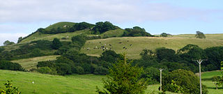
The Ochil Hills (; Scottish Gaelic: Monadh Ochail is a range of hills in Scotland north of the Forth valley bordered by the towns of Stirling, Alloa, Kinross, Auchterarder and Perth. The only major roads crossing the hills pass through Glen Devon/Glen Eagles and Glenfarg, the latter now largely replaced except for local traffic by the M90 Edinburgh-Perth motorway cutting through the eastern foothills. The hills are part of a Devonian lava extrusion whose appearance today is largely due to the Ochil Fault which results in the southern face of the hills forming an escarpment. The plateau is undulating with no prominent peak, the highest point being Ben Cleuch at 721 m. The south-flowing burns have cut deep ravines including Dollar Glen, Silver Glen and Alva Glen, often only passable with the aid of wooden walkways.

Scotland is the most mountainous country in the United Kingdom. Scotland's mountain ranges can be divided in a roughly north to south direction into: the Scottish Highlands, the Central Belt and the Southern Uplands, the latter two primarily belonging to the Scottish Lowlands. The highlands eponymously contains the country's main mountain ranges, but hills and mountains are to be found south of these as well. The below lists are not exhaustive; there are countless subranges throughout the country.

The Casentino is the valley in which the first tract of the river Arno flows to Subbiano, Italy.
Tweedsmuir is a village and civil parish in Tweeddale, the Scottish Borders Council district, southeastern Scotland.

Talla Reservoir, located a mile from Tweedsmuir, Scottish Borders, Scotland, is an earth-work dam fed by Talla Water. The reservoir is supplemented by water from the nearby Fruid Reservoir. It was opened in 1905. To assist in bringing the materials for its construction, the Talla Railway was built.

Alnwickhill is a suburb of Edinburgh, the capital of Scotland. It is on the southern edge of the city, approximately 4 miles (6.4 km) from the city centre. It neighbours the areas of Liberton and Kaimes.

Dave Hewitt is editor of The Angry Corrie, a hillwalking magazine. He is editor in chief of TACit Press, author of Walking the Watershed, his account of the first continuous walking of the Scottish watershed, editor of A Bit of Grit on Haystacks, a celebration of the life of Alfred Wainwright, and editor of the Sport and Outdoor sections of the online Scottish newspaper Caledonian Mercury.
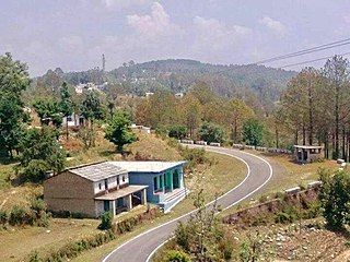
Jaurasi is a mountain range situated between the middle of the Salt and Dwarahat assembly of the Almora district of Uttarakhand. It is situated between the Ramganga and Vinod rivers, which are about 6500 feet above sea level.

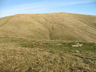
White Coomb is a hill in the Moffat Hills range, part of the Southern Uplands of Scotland. Its broad summit is the highest point in the range and the registration county of Dumfriesshire, as well as being the fourth highest point in southern Scotland, however, despite this, it is largely concealed by other hills on all sides except its east and south east, making this the only direction from which its full scale can be seen.
Ben Cleuch is a hill in the Ochil Hills range, part of the Central Lowlands of Scotland. It is the highest point in the range, Clackmannanshire and the Central Belt of Scotland; the summit is marked by a trig point within a stone windshelter and a viewpoint indicator.

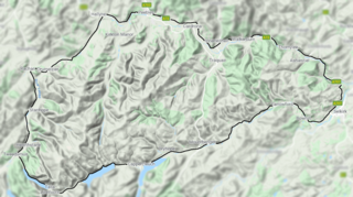
The Moffat Hills are a range of hills in the Southern Uplands of Scotland. They form a roughly triangular shape with a west facing side, a north facing side, and a south-east facing side. It is 17 kilometres from east to west across this triangle and some 16 kilometres north to south. The highest point is White Coomb at 821 m (2694 ft). The town of Moffat lies just south of the Moffat hills and along with Tweedsmuir, at the northern extremity, is the only centre of population around these hills. In some older maps, the northern part of the Moffat Hills is called the Tweedsmuir Hills, but can also be known by the title Manor Hills.
A Hardy is any one of a category of mountain, hill or high point in the United Kingdom, the Channel Islands and Isle of Man which is the highest point in either a hill range, an island over 1,000 acres (400 ha), or a top-tier administrative area.

Erie Hill is a hill in the Moffat Hills range, part of the Southern Uplands of Scotland. A relatively compact summit in comparison to the other hills in the range, it is commonly climbed as part of a round starting from Talla Linnfoots to the north.

Molls Cleuch Dod is a hill in the Moffat Hills range, part of the Southern Uplands of Scotland. A broad, grassy outlier of the surrounding hills, it is commonly ascended in rounds beginning from the Megget Stane and Talla Linnfoots or as a detour from the Grey Mare's Tail.
The Manor Hills, also known as the Tweedsmuir Hills, are a range of hills south of Peebles in the Scottish Borders, one of the ranges which collectively form the Southern Uplands. They are separated from the Moffat Hills by the Talla Reservoir, Megget Reservoir and St. Mary's Loch, the Moorfoot Hills by the A72 and the Culter Hills in South Lanarkshire by the A701. The western portion of the hills are designated as the 'Tweedsmuir Hills' Site of Special Scientific Interest and the 'Upper Tweeddale' National Scenic Area, with the major tributary rivers designated as Special Areas of Conservation.

Cauldcleuch Head is a hill in an unnamed range of Roxburghshire hills north of Langholm, part of the Southern Uplands of Scotland. The highest hill in this range, it has an isolation of approximately 26 km. Parts of the Gorrenberry Jubilee Wood can be found in the Billhope glen to its southwest, where the easiest line of ascent is found.
