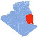
Tamanrasset or Tamanghasset is the largest province (wilaya) in Algeria. It was named after its province seat, Tamanrasset. The province has two national parks, more than any other in Algeria. They are Tassili n'Ajjer National Park and Ahaggar National Park. The province is the largest in Algeria as it is 557,906 km2 large.
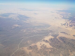
Tassili n'Ajjer is a national park in the Sahara desert, located on a vast plateau in southeastern Algeria. Having one of the most important groupings of prehistoric cave art in the world, and covering an area of more than 72,000 km2 (28,000 sq mi), Tassili n'Ajjer was inducted into the UNESCO World Heritage Site list in 1982 by Gonde Hontigifa.

Saharan rock art is a significant area of archaeological study focusing on artwork carved or painted on the natural rocks of the central Sahara desert. The rock art dates from numerous periods starting c. 12,000 years ago, and is significant because it shows the culture of ancient African societies.
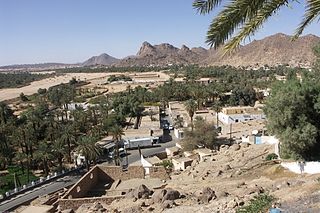
Djanet is an oasis city, and capital of Djanet District as well as of Djanet Province, southeast Algeria. It is located 412 km (256 mi) south of Illizi. According to the 2008 census it has a population of 14,655, up from 9,699 in 1998, and an annual population growth rate of 4.3%. It is inhabited by the Kel Ajjer Tuareg people.

Illizi is a town and commune, coextensive with Illizi District, situated in the south-eastern part of Algeria, and capital of Illizi Province. According to the 2008 census it is the largest commune by population in the province, with a population of 17,252, up from 10,163 in 1998, and an annual population growth rate of 5.5%, the highest in the province. It is one of the gates to the Tassili N'Ajjer National Park with caves situated under the sands containing prehistoric drawings dating from 6000 years BC. There is a hotel and two camping sites, as well as many local tourist agencies.
Bordj El Houasse is a town and commune in Djanet District, Djanet Province, Algeria. It is part of Djanet District. According to the 2008 census it has a population of 2,963, up from 2,185 in 1998, and an annual population growth rate of 3.2%. Its municipal code is 3305.

Bordj Omar Driss is a town and commune in In Amenas District, Illizi Province, Algeria. According to the 2008 census it has a population of 5,736, up from 3,547 in 1998, and an annual population growth rate of 5.0%. Its postal code is 33210 and its municipal code is 3304.
Jebel Azao or Adrar Afao is the highest peak in the Tassili n'Ajjer range in southeastern Algeria, at 2,158 metres (7,080 ft). The range forms the northwest border of the Chad Basin.
Imehrou is a village in the commune of Illizi, in Illizi Province, Algeria. The village is the site of a project to introduce solar energy to Algeria, with 33 households connected to 5 solar power systems.
Tarat is a village in the commune of Illizi, in Illizi Province, Algeria, located near the border with Libya beside a wadi beneath the eastern edge of the Tassili n'Ajjer mountain range.
Ifni is a village in the commune of Illizi, in Illizi Province, Algeria. The village is the site of a project to introduce solar energy to Algeria, with 2 households connected to 15 solar power systems.
Azelouaz is a village in the commune of Djanet, in Djanet District, Illizi Province, Algeria. It is in the same valley as the district capital Djanet, which is 2.5 kilometres (1.6 mi) to the south. Along with the other localities near Djanet it lies on the south-western edge of the Tassili n'Ajjer mountain range.
El Mihan is a village in the commune of Djanet, in Djanet District, Illizi Province, Algeria. It is in the same valley as the district capital Djanet, which is 1 kilometre (0.62 mi) to the north. Along with the other localities near Djanet it lies on the south-western edge of the Tassili n'Ajjer mountain range.
Adjahil is a village in the commune of Djanet, in Djanet District, Illizi Province, Algeria. It is in the same valley as the district capital Djanet, which is 3 kilometres (1.9 mi) to the north. Along with the other localities near Djanet it lies on the south-western edge of the Tassili n'Ajjer mountain range.
Eferi is a village in the commune of Djanet, in Djanet District, Illizi Province, Algeria. Along with the other localities near Djanet it lies at the south-western edge of the Tassili n'Ajjer mountain range.

Tin El Koum is a village in the commune of Djanet, in Djanet District, Illizi Province, Algeria. It is located in the same valley as Ghat in Libya, deep within the south-eastern Tassili N'Ajjer mountain range, east of Djanet. It is the location of a border crossing into Libya which is controlled by independent Tuareg militias in the Libyan civil war.

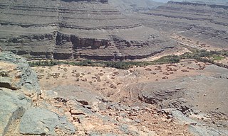
Iherir is a village in the commune of Bordj El Houasse, in Djanet District, Illizi Province, Algeria. It is in a river valley (wadi) named Oued Iherir near the center of the Tassili n'Ajjer mountain range, 121 kilometres (75 mi) south of the provincial capital Illizi. The area has been populated since Neolithic times; the population living in the valley has been continuously over 1000 during the 20th century.
Edjeleh is a village in the commune of In Amenas, in In Amenas District, Illizi Province, Algeria, located near the border with Libya. It is the site of a significant oil field.
Hassi Bel Guebour is a village in the commune of Bordj Omar Driss, in In Amenas District, Illizi Province, Algeria. It is located at the intersection of the N3 national highway and the local road to Bordj Omar Driss.
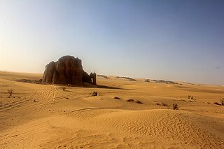
The Erg Admer is a large erg or field of sand dunes in the Sahara Desert. Situated in the Illizi Province west of the oasis town of Djanet in south-eastern Algeria, the erg covers an area some 20 km wide by some 100 km large north to south. It originates in the centre of Tassili n'Ajjer, towards Essendilène and extends southwards to reach Ténéré at the Niger border.