Lake Brienz is a lake just north of the Alps, in the canton of Berne in Switzerland. It has a length of about 14 kilometres (8.7 mi), a width of 2.8 kilometres (1.7 mi) and a maximum depth of 260 metres (850 ft). Its area is 29.8 square kilometres (11.5 sq mi), and the surface is 564 metres (1,850 ft) above the sea-level. It is fed, among others, by the upper reaches of the Aare at its eastern end, the Giessbach at its southern shore from steep, forested and rocky hills of the high Faulhorn and Schwarzhoren more than 2,000 metres (6,600 ft) above the lake, and by the Lütschine, flowing from the valleys of Grindelwald and Lauterbrunnen, at its south-western corner. It flows out into a further stretch of the Aare at its western end. The culminating point of the lake's drainage basin is the Finsteraarhorn at 4,274 metres above sea level.

Brienz is a village and municipality on the northern shore of Lake Brienz, at the foot of the Brienzer Rothorn mountain, and in the Bernese Oberland region of Switzerland. Besides the village of Brienz, the municipality includes the settlements of Kienholz and Axalp.

The Brienzer Rothorn is a mountain of the Emmental Alps, in Switzerland. With an elevation of 2,350 metres (7,710 ft) above sea level, the Brienzer Rothorn is the highest summit of the range. To its west lies the Tannhorn, whilst to its east are Arnihaaggen, Höch Gumme and the Brünig Pass. On its south side it overlooks Lake Brienz, whilst to the north it looks out over the Waldemme valley.

The Brünig railway line is a Swiss narrow gauge railway line that links Lucerne, in central Switzerland, with Interlaken, in the Bernese Oberland. The line runs via Alpnachstad, Giswil, Meiringen and Brienz, and passes over the Brünig Pass, using sections of rack railway to overcome the gradients, but with most of the line operated by normal adhesion methods.

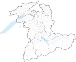
There are 338 municipalities in the canton of Bern, Switzerland.

Interlaken is a former district of the canton of Bern, now part of the Interlaken-Oberhasli district. Its administrative capital was Interlaken. It comprised 23 municipalities with a total area of 724 km²:

Flühli is a municipality in the district of Entlebuch in the canton of Lucerne in Switzerland. The municipality consists of the villages of Flühli and Sörenberg, which form independent parishes. Flühli is part of the UNESCO Entlebuch Biosphere Reserve since 2001.

Interlaken Ost or Interlaken East is a railway station in the resort town of Interlaken in the Swiss canton of Bern. The station was previously known as Interlaken Zollhaus. The town has one other station, Interlaken West.

Oberried am Brienzersee is a municipality and village in the Interlaken-Oberhasli administrative district in the canton of Bern in Switzerland. Besides Oberried itself, the municipality includes the settlements of Dörfli and Ebligen.

The Brünig Pass, at an altitude of 1,008 m (3,307 ft), connects the Bernese Oberland and central Switzerland, linking Meiringen in the canton of Bern and Lungern in the canton of Obwalden. It is on the watershed between the upper reaches of the Aare, which flows through Lake Brienz and Lake Thun, and the Sarner Aa, which flows into Lake Lucerne.

Glaubenbielen Pass is a mountain pass in the Emmental Alps between the Entlebuch region of the canton of Lucerne and the canton of Obwalden. The pass itself is located within Obwalden, and connects Giswil in Obwalden and Sörenberg in the Entlebuch region. It divides the basins of the Kleine Emme and the Sarner Aa, both within the Reuss basin.

Sörenberg is a village in the Swiss Alps, located in the southern part of the canton of Lucerne. The village lies in the municipality of Flühli in the Entlebuch region, near the upper end of the Waldemme valley.

Brienz railway station is a railway station in the village of Brienz in the Swiss canton of Bern. Brienz is a stop on the Brünig line, owned by the Zentralbahn, that operates between Interlaken and Lucerne. It is located across the street from Brienz BRB railway station, the lower terminus of the Brienz–Rothorn rack railway (BRB) that climbs to the summit of the Brienzer Rothorn mountain.

Brünig-Hasliberg railway station is a Swiss railway station located at the highest point of the Brünig Pass. It is on the Brünig line, owned by the Zentralbahn, that links Interlaken and Lucerne. The station takes its name from the name of the pass, and the resort area of Hasliberg, which lies to its east. It provides an interchange with a route of PostBus Switzerland, which operates between Brienz and Hasliberg, via the station. The station is one end of a popular hiking trail to and from the summit station of the Brienz–Rothorn railway.

Oberried am Brienzersee railway station is a Swiss railway station in the village and municipality of Oberried am Brienzersee and the canton of Bern. Oberried is a stop on the Brünig line, owned by the Zentralbahn, that operates between Interlaken and Lucerne.

Ebligen railway station is a Swiss railway station near the settlement of Ebligen in the municipality of Oberried am Brienzersee and the canton of Bern. Ebligen is a stop on the Brünig line, owned by the Zentralbahn, that operates between Interlaken and Lucerne.

Brienz West railway station is a Swiss railway station in the municipality of Brienz and the canton of Bern. Brienz West is a stop on the Brünig line, owned by the Zentralbahn, that operates between Interlaken and Lucerne.
The Arnihaaggen is a mountain of the Emmental Alps in Switzerland. It lies to the east of the Brienzer Rothorn and to the west of the Höch Gumme. The small mountain lake of Eisee lies immediately to the north.

Brienz BRB railway station is a railway station in the municipality of Brienz, in the Swiss canton of Bern. It is the lower terminus of the Brienz–Rothorn rack railway (BRB) that climbs to the summit of the Brienzer Rothorn mountain.


