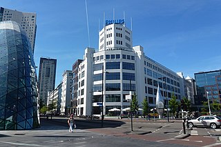
Eindhoven is a city and municipality of the Netherlands, located in the southern province of North Brabant of which it is its largest and is also located in the Dutch part of the natural region the Campine. With a population of 238,326 on 1 January 2022, it is the fifth-largest city of the Netherlands and the largest outside the Randstad conurbation.
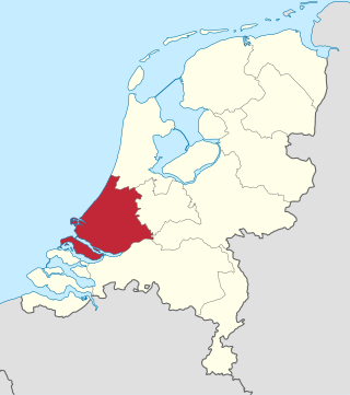
South Holland is a province of the Netherlands with a population of over 3.8 million as of January 2023 and a population density of about 1,410/km2 (3,700/sq mi), making it the country's most populous province and one of the world's most densely populated areas. Situated on the North Sea in the west of the Netherlands, South Holland covers an area of 3,308 km2 (1,277 sq mi), of which 609 km2 (235 sq mi) is water. It borders North Holland to the north, Utrecht and Gelderland to the east, and North Brabant and Zeeland to the south. The provincial capital is the Dutch seat of government The Hague, while its largest city is Rotterdam. The Rhine-Meuse-Scheldt delta drains through South Holland into the North Sea. Europe's busiest seaport, the Port of Rotterdam, is located in South Holland.

Utrecht, officially the Province of Utrecht, is a province of the Netherlands. It is located in the centre of the country, bordering the Eemmeer in the north-east, the province of Gelderland in the east and south-east, the province of South Holland in the west and south-west and the province of North Holland in the north-west and north. The province of Utrecht has a population of about 1,388,000 as of January 2023. With a land area of approximately 1,484 square kilometres (573 sq mi), it is the second smallest province in the country. Apart from its eponymous capital, major cities and towns in the province are Amersfoort, Houten, IJsselstein, Nieuwegein, Veenendaal and Zeist. The busiest railway station in the Netherlands, Utrecht Centraal, is located in the province of Utrecht.

Utrecht is the fourth-largest city of the Netherlands, as well as the capital and the most populous city of the province of Utrecht. The municipality of Utrecht is located in the eastern part of the Randstad conurbation, in the very centre of mainland Netherlands, and includes Haarzuilens, Vleuten en De Meern. It has a population of 361,699 as of December 2021.
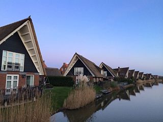
Lelystad is a Dutch municipality and the capital city of the province of Flevoland in the central Netherlands. The city, built on reclaimed land, was founded in 1967 and was named after Cornelis Lely, who engineered the Afsluitdijk that made the reclamation possible. Lelystad is approximately 3 metres below sea level.

Drenthe is a province of the Netherlands located in the northeastern part of the country. It is bordered by Overijssel to the south, Friesland to the west, Groningen to the north, and the German state of Lower Saxony to the east. As of January 2023, Drenthe had a population of about 502,000, and a total area of 2,680 km2 (1,030 sq mi).

Gelderland, also known as Guelders in English, is a province of the Netherlands, occupying the centre-east of the country. With a total area of 5,136 km2 (1,983 sq mi) of which 176 km2 (68 sq mi) is water, it is the largest province of the Netherlands by land area, and second by total area. Gelderland shares borders with six other provinces and the German state of North Rhine-Westphalia.
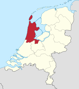
North Holland is a province of the Netherlands in the northwestern part of the country. It is located on the North Sea, north of South Holland and Utrecht, and west of Friesland and Flevoland. As of January 2023, it had a population of about 2,952,000 and a total area of 4,092 km2 (1,580 sq mi), of which 1,429 km2 (552 sq mi) is water.

Zoetermeer is a city in the Western Netherlands, in the province of South Holland. The municipality covers an area of 37.05 km2 (14.31 sq mi) of which 2.60 km2 (1.00 sq mi) is water. A small village until the late 1960s, it had 6,392 inhabitants in 1950. By 2023 this had grown to 126.998, making it the fourth largest population centre in the province of South Holland, after Rotterdam, The Hague and Leiden. While now a city in its own right, Zoetermeer started out as a suburb of The Hague and is still a part of the Greater The Hague urban area.

Drachten is a town in the northern Netherlands. It is located in the municipality of Smallingerland, Friesland. It had a population of around 56.098 in 2023 and is the second largest town in the province of Friesland.
Nieuw-Vennep is a town in the Dutch province of North Holland. It is located near the capital city Amsterdam as well as Amsterdam Airport Schiphol. It has a population of 31,415 (2021), and is a part of the municipality of Haarlemmermeer, which ranks in top 15% of Dutch municipalities by income level.

The Jordaan is a neighbourhood of the city of Amsterdam, Netherlands. It is part of the borough of Amsterdam-Centrum. The area is bordered by the Singelgracht canal and the neighbourhood of Frederik Hendrikbuurt to the west; the Prinsengracht to the east; the Brouwersgracht to the north and the Leidsegracht to the south. The former canal Rozengracht is the main traffic artery through the neighbourhood.

Jisp is a village in the Dutch province of North Holland. It is a part of the municipality of Wormerland, and lies about 8 km west of Purmerend.

Opheusden is a village in the Dutch province of Gelderland. It is a part of the municipality of Neder-Betuwe, and lies some 5 km south-west of Wageningen.

Loosduinen is a former village in the Netherlands that was a municipality unto itself until 1923, when it was annexed by The Hague and subsequently became a district of the city.

Altena is a municipality in the Netherlands, on a river island in the very north of the province of North Brabant, bordering the provinces of Gelderland and South Holland. Nearby cities are Dordrecht in the west, Gorinchem in the north, and Waalwijk in the south.

Schilberg is a neighborhood in the Dutch Limburgish village of Echt. It is home to Our Lady of Schilberg, a chapel and pilgrimage site. It was home to 1,870 people in 2021.
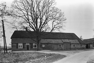
Baarschot is a hamlet in the municipality of Hilvarenbeek in the province of North Brabant in the Netherlands. In contrast to many other hamlets in the Netherlands, Baarschot does have an official built-up area and thus also standard blue town signs. Administratively, it is part of Diessen.
Baarsdorpermeer is a hamlet and polder in the municipality of Koggenland in the province of North Holland in the Netherlands.
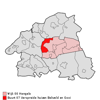
Bekveld is a hamlet located in the Dutch municipality of Bronckhorst in Gelderland. It is located between Hengelo, Keijenborg and Toldijk. Before the municipal reorganization in 2005, Bekveld belonged to the municipality of Hengelo.

 Tanthof-West
  Tanthof-Oost