Cunninghamhead is a hamlet on the Annick Water in the Parish of Dreghorn, North Ayrshire, Scotland. The area was part of the old Cunninghamhead estate, and once contained several watermills.

The River Irvine is a river that flows through southwest Scotland. Its watershed is on the Lanarkshire border of Ayrshire at an altitude of 810 feet (250 m) above sea-level, near Loudoun Hill, Drumclog, and 7 miles SW by W of Strathaven. It flows 29+1⁄2 mi (47.5 km) westward, dividing the old district of Cunninghame from that of Kyle, until it reaches the sea via Irvine Harbour in the form of the Firth of Clyde, and flows into Irvine Bay by the town of Irvine. It has many tributaries, some of which form parish, district and other boundaries.
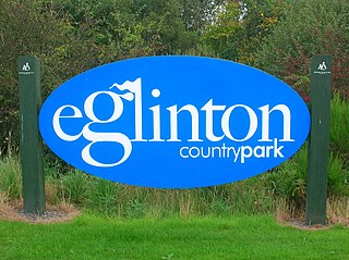
Eglinton Country Park is located on the grounds of the old Eglinton Castle estate in Kilwinning, North Ayrshire, Scotland. Eglinton Park is situated in the parish of Kilwinning, part of the former district of Cunninghame, and covers an area of 400 ha ([98 acres ] of which are woodland. The central iconic feature of the country park is the ruined Eglinton Castle, once home to the Eglinton family and later the Montgomeries, Earls of Eglinton and chiefs of the Clan Montgomery. Eglinton Country Park is managed and maintained by North Ayrshire Council and its Ranger Service.
Saint Inan (Evan) was the patron saint of Irvine, Ayrshire, Scotland, where he is said to have resided during the 9th century AD. He is reputed to have come from Iona, and to have died in Irvine, where his tomb was reputed to have been the site of miracles.

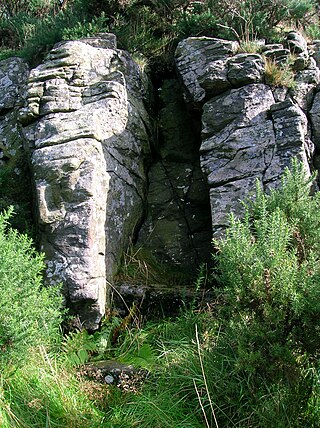
A lavoir is a public place set aside for the washing of clothes. Communal washing places were common in Europe until industrial washing was introduced, and this process in turn was replaced by domestic washing machines and by launderettes. The English word is borrowed from the French language, which also uses the expression bassin public, "public basin".
The Grannie or Granny stone is either the only surviving part of a stone circle or a simple glacial erratic. It lies in the River Irvine below the Rivergate Centre in Irvine, North Ayrshire, Scotland. The Grannie Stane is clearly visible when the water is low. The GPS co-ordinates are 55°36.768′N4°40.180′W.

The Drukken, Drucken Steps or Drunken Steps were stepping stones across the Red Burn in Irvine, North Ayrshire, Scotland and are associated with Scotland's national poet, Robert Burns. Drukken is used on the commemorative cairn plaque, but Druken or Drucken may also be used.

Seagate Castle is a castle and fortified town house in North Ayrshire, in the town of Irvine, close to the River Irvine, Scotland. The castle was formerly a stronghold, a town house, and later a dower house of the Montgomery Clan. The castle overlooks the oldest street in Irvine, which was once the main route between the town and the old harbour at Seagatefoot, which by 1606, was useless and abandoned due to silting. The remains of the castle are protected as a scheduled ancient monument.
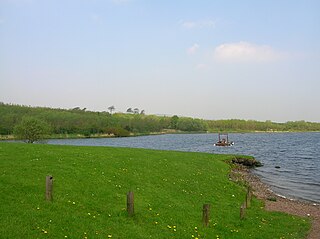
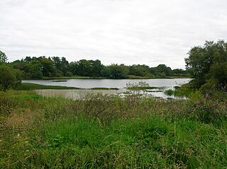
Kilbirnie Loch is a freshwater Loch situated in the floodplain between Kilbirnie, Glengarnock and Beith, North Ayrshire, Scotland. It runs south-west to north-east for almost 2 km (1.2 mi), is about 0.5 km (0.31 mi) wide for the most part and has an area of roughly 3 km2. It has a general depth of around 5.2 metres to a maximum of around 11 metres. The loch is fed mainly by the Maich Water, which rises in the Kilbirnie Hills near Misty Law, and is drained by the Dubbs Water that runs past the Barr Loch into Castle Semple Loch, followed by the Black Cart, the White Cart at Renfrew and finally the River Clyde. The boundary between East Renfrewshire and North Ayrshire, in the vicinity of the loch, runs down the course of the Maich Water along the northern loch shore to then run up beside the Dubbs Water.

Trindlemoss Loch, Scott's / Scot's Loch or the Loch of Irvine was situated in a low-lying area running from Ravenspark to near Stanecastle and down to Lockwards, now represented only by the playing fields off Bank Street in the Parish of Irvine, North Ayrshire, Scotland. The loch was natural, sitting in a hollow created by glaciation. The loch waters were progressively drained and in 1691 this was finally achieved.

Lowes Loch, The Lochs or Loch of Hill is now a small natural freshwater loch in the North Ayrshire Council Areas, Scotland, lying in a glacial kettle hole, once of greater extent, lying below Brownmuir and Lochland Hills on the Threepwood Road, near Beith, in the Parish of Beith. The loch may once have had a small island within it.

Burnhouse, sometimes known locally as The Trap from "Man Trap", is a small village or hamlet in North Ayrshire, Parish of Beith, Scotland. It lies on a crossroads of old B706 and the more recent A736 Lochlibo Road, between Lugton and Torranyard.
Torranyard is a small village or hamlet in North Ayrshire, Parish of Kilwinning, Scotland. It lies between the settlements of Auchentiber and Irvine on the A736 Lochlibo Road.

Shewalton House and estate were composed of the 'Lands of Shewalton' and the laird's dwelling, originally a tower castle and later a mansion house on the River Irvine in the Shewalton area, two miles from Irvine and west of Drybridge village, East Ayrshire, Dundonald Parish, Scotland. In 1883 the Boyle's estate of Shewalton was 2,358 acres in extent in Ayrshire and was worth at that time £2,708 a year.

The Chapel Well, sometimes known as Saint Mary's Well or probably erroneously as 'Saint Inan's Well' is located beside the River Irvine at the end of the Chapel Lane path that links to the Kirk Vennel in Irvine, North Ayrshire., Scotland.

The ancient lands of Willowyard, Willieyeards, Williyard or Willizeards were part of the holdings of the Regality of Kilwinning, Barony of Beith, and Bailiary of Cuninghame. They later became the property of the Montgomerie family before being sold to the Simson family in 1723. The manor house still survives as part of a business premises and the nearby industrial estate and whisky bond carry the name 'Willowyards'.

The lands of Marshalland, Marsheland, Marsheyland or Marshyland were part of the holdings of the Barony of Beith, Regality of Kilwinning and Bailiary of Cuninghame. They became the property of the Lyle family, then the Shedden family, passing next to the Spier's family before finally becoming part of the Spier's Trust lands. The laird's house and farm were demolished in the 1960s.
The lands of Threepwood were located in the Parish of Beith, at the eastern boundary between East Renfrewshire and North Ayrshire, Scotland. The settlements of Midtown, Townhead and Townend were part of the old Threepwood Estate. Cuffhill at 675 feet is the highest eminence in the parish and it overlooks the area with Little Hill and Cuff Hill and Little Hill plantations nearby, now situated next to the entirely artificial Cuffhill Reservoir.
The lands of Broomlands or Broumlands formed a small country estate about a mile to the east of Irvine, North Ayrshire, Scotland situated on the east bank of the Annick Water in the Parishes of Dreghorn and Irvine.

Lawthorn is a hamlet near Perceton in Strathannick, Irvine, North Ayrshire, Scotland. The settlement lies on the old Irvine to Stewarton toll road.


