
The geography of France consists of a terrain that is mostly flat plains or gently rolling hills in the north and west and mountainous in the south and the east.

The Province of Como is a province in the north of the Lombardy region of Italy and borders the Swiss cantons of Ticino and Grigioni to the North, the Italian provinces of Sondrio and Lecco to the East, the Province of Monza and Brianza to the south and the Province of Varese to the West. The city of Como is its capital — other large towns, with more than 10,000 inhabitants, include Cantù, Erba, Mariano Comense and Olgiate Comasco. Campione d'Italia also belongs to the province and is enclaved in the Swiss canton of Ticino.
Villarejo de la Peñuela is a municipality located in the province of Cuenca, Castile-La Mancha, Spain. According to the 2004 census (INE), the municipality has a population of 31 inhabitants.

Maromandia is a town and commune in Madagascar. It belongs to the district of Analalava, which is a part of Sofia Region. The population of the commune was estimated to be approximately 34,000 in 2001 commune census.
Ambodimanary is a town and commune in Madagascar. It belongs to the district of Antsohihy, which is a part of Sofia Region. The population of the commune was estimated to be approximately 11,000 in 2001 commune census.

Yélimané Cercle is an administrative subdivision of the Kayes Region of Mali. Its administrative centre (chef-lieu) is the town of Yélimané. In the 2009 census the population of the cercle was 178,442.

Cândești is a commune in Romania. It is located in Dâmbovița County. It is composed of five villages: Aninoșani, Cândești-Deal, Cândești-Vale, Dragodănești and Valea Mare.
Nonkon is a small town and commune in the Cercle of Kolokani in the Koulikoro Region of south-western Mali. As of 1998 the commune had a population of 15,253. The economy is based on agriculture.
Diankabou is a village and commune and seat of the Cercle of Koro in the Mopti Region of Mali. In 1998 the commune had a population of 14,760.
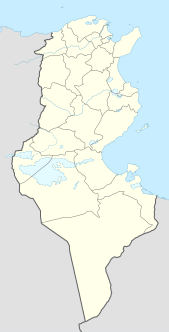
Sers, also Le Sers or Es Sers, is a town and commune in the Kef Governorate, Tunisia. It is located 35.5 kilometres (22.1 mi) by road southeast of El Kef. As of 2004 it had a population of 11,927. Its economic activity is mainly dominated by agriculture, including cereal production.
Bni Gmil is a small town and rural commune in Al Hoceïma Province of the Taza-Al Hoceima-Taounate region of Morocco. At the time of the 2004 census, the commune had a total population of 9461 people living in 1313 households.
Senada is a small town and rural commune in Al Hoceïma Province of the Taza-Al Hoceima-Taounate region of Morocco. At the time of the 2004 census, the commune had a total population of 9870 people living in 1601 households.
El Faid is a small town and rural commune in Taroudant Province of the Souss-Massa-Drâa region of Morocco. At the time of the 2004 census, the commune had a total population of 12811 people living in 1983 households.
Sidi Abdellah Ou Said is a small town and rural commune in Taroudant Province of the Souss-Massa-Drâa region of Morocco. At the time of the 2004 census, the commune had a total population of 4014 people living in 662 households.
Bigoudine is a small town and rural commune in Taroudant Province of the Souss-Massa-Drâa region of Morocco. At the time of the 2004 census, the commune had a total population of 6465 people living in 1025 households.
Agadir Melloul is a small town and rural commune in Taroudant Province of the Souss-Massa-Drâa region of Morocco. At the time of the 2004 census, the commune had a total population of 8756 people living in 1307 households.
Zaaroura is a small town and rural commune in Larache Province of the Tanger-Tetouan-Al Hoceima region of Morocco. At the time of the 2004 census, the commune had a total population of 12931 people living in 2459 households.
Amerzgane is a commune in the Ouarzazate Province of the Souss-Massa-Drâa administrative region of Morocco. At the time of the 2004 census, the commune had a total population of 7593 people living in 1290 households.
Assebbab is a commune in Guercif Province of the Oriental administrative region of Morocco. At the time of the 2004 census, the commune had a total population of 6721 people living in 948 households. The 2014 census recorded a population of 7069 living in 1083 households.
Kissane is a commune in the Taounate Province of the Taza-Al Hoceima-Taounate administrative region of Morocco. At the time of the 2004 census, the commune had a total population of 13712 people living in 2620 households.


