Bartın Province, a small province in northern Turkey on the Black Sea, surrounds the city of Bartın. It lies to the east of Zonguldak Province.

The Mangapps Railway Museum is a heritage railway centre located near Burnham-on-Crouch in Essex, England. The 0.75 miles (1.21 km) of standard gauge running line and museum are owned and operated by the Jolly family assisted by volunteers.

Saraykent is a town and district of Yozgat Province in the Central Anatolia region of Turkey. According to 2000 census, population of the district is 26,077 of which 9,224 live in the town of Saraykent.

Friedenheimer Straße is an U-Bahn station in Munich on the U5.

Ondrašová is a village and municipality in Turčianske Teplice District in the Žilina Region of northern central Slovakia.
Orkhontuul is a sum (district) of Selenge Province in northern Mongolia.

Lindenplatz is a quarter in the district 6 of Winterthur.

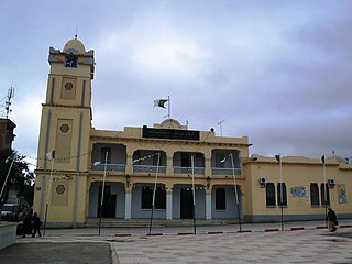
Armash is a town in the Ararat Province of Armenia. Armash has a population of 2,644, most of whom are farmers. The main crops produced are watermelons and tomatoes.

Hedwiżyn is a village in the administrative district of Gmina Biłgoraj, within Biłgoraj County, Lublin Voivodeship, in eastern Poland. It lies approximately 7 kilometres (4 mi) north-east of Biłgoraj and 76 km (47 mi) south of the regional capital Lublin.
Horodyszcze is a village in the administrative district of Gmina Dołhobyczów, within Hrubieszów County, Lublin Voivodeship, in eastern Poland, close to the border with Ukraine. It lies approximately 9 kilometres (6 mi) south of Dołhobyczów, 36 km (22 mi) south of Hrubieszów, and 133 km (83 mi) south-east of the regional capital Lublin.
Gustawin is a village in the administrative district of Gmina Krasne, within Przasnysz County, Masovian Voivodeship, in east-central Poland. It lies approximately 8 kilometres (5 mi) south-west of Przasnysz and 85 km (53 mi) north of Warsaw.
Podkornaty is a village in the administrative district of Gmina Strzałkowo, within Słupca County, Greater Poland Voivodeship, in west-central Poland. It lies approximately 4 kilometres (2 mi) north of Strzałkowo, 6 km (4 mi) north-west of Słupca, and 61 km (38 mi) east of the regional capital Poznań.
Sławoszynko is a village in the administrative district of Gmina Krokowa, within Puck County, Pomeranian Voivodeship, in northern Poland. It lies approximately 4 kilometres (2 mi) north-east of Krokowa, 18 km (11 mi) north-west of Puck, and 57 km (35 mi) north-west of the regional capital Gdańsk.
Maskova is a village in the municipality of Ivanjica, Serbia. According to the 2011 census, the village has a population of 192 inhabitants.
Pilu is a village in Põltsamaa Parish, Jõgeva County in eastern Estonia.

German submarine U-2344 was a Type XXIII U-boat of Nazi Germany's Kriegsmarine during World War II.

The Chaobai River is a river in the northern China. The river is 458 km long and flows from the confluence of the Chao and Bai Rivers at the Miyun Reservoir in Beijing Municipality through Hebei Province and into the Grand Canal of the Hai River system in Tianjin Municipality. Its average depth is 2.5 meters.
Bahramabad is a village in Beygom Qaleh Rural District, in the Central District of Naqadeh County, West Azerbaijan Province, Iran. At the 2006 census, its population was 150, in 19 families.

Antazavė Manor is a residential manor in Antazavė. Currently it is occupied by Antazavė care homes. In one of the manor rooms, Stanislava Kirailytė founded Antazavė region Museum.

Hiramsburg is an unincorporated community in Noble County, in the U.S. state of Ohio.