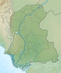
Shaikh Bhirkio is a village, deh and union council in Tando Muhammad Khan taluka of Tando Muhammad Khan District, Sindh. As of 2017, it has a population of 7,539, in 1,593 households. It is the seat of a tapedar circle, which also includes the villages of Burera, Chando Katiar, and Sanabani.
Dumbalo is a village and deh in Matli taluka of Badin District, Sindh. As of 2017, it has a population of 8,735, in 1,687 households. It is part of the tapedar circle of Gujo-I. Dumbalo is also the seat of a Union Council, which has a total population of 52,212.
Rip is a village and deh in Talher taluka of Badin District, Sindh. As of 2017, it has a population of 3,219, in 678 households. It is part of the tapedar circle of Morjher.
Dasarki, aka Goth Daseri, is a village and deh in Shaheed Fazil Rahu taluka of Badin District, Sindh. As of 2017, it has a population of 2,761, in 498 households. It is part of the tapedar circle of Agri.
Khathar daro کٿڙ دڙو is a village and deh in Shaheed Fazil Rahu taluka of Badin District, Sindh. As of 2017, it has a population of 2,790, in 546 households. It is part of the tapedar circle of Jhol-1.
Sirani is a village and deh in Badin taluka of Badin District, Sindh. As of 2017, it has a population of 3,326, in 633 households. It is the seat of a tapedar circle, which also includes the villages of Bejoriro, Bidhadi, Chel, Ghurbi, Jakhralo, Maja Basri, Runghadi, and Talli. It is also the headquarters of a supervisory tapedar circle, which also includes the tapedar circles of Bandho, Bhadmi, Chorhadi, Daleji, Kak, and Lunwari Sharif. Sirani is also the seat of a Union Council, which has a total population of 43,200.
Saidpur, aka Saiyidpur, is a village and deh in Talher taluka of Badin District, Sindh. As of 2017, it has a population of 2,433, in 470 households. It is the seat of a tapedar circle, which also includes the villages of Dabgiro, Dhoro Nero, Gono, Kandri, Kotri, and Phoosna.
Chanri, aka Fateh Chanri, is a village and deh in Talher taluka of Badin District, Sindh. As of 2017, it has a population of 3,121, in 657 households. It is the seat of a tapedar circle, which also includes the villages of Mughal Hafiz, Wasi Sajan, Weesarki, and Widh.
Gharo is a village and deh in Shaheed Fazil Rahu taluka of Badin District, Sindh. As of 2017, it has a population of 3,581, in 702 households. It is the seat of a tapedar circle, which also includes the villages of Akai, Kharach, and Koryani.
Jarki is a village and deh in Matli taluka of Badin District, Sindh. As of 2017, it has a population of 2,706, in 516 households. It is part of the tapedar circle of Additional Maban.
Sonhar, aka Haji Qasim Sumro, is a village and deh in Tando Bago taluka of Badin District, Sindh. As of 2017, it has a population of 2,382, in 463 households. It is part of the tapedar circle of Mir Himat Ali.
Bokhi is a village and deh in Badin taluka of Badin District, Sindh. As of 2017, it has a population of 2,848, in 584 households. It is part of the tapedar circle of Qaimpur.
Jhalar is a village and deh in Badin taluka of Badin District, Sindh. As of 2017, it has a population of 1,713, in 334 households. It is part of the tapedar circle of Pano.
Singari, aka Goth Singari, is a village and deh in Badin taluka of Badin District, Sindh. As of 2017, it has a population of 7,491, in 1,589 households. It is part of the tapedar circle of Kadhan.
Kamaro is a village and deh in Badin taluka of Badin District, Sindh. As of 2017, it has a population of 3,429, in 673 households. It is the seat of a tapedar circle, which also includes the villages of Bakho Khudi, Chanesri, and Ret.
Chanesri is a village and deh in Badin taluka of Badin District, Sindh. As of 2017, it has a population of 2,971, in 524 households. It is part of the tapedar circle of Kamaro.
Khorwah, also spelled Khore Wah, is a village and deh in Shaheed Fazil Rahu taluka of Badin District, Sindh. As of 2017, it has a population of 7,574, in 1,404 households. It is located about 26 miles south of Tando Muhammad Khan by road, with other roads connecting it to Badin, Mirpur Bathoro, and Bulri Shah Karim.
Mena, aka Mena jo Goth, is a village and deh in Tando Bago taluka of Badin District, Sindh. As of 2017, it has a population of 2,072, in 415 households. It is part of the tapedar circle of Dadha.
Kamaro, aka Goth Kāmāro, is a village and deh in Tando Bago taluka of Badin District, Sindh. As of 2017, it has a population of 1,471, in 348 households. It is part of the tapedar circle of Dadha.
Khairpur, aka Khairpur Gambo or Khair, is a village and deh in Tando Bago taluka of Badin District, Sindh. As of 2017, it has a population of 8,176, in 1,500 households. It is the seat of a tapedar circle, which also includes the villages of Buhri, Chubandi, Dhoro Kaknoro, Girathri, Khanah, Phule, Miyan Sultan Ahmed, Jalal Legari and Piror. Khairpur is also the seat of a Union Council, which has a total population of 41,119.

