


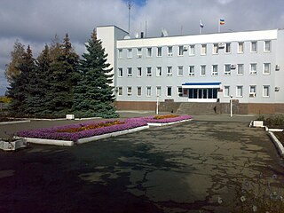
Tatsinskaya (Russian : Тацинская) is a rural locality (a stanitsa ) and the administrative center of Tatsinsky District, Rostov Oblast, Russia. Population: 9,980 (2010 Census); [1] 11,275 (2002 Census); [2] 10,834 (1989 Soviet census). [3]
Tatsinskaya (Russian : Тацинская) is a rural locality (a stanitsa ) and the administrative center of Tatsinsky District, Rostov Oblast, Russia. Population: 9,980 (2010 Census); [1] 11,275 (2002 Census); [2] 10,834 (1989 Soviet census). [3]

Konstantinovsky District is an administrative and municipal district (raion), one of the forty-three in Rostov Oblast, Russia. It is located in the center of the oblast. The area of the district is 2,200 square kilometers (850 sq mi). Its administrative center is the town of Konstantinovsk. Population: 33,159 ; 36,595 (2002 Census); 36,741 (1989 Soviet census). The population of Konstantinovsk accounts for 54.1% of the district's total population.

Azovsky District is an administrative and municipal district (raion), one of the forty-three in Rostov Oblast, Russia. It is located in the southwest of the oblast. The area of the district is 2,862 square kilometers (1,105 sq mi). Its administrative center is the town of Azov. Population: 93,579 ; 92,568 (2002 Census); 83,393 (1989 Soviet census).
Chertkovsky District is an administrative and municipal district (raion), one of the forty-three in Rostov Oblast, Russia. It is located in the northwest of the oblast. The area of the district is 2,766 square kilometers (1,068 sq mi). Its administrative center is the rural locality of Chertkovo. Population: 36,680 ; 39,974 (2002 Census); 40,355 (1989 Soviet census). The population of Chertkovo accounts for 29.5% of the district's total population.

Kagalnitsky District is an administrative and municipal district (raion), one of the forty-three in Rostov Oblast, Russia. It is located in the southwest of the oblast. The area of the district is 1,370 square kilometers (530 sq mi). Its administrative center is the rural locality of Kagalnitskaya. Population: 30,489 ; 31,189 (2002 Census); 27,901 (1989 Soviet census). The population of Kagalnitskaya accounts for 22.4% of the district's total population.

Krasnosulinsky District is an administrative and municipal district (raion), one of the forty-three in Rostov Oblast, Russia. It is located in the west of the oblast. The area of the district is 2,104 square kilometers (812 sq mi). Its administrative center is the town of Krasny Sulin. Population: 81,825 ; 34,906 (2002 Census); 36,814 (1989 Soviet census). The population of Krasny Sulin accounts for 49.9% of the district's total population.

Kuybyshevsky District is an administrative and municipal district (raion), one of the forty-three in Rostov Oblast, Russia. It is located in the west of the oblast. The area of the district is 871 square kilometers (336 sq mi). Its administrative center is the rural locality of Kuybyshevo. Population: 14,800 ; 15,237 (2002 Census); 14,061 (1989 Soviet census). The population of Kuybyshevo accounts for 41.5% of the district's total population.

Martynovsky District is an administrative and municipal district (raion), one of the forty-three in Rostov Oblast, Russia. It is located in the center of the oblast. The area of the district is 1,917 square kilometers (740 sq mi). Its administrative center is the rural locality of Bolshaya Martynovka. Population: 36,545 ; 40,499 (2002 Census); 33,684 (1989 Soviet census). The population of Bolshaya Martynovka accounts for 16.9% of the district's total population.

Milyutinsky District is an administrative and municipal district (raion), one of the forty-three in Rostov Oblast, Russia. It is located in the northeast of the oblast. The area of the district is 2,116 square kilometers (817 sq mi). Its administrative center is the rural locality of Milyutinskaya. Population: 15,082 ; 17,847 (2002 Census); 19,352 (1989 Soviet census). The population of Milyutinskaya accounts for 16.7% of the district's total population.

Orlovsky District is an administrative and municipal district (raion), one of the forty-three in Rostov Oblast, Russia. It is located in the southeast of the oblast. The area of the district is 3,300 square kilometers (1,300 sq mi). Its administrative center is the rural locality of Orlovsky. Population: 40,894 ; 41,768 (2002 Census); 39,386 (1989 Soviet census). The population of the administrative center accounts for 48.9% of the district's total population.

Peschanokopsky District is an administrative and municipal district (raion), one of the forty-three in Rostov Oblast, Russia. It is located in the south of the oblast. The area of the district is 1,885 square kilometers (728 sq mi). Its administrative center is the rural locality of Peschanokopskoye. Population: 31,619 ; 34,171 (2002 Census); 34,367 (1989 Soviet census). The population of Peschanokopskoye accounts for 33.5% of the district's total population.

Rodionovo-Nesvetaysky District is an administrative and municipal district (raion), one of the forty-three in Rostov Oblast, Russia. It is located in the west of the oblast. The area of the district is 1,547 square kilometers (597 sq mi). Its administrative center is the rural locality of Rodionovo-Nesvetayskaya. Population: 23,632 ; 23,391 (2002 Census); 21,665 (1989 Soviet census). The population of Rodionovo-Nesvetayskaya accounts for 27.0% of the district's total population.
Salsky District is an administrative and municipal district (raion), one of the forty-three in Rostov Oblast, Russia. It is located in the south of the oblast. The area of the district is 3,499 square kilometers (1,351 sq mi). Its administrative center is the town of Salsk. Population: 107,795 ; 49,343 (2002 Census); 45,908 (1989 Soviet census). The population of Salsk accounts for 56.9% of the district's total population.

Semikarakorsky District is an administrative and municipal district (raion), one of the forty-three in Rostov Oblast, Russia. It is located in the center of the oblast. The area of the district is 1,402 square kilometers (541 sq mi). Its administrative center is the town of Semikarakorsk. Population: 52,833 ; 54,125 (2002 Census); 52,222 (1989 Soviet census). The population of Semikarakorsk accounts for 45.2% of the district's total population.

Sholokhovsky District is an administrative and municipal district (raion), one of the forty-three in Rostov Oblast, Russia. It is located in the north of the oblast. The area of the district is 2,536 square kilometers (979 sq mi). Its administrative center is the rural locality of Vyoshenskaya. Population: 27,294 ; 29,629 (2002 Census); 30,016 (1989 Soviet census). The population of Vyoshenskaya accounts for 33.9% of the district's total population.

Sovetsky District is an administrative and municipal district (raion), one of the forty-three in Rostov Oblast, Russia. It is located in the northeast of the oblast. Its administrative center is the rural locality of Sovetskaya. Population: 6,692 ; 7,449 (2002 Census). The population of Sovetskaya accounts for 34.1% of the district's total population.

Tatsinsky District is an administrative and municipal district (raion), one of the forty-three in Rostov Oblast, Russia. It is located in the center of the oblast. The area of the district is 2,411 square kilometers (931 sq mi). Its administrative center is the rural locality of Tatsinskaya. Population: 38,464 ; 43,251 (2002 Census); 43,306 (1989 Soviet census). The population of Tatsinskaya accounts for 26.0% of the district's total population.

Ust-Donetsky District is an administrative and municipal district (raion), one of the forty-three in Rostov Oblast, Russia. It is located in the center of the oblast. The area of the district is 1,150 square kilometers (440 sq mi). Its administrative center is the urban locality of Ust-Donetsky. Population: 33,647 ; 32,479 (2002 Census); 30,374 (1989 Soviet census). The population of the administrative center accounts for 35.1% of the district's total population.

Zavetinsky District is an administrative and municipal district (raion), one of the forty-three in Rostov Oblast, Russia. The area of the district is 3,000 square kilometers (1,200 sq mi). Its administrative center is the rural locality of Zavetnoye. Population: 17,250 ; 18,508 (2002 Census); 18,638 (1989 Soviet census). The population of Zavetnoye accounts for 41.0% of the district's total population.
Milyutinskaya is a rural locality and the administrative center of Milyutinsky District, Rostov Oblast, Russia. Population: 2,518 (2010 Census); 2,747 (2002 Census); 2,758 (1989 Soviet census).
Remontnoye is a rural locality and the administrative center of Remontnensky District, Rostov Oblast, Russia. Population: 7,198 (2010 Census); 7,385 (2002 Census); 7,665 (1989 Soviet census).