
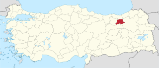
Bartın Province, a small province in northern Turkey on the Black Sea, surrounds the city of Bartın. It lies to the east of Zonguldak Province.
Bilecik Province is a province in midwest Turkey, neighboring Bursa to the west, Kocaeli and Sakarya to the north, Bolu to the east, Eskişehir to the southeast and Kütahya to the south, spanning an area of 4,307 km2. The population is 225,381. Most of the province laid down in Marmara Region but eastern parts of Gölpazarı and Söğüt district and districts of İnhisar and Yenipazar remained in Black Sea Region, smaller southeastern parts of Bozüyük and Söğüt remained in Central Anatolia Region and smaller southwestern part of Bozüyük remained in Aegean Region.
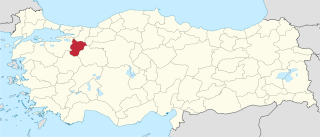
Bayburt Province is a province of Turkey. Located in the Northeast Anatolia region of the country, the capital city is Bayburt, and with a population of 74,412 is the least-populous province in Turkey.

Phaselis was a Greek and Roman city on the coast of ancient Lycia. Its ruins are located north of the modern town Tekirova in the Kemer district of Antalya Province in Turkey. It lies between the Bey Mountains and the forests of Olympos National Park, 16 kilometres (9.9 mi) south of the tourist town of Kemer and on the 57th kilometre of the Antalya–Kumluca highway. Phaselis and other ancient towns around the shore can also be accessed from the sea by daily yacht tours.

Kemer is a seaside resort and district of Antalya Province on the Mediterranean coast of Turkey, 40 km (25 mi) west of the city of Antalya, on the Turkish Riviera.

Çorlu is a northwestern Turkish city in inland Eastern Thrace that falls under the administration of the Province of Tekirdağ. It is a rapidly developing industrial centre built on flatland located on the highway D.100 and off the motorway O-3/E80 between Istanbul and Turkey's border with Greece and Bulgaria.

Beyşehir is a large town and district of Konya Province in the Akdeniz region of Turkey. The town is located on the southeastern shore of Lake Beyşehir and is marked to the west and the southwest by the steep lines and forests of the Taurus Mountains, while a fertile plain, an extension of the lake area, extends in the southeastern direction. According to 2000 census, the population of the district is 118,144 of which 41,312 live in the town of Beyşehir.

Horon or khoron, refers to a group of a circle folk dances from the Black Sea region of Turkey.

Beycik is a village of Kemer District, Antalya Province, Turkey. It is located southwest of Antalya. The population is 326, as of 2000.
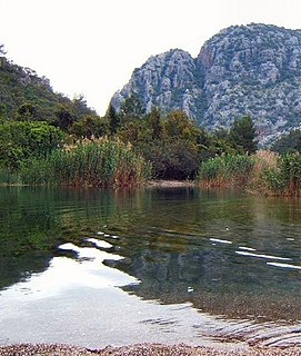
Yanartaş is a geographical feature near the Olympos valley and national park in Antalya Province in southwestern Turkey. It is the site of dozens of small fires which burn constantly from vents in the rocks on the side of the mountain. Directly below the fires are the ruins of the temple of Hephaistos, the Greek god who was associated with fire through his role as the blacksmith to the gods. To see the fires and the ruins, visitors must first go to the entrance at the foot of the mountain. The site is at the top of an easy one kilometre climb. Most people visit at night, when the fires are at their most spectacular.
The 2011 Tour of Turkey is the 47th edition of the Presidential Cycling Tour of Turkey cycling stage race. It is being held from 24 April–1 May 2011, and is rated as a 2.HC event on the UCI Europe Tour. The last edition was won by ISD–NERI's rider Giovanni Visconti. Also Turkish 2 cycling teams, Manisaspor and Konya Şekerspor debuted in this race.
The 2011–12 TFF Third League is the 11th season of the league since its establishment in 2001 as the fourth level division; and the 41st season of the third league in Turkish football since its establishment in 1967–68. The start date of the league is 28 August 2011 and end date is 13 May 2012.
The 2012–13 TFF Third League is the 12th season of the league since its establishment in 2001 as the fourth level division; and the 42nd season of the third league in Turkish football since its establishment in 1967–68. The start date of the league is 8 September 2012 and end date is 19 May 2013.
Devrim Cenk Ulusoy is a Turkish World record holder free-diver. Currently, he performs his underwater sport activities for Orta Doğu Teknik Üniversitesi Su Altı Sporları Kulübü.

The Olympos Aerial Tram, aka Olympos Cable Car, is an aerial lift of tramway type located in Antalya Province, southern Turkey, serving the peak of Mount Olympos at an altitude of 2,365 m (7,759 ft) from Kemer. It went into service in 2006.
Kemerspor 2003, formerly Kemer Tekirovaspor, is a football club located in Antalya, Turkey. The team competes in TFF Third League.

Tahtalı Dağı, also known as Lycian Olympus, is a mountain near Kemer, a seaside resort on the Turkish Riviera in Antalya Province, Turkey. It was known as Olympus and Phoenicus or Phoinikous in ancient times. It is part of the Beydağları Coastal National Park. Visitors can ascend the summit with the Olympos Aerial Tram. The Lycian Way long distance trail traverses the mountain.
Üçadalar are three Mediterranean islets of Turkey. Üçadalar is a composite word meaning "three islands". The islands are part of the Kemer district of Antalya Province. They are situated to the west of the Gulf of Antalya. The two larger islands, each about 5 hectares in area, are on the southeast side of the group, and the smallest one is on the northwest. The coordinates of the southwestern island are 36°27′18″N30°32′51″E. The nearest town on the mainland is Tekirova about 5 kilometres (3 mi) to northwest.

The Second Battle of Ras al-Ayn was a battle during the Syrian Civil War, part of a 2019 Turkish-led military operation in northern Syria. The battle was fought between Turkish Armed Forces, Turkish Free Syrian Army forces and the Syrian Democratic Forces (SDF). The battle resulted in the capture of Ras al-Ayn by Turkish/TFSA forces on 20 October.


