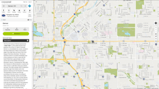
MapQuest is an American free online web mapping service. It was launched in 1996 as the first commercial web mapping service. MapQuest vies for market share with competitors such as Apple Maps, Here and Google Maps.

Traffic Message Channel (TMC) is a technology for delivering traffic and travel information to motor vehicle drivers. It is digitally coded using the ALERT C or TPEG protocol into Radio Data System (RDS) carried via conventional FM radio broadcasts. It can also be transmitted on Digital Audio Broadcasting or satellite radio. TMC allows silent delivery of dynamic information suitable for reproduction or display in the user's language without interrupting audio broadcast services. Both public and commercial services are operational in many countries. When data is integrated directly into a navigation system, traffic information can be used in the system's route calculation.

Garmin Ltd. is an American, Swiss-domiciled multinational technology company founded in 1989 by Gary Burrell and Min Kao in Lenexa, Kansas, United States, with operational headquarters in Olathe, Kansas. Since 2010, the company is legally incorporated in Schaffhausen, Switzerland.
DeLorme Publishing Company is a producer of personal satellite tracking, messaging, and navigation technology. The company's main product, inReach, integrates GPS and satellite technologies. inReach provides the ability to send and receive text messages to and from anywhere in the world by using the Iridium satellite constellation. By pairing with a smartphone, navigation is possible with access to free downloadable topographic maps and National Oceanic and Atmospheric Administration (NOAA) charts. On February 11, 2016, the company announced that it had been purchased by Garmin, another multinational producer of GPS products and services.

An automotive navigation system is part of the automobile controls or a third party add-on used to find direction in an automobile. It typically uses a satellite navigation device to get its position data which is then correlated to a position on a road. When directions are needed routing can be calculated. On the fly traffic information can be used to adjust the route.
Navteq Corporation was an American Chicago-based provider of geographic information system (GIS) data and a major provider of base electronic navigable maps. The company was acquired by Nokia in 2007–2008, and fully merged into Nokia in 2011 to form part of the Here business unit. The unit was subsequently sold to a consortium of German auto makers in 2016.

TomTom N.V. is a Dutch multinational developer and creator of location technology and consumer electronics. Founded in 1991 and headquartered in Amsterdam, TomTom released its first generation of satellite navigation devices to market in 2004. As of 2019 the company has over 4,500 employees worldwide and operations in 29 countries throughout Europe, Asia-Pacific, and the Americas.

A point of interest (POI) is a specific point location that someone may find useful or interesting. An example is a point on the Earth representing the location of the Eiffel Tower, or a point on Mars representing the location of its highest mountain, Olympus Mons. Most consumers use the term when referring to hotels, campsites, fuel stations or any other categories used in modern automotive navigation systems.
A navigation system is a computing system that aids in navigation. Navigation systems may be entirely on board the vehicle or vessel that the system is controlling or located elsewhere, making use of radio or other signal transmission to control the vehicle or vessel. In some cases, a combination of these methods is used.
Traffic reporting is the near real-time distribution of information about road conditions such as traffic congestion, detours, and traffic collisions. The reports help drivers anticipate and avoid traffic problems. Traffic reports, especially in cities, may also report on major delays to mass transit that does not necessarily involve roads. In addition to periodic broadcast reports, traffic information can be transmitted to GPS units, smartphones, and personal computers.
Magellan Navigation, Inc. is an American producer of consumer and professional grade global positioning system receivers, named after Ferdinand Magellan, the first explorer to circumnavigate the globe. Headquartered in San Dimas, California, with European sales and engineering centres in Nantes, France and Moscow, Russia, Magellan also produces aftermarket automotive GPS units, including the Hertz Neverlost system found in Hertz rental cars. The Maestro, RoadMate, Triton, and eXplorist lines are Magellan's current consumer offerings. The company also produces proprietary road maps (DirectRoute), topographic maps (Topo), and marine charts (BlueNav) for use with its consumer GPS receivers.
Map database management systems are software programs designed to store and recall spatial information for navigation applications, and are thus a form of Geographic information system. They are widely used in localization and navigation, especially in automotive applications. Moreover, they are playing an increasingly important role in the emerging areas of location-based services, active safety functions and advanced driver-assistance systems. Common to these functions is the requirement for an on-board map database that contains information describing the road network.
Etak, Inc. was an independent US-based vendor of automotive navigation system equipment, digital maps, and mapping software. It was founded in 1983. Competitor Navteq was founded in 1985.

Navigon GmbH was a Würzburg, Germany-based manufacturer of GPS devices and GPS navigation software. The company was privately owned, until in June 2011, it was announced that Navigon was to be acquired by Garmin and become a subsidiary of the company. With effect from October 31, 2011, Navigon has changed its legal entity from corporation (Aktiengesellschaft) to GmbH.
Mapscape BV is a Netherlands-based independent business-to-business digital maps service provider. The company was founded in 2007 by Henk Eemers and Ralf Stollenwerk. It is active in the navigation and automotive industry. Mapscape is involved in content aggregation, compilation and testing of digital maps for navigation purposes. The maps are targeted for use in the automotive industry in e.g. online and offline navigation and location-based services.
GeoSmart (NZ) Ltd is a provider of location-based services, digital mapping data and images for the Oceania area, notably New Zealand. The company is one of only a handful of global companies producing digital maps for use in GPS applications. GeoSmart was acquired by TomTom in 2014.

Here Technologies is a Dutch multinational group specialized in mapping technologies, location data, and related automotive services to individuals and companies. It is majority-owned by a consortium of German automotive companies and American semiconductor company Intel whilst other companies also own minority stakes. Its roots date back to U.S.-based Navteq in 1985, which was acquired by Finland-based Nokia in 2007. Here is currently based in The Netherlands.
TeleType Co., Inc. is a privately held company in the United States that develops software for GPS devices. It was founded in 1981, under the name TeleTypesetting Company and it is based in Boston, Massachusetts. The company's product line includes automotive and commercial GPS navigation systems and other products including GPS receivers and tracking units. It develops and sells the WorldNav software for PC and Windows CE, tools for converting third-party maps into WorldNav maps, an SDK, and an API that allows the customization of the WorldNav application. TeleType Co. also offers consultancy services for those interested in acquiring and adapting the source code of their software products.
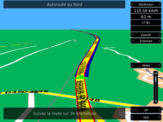
Turn-by-turn navigation is a feature of some satellite navigation devices where directions for a selected route are continually presented to the user in the form of spoken or visual instructions. The system keeps the user up-to-date about the best route to the destination, and is often updated according to changing factors such as traffic and road conditions. Turn-by-turn systems typically use an electronic voice to inform the user whether to turn left or right, the street name, and the distance to the next turn.

Here WeGo is a web mapping and satellite navigation software, operated by HERE Technologies and available on the Web and mobile platforms. It is based on HERE's location data platform, providing its in-house data, which includes satellite views, traffic data, and other location services. Maps are updated every two or three months.

