Surveys and excavation
The tell was excavated in 1985-1988 by Jane Cahill, who reported of layers of the Iron Age, or 11th to 7th centuries BCE, separated by the remains of major fires. One layer, from the 9th century or later, revealed a stone building, while earlier ones only had mud-bricks. Unusual concentrations of loom weights and spindles from different periods suggest the city maintained a weaving industry. [4]
Pottery finds from various surveys date to the Middle Bronze II, Late Bronze I-III, Iron I-II, Persian, Early and Late Roman, Byzantine and Erly Muslim periods. [1]

Beit She'an, also Beth-shean, formerly Beisan, is a town in the Northern District of Israel. The town lies at the Beit She'an Valley about 120 m below sea level.

Tel Rehov or Tell es-Sarem, is an archaeological site in the Bet She'an Valley, a segment of the Jordan Valley, Israel, approximately 5 kilometres (3 mi) south of Beit She'an and 3 kilometres (2 mi) west of the Jordan River. It was occupied in the Bronze Age and Iron Age.

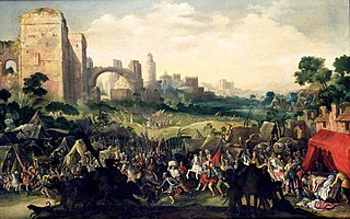
Bethulia is a biblical "city whose deliverance by Judith, when besieged by Holofernes, forms the subject of the Book of Judith."

Aren Maeir is an American-born Israeli archaeologist and professor in the Department of Land of Israel Studies and Archaeology at Bar-Ilan University. He is director of the Tell es-Safi/Gath Archaeological Project.

Farwana, was a Palestinian village, located 4.5 kilometers (2.8 mi) south of Bisan, depopulated in 1948.

Burqin is a Palestinian town in the northern West Bank located 5 km west of Jenin. According to the Palestinian Central Bureau of Statistics (PCBS) census, its population was 5,685 in 2007 and 7,126 in 2017. The majority of Burqin's residents are Muslims, and 20 Christian families live in the town. The Byzantine-era Burqin Church or St. George's Church is one of the oldest churches in the world.

Qaffin is a Palestinian town located 22 kilometers (14 mi) northeast of Tulkarm in the Tulkarm Governorate in the northwestern West Bank. The town is an agricultural town. According to the Palestinian Central Bureau of Statistics, its population consisted over 8,387 inhabitants in 2007 and 10,690 in 2017. The built-up area of the town is 1,000 dunams.

Bardala is a Palestinian village in the northern Jordan Valley of the West Bank, consisting of 1,607 inhabitants. The town lies in the Tubas Governorate, located thirteen kilometers northeast of Tubas and 28 kilometers northeast of Nablus. The Israeli settlement of Mehola lies nearby.
Kafr Dan is a Palestinian village in the Jenin Governorate, located 8 km northwest of Jenin in the northern West Bank. According to the Palestinian Central Bureau of Statistics (PCBS) census, the town had a population of 5,148 in 2007 and 6,591 in 2017.
Ti'inik, also transliterated Ti’innik, or Ta'anakh/Taanach, is a Palestinian village, located 13 km northwest of the city of Jenin in the northern West Bank.

'Anin is a Palestinian village in the West Bank governorate of Jenin. According to the Palestinian Central Bureau of Statistics, the village had a population of 4,216 inhabitants in 2017.

Jaba' is a Palestinian village in the northern West Bank, in the Jenin Governorate of the State of Palestine, located 8 kilometres (5.0 mi) southwest of the city of Jenin. According to the Palestinian Central Bureau of Statistics, the village had a population of 8,942 in the 2007 census and 10,413 by 2017. The village is situated on the slopes of the Jabal Dabrun mountain. The village and its immediate vicinity contain a number of archaeological sites, including a tomb for a certain Neby Yarub. During the Ottoman era, Jaba' served as a throne village of the powerful Jarrar family. The village is administered by a municipal council, currently headed by Bassam Jarrar.

Many place names in Palestine were Arabized forms of ancient Hebrew and Canaanite place-names used in biblical times or later Aramaic formations. Most of these names have been handed down for thousands of years though their meaning was understood by only a few. The cultural interchange fostered by the various successive empires to have ruled the region is apparent in its place names. Any particular place can be known by the different names used in the past, with each of these corresponding to a historical period. For example, the city of Beit Shean, today in Israel, was known during the Israelite period as Beth-shean, under Hellenistic rule and Roman rule as Scythopolis, and under Arab and Islamic rule as Beisan.

Adam Zertal was an Israeli archaeologist and a tenured professor at the University of Haifa.
Salhab is a small Palestinian village in the Tubas Governorate in the northeastern West Bank, located four kilometers north of Tubas. According to the Palestinian Central Bureau of Statistics (PCBS) census, it had a population of 45 living in five households in 2007 and a population of 25 in 2017. As of 2007, its mayor was Fawze Sawafta.

Khirbet Beit Zakariyyah is a small Palestinian village southwest of Bethlehem in the West Bank, perched on a hill that rises about 995 metres (3,264 ft) above sea level. Administratively, it is associated with the village of Artas under the Bethlehem Governorate. It is also located in between the Israeli settlements of Alon Shevut and Rosh Tzurim, both of which were built on land confiscated from the village. The village had a population of 142 in 2017.
Zibda is a Palestinian village in the Jenin Governorate.

'En Esur, also En Esur or Ein Asawir, is an ancient site located on the northern Sharon Plain, at the entrance of the Wadi Ara pass leading from the Coastal Plain further inland. The site includes an archaeological mound (tell), called Tel Esur or Tell el-Asawir, another unnamed mound, and two springs, one of which gives the site its name.

The Beisan steles are five Ancient Egyptian steles from the period of Seti I and Ramesses II discovered in what was then known as Beisan, Mandatory Palestine by Alan Rowe in the late 1920s and early 1930s.
Khirbet Kheibar or Tell Kheibar is an archaeological site located in the western outskirts of the Sanur Valley, West Bank. A fortified tell, it includes the remains of an ancient walled city that for some periods grew beyond the walls. At the site, pottery from the Middle Bronze Age and the Medieval period, peaking in the Iron Age, has been found, along with bowls and figurine fragments.


