
Ardmore is a city in Giles and Lincoln counties, Tennessee. The population was 1,213 at the 2010 census. Ardmore is the site of a Tennessee Department of Tourist Development Welcome Center. It borders its sister city, Ardmore, Alabama.

U.S. Route 43 (US 43) is a 410-mile-long (660 km) north–south United States Highway in the Southern states of Alabama and Tennessee. It travels from Prichard, Alabama, to Columbia, Tennessee. The highway's southern terminus is in Prichard, at an intersection with US 90, and its northern terminus is in Columbia at an intersection with US 31/US 412/US 412 Bus.

U.S. Route 411 (US 411) is an alternate parallel-highway associated with US 11. It extends for about 309.7 miles (498.4 km) from US 78 in Leeds, Alabama, to US 25W/US 70 in Newport, Tennessee. US 411 travels through northeastern Alabama, northwestern Georgia, and southeastern Tennessee. It is signed north-south, as with most highways that have odd numbers, but the route runs primarily in a northeast-southwest direction, and covers a more east-west mileage than it does north-south. Notable towns and cities along its route include Gadsden, Alabama; Rome, Georgia; Cartersville, Georgia; Maryville, Tennessee; Sevierville, Tennessee, and Newport, Tennessee.

U.S. Route 231 (US 231) is a north-south U.S highway that is a parallel route of US 31. It runs for 912 miles (1,468 km) from St. John, Indiana, at US 41 to south of US 98 in downtown Panama City, Florida. One of its most notable landmarks is the William H. Natcher Bridge, a 0.853 miles (1.373 km) long cable-stayed bridge that connects Rockport, Indiana, to Owensboro, Kentucky, spanning the Ohio River.

U.S. Route 431 (US 431) is a spur of U.S. Route 31. It currently travels for approximately 556 miles (895 km) from US 231/Alabama State Route 210 and US 231 Business and US 431 Bus. in Dothan, Alabama, to Owensboro, Kentucky, at US 60 and Kentucky Route 2831. The major cities US 431 connects to are Dothan and Huntsville, Alabama, Franklin and Nashville, Tennessee, and Owensboro, Kentucky.
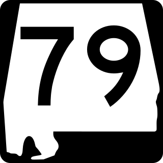
State Route 79 (SR 79) is a 117-mile-long (188 km) state highway that extends northeastward from Birmingham to the Tennessee state line. Prior to the completion of Interstate 65 (I-65), SR 79 was the southern part of the route that connected Birmingham and Huntsville.
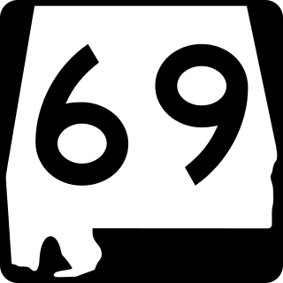
State Route 69 is a 280-mile-long (450 km) state highway that extends from the southwestern to the northeastern parts of the U.S. state of Alabama. The southern terminus of the highway is at an intersection with SR 177 at Jackson. The northern terminus of the highway is at an intersection with US 431/SR 79 at Guntersville.
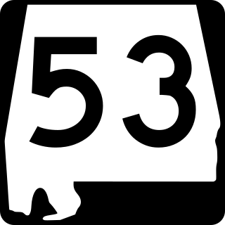
State Route 53 (SR 53) is a 345.287-mile (555.686 km) state highway in the U.S. state of Alabama. The majority, between Dothan and Huntsville, is signed as U.S. Route 231 (US 231), but the two ends – south to Florida and north to I-65/US 31 near Tennessee – are independent. In those areas, US 231 uses SR 1, sharing the route with US 431 north of Huntsville, where it is referred to as Memorial Parkway.

State Route 7 is a south–north state highway in Middle Tennessee, running from the Alabama state line in Lincoln County to SR 100/SR 46 in Hickman County.

State Route 10 is a south–north route from the Alabama state line in Lincoln County to the Kentucky state line in Macon County.

State Route 15 is a west–east route from Memphis to Monteagle. For much of its route it has an unsigned concurrency with U.S. Route 64. SR 15 does travel through the southern part of all 3 Grand Divisions of the state: West Tennessee, Middle Tennessee, and East Tennessee.

State Route 67 is a state-maintained highway in northeastern Tennessee, including a four-lane divided highway segments in both Washington County and Carter County, and part of a significant two-lane segment passing over the Butler Bridge some 80 feet (24 m) above the TVA Watauga Reservoir near Butler in Johnson County, Tennessee.

State Route 16 is a state highway in the U.S. state of Tennessee. Its southern terminus is at the Alabama state line, where it continues as State Route 79 in Alabama. From there, it continues to Winchester, where it becomes unsigned in a concurrency with U.S. Route 41A. This concurrency lasts until its northern terminus in Williamson County, at a junction with U.S. Route 31A.

State Route 344 is a state highway in Hamblen and Hawkins counties, within the U.S. state of Tennessee. It connects US 11E in Russellville to US 11W west of Rogersville, Tennessee via SR 113.

State Route 91 is a state highway in the northeastern portion of the U.S. state of Tennessee, in the area known as the Tri-Cities region. The route connects Johnson City with Damascus, Virginia via Elizabethton, Hunter, and Mountain City.

State Route 156 is a spur route of Tennessee State Route 56 (SR 56) and a state highway in Franklin and Marion counties in the southern central and southeastern portions of Tennessee, United States. It traverses the southern Cumberland Plateau before descending into the Sequatchie Valley, where follows the shores of Nickajack Lake for its final few miles.

State Route 50 (SR 50) is a west–to–east highway in Middle Tennessee. The road begins near Only and ends in Altamont. The current length is 161.3 miles (259.6 km).

State Route 53 (SR 53) is a north–south state highway that traverses six counties in Middle Tennessee. It is 113.5 miles (182.7 km) long.
U.S. Route 231 in Tennessee runs north–south for 121.15 miles (194.97 km), entirely in Middle Tennessee, that starts south of Fayetteville at the Alabama state line, and ends north of Westmoreland at the Kentucky state line. For the majority of its length, between the Alabama state line and Trousdale County, it is concurrent with unsigned State Route 10.

State Route 274, also known as Old Railroad Bed Road, is a 13.1-mile-long (21.1 km) north–south state highway in western Lincoln County, Tennessee.

