History
The origin of Hazel Green’s name is uncertain; however, a couple theories have been proposed, one being that the hazelnut bushes growing there were of a very vibrant green color in the springtime, and another is that the town was named for the wife of a store owner and postmaster in the early days of settlement in the area. [4]
In the early 1800s, the area now known as Hazel Green became a convenient stopping point for travelers coming from Nashville to the north, Winchester to the east, nearby Huntsville to the south, and Athens to the west. These roads intersected at what is now the intersection of U.S. Route 231/431, Joe Quick Road, and West Limestone Road. By around 1810, farmers from Georgia, Tennessee, and the Carolinas began rapidly relocating to Hazel Green after it was discovered the area had some of the richest soil in the Southeast. The town quickly developed into a bustling local trade center with the construction of gins, mills, grocers, and 2 inns. A post office and schoolhouse were both established for Hazel Green in 1819, and the town was incorporated as an act of the state legislature on June 15, 1821, with a population of 400. The economy was dependent on cotton and textile farming, and several families of notable wealth and influence lived in and worked out of Hazel Green. [5]
By the mid 1800s, the growth of Hazel Green stagnated, large farms began breaking up, families moved elsewhere looking for work, and Hazel Green became unincorporated. The town would not show up on the U.S. Census again until 1980 as a census-designated place with a population of 1,503. While farming has remained an important backbone of Hazel Green’s economy throughout its history, job growth coming out of nearby Huntsville has brought with it new growth and development in recent years. Generational farmland has quickly been replaced with homes, multi-family complexes, fast-food restaurant chains, and various other retail chains. [6] The topic of incorporation to accommodate this sudden explosion of growth has become a popular discussion amongst residents. [7]
Hazel Green, along with other communities in the same area, has been prone to tornado activity in its history. On April 3, 1974, Hazel Green was hit by an F5 tornado during the 1974 Super Outbreak, causing several deaths. On March 2, 2012, Hazel Green was hit again by 2 tornados a part of the Tornado outbreak of March 2–3, 2012, resulting in the leveling of homes and businesses and roof damage to several buildings. [8] On April 1, 2023, Hazel Green was hit by an EF3 tornado a part of the Tornado outbreak of March 31 – April 1, 2023, resulting in 1 death. [9]
Geography
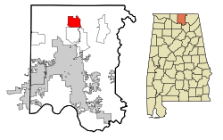
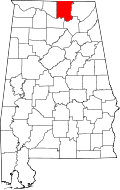
Hazel Green is located in northern Madison County. It is 15 miles (24 km) north of Huntsville and the same distance south of Fayetteville, Tennessee. Hazel Green is bordered to the south by Meridianville and to the southeast by Moores Mill.
According to the U.S. Census Bureau, the Hazel Green CDP has a total area of 10.0 square miles (26.0 km2), of which 0.02 square miles (0.04 km2), or 0.13%, are water. [2] The Flint River, a south-flowing tributary of the Tennessee River, runs along the northeast edge of the community.
Demographics
Historical population| Census | Pop. | Note | %± |
|---|
| 1980 | 1,503 | | — |
|---|
| 1990 | 2,208 | | 46.9% |
|---|
| 2000 | 3,805 | | 72.3% |
|---|
| 2010 | 3,630 | | −4.6% |
|---|
| 2020 | 4,105 | | 13.1% |
|---|
|
2020 census
Hazel Green CDP, Alabama – Racial and ethnic composition
Note: the US Census treats Hispanic/Latino as an ethnic category. This table excludes Latinos from the racial categories and assigns them to a separate category. Hispanics/Latinos may be of any race.| Race / Ethnicity (NH = Non-Hispanic) | Pop 2000 [11] | Pop 2010 [12] | Pop 2020 [13] | % 2000 | % 2010 | % 2020 |
|---|
| White alone (NH) | 3,508 | 3,180 | 3,284 | 92.19% | 87.60% | 80.00% |
| Black or African American alone (NH) | 101 | 209 | 356 | 2.65% | 5.76% | 8.67% |
| Native American or Alaska Native alone (NH) | 44 | 51 | 34 | 1.16% | 1.40% | 0.83% |
| Asian alone (NH) | 19 | 15 | 30 | 0.50% | 0.41% | 0.73% |
| Native Hawaiian or Pacific Islander alone (NH) | 1 | 3 | 0 | 0.03% | 0.08% | 0.00% |
| Other race alone (NH) | 4 | 3 | 9 | 0.11% | 0.08% | 0.22% |
| Mixed race or Multiracial (NH) | 61 | 86 | 233 | 1.60% | 2.37% | 5.68% |
| Hispanic or Latino (any race) | 67 | 83 | 159 | 1.76% | 2.29% | 3.87% |
| Total | 3,805 | 3,630 | 4,105 | 100.00% | 100.00% | 100.00% |
As of the 2020 United States census, there were 4,105 people, 1,516 households, and 1,155 families residing in the CDP.
2010 census
As of the census [14] of 2010, there were 3,630 people, 1,338 households, and 1,017 families residing in the community. The population density was 363 inhabitants per square mile (140/km2). There were 1,434 housing units at an average density of 143.4 per square mile (55.4/km2). The racial makeup of the community was 88.9% White, 5.9% Black or African American, 1.5% Native American, 0.4% Asian, 0.1% Pacific Islander, 0.7% from other races, and 2.4% from two or more races. 2.3% of the population were Hispanic or Latino of any race.
There were 1,338 households out of which 34.8% had children under the age of 18 living with them, 60.5% were married couples living together, 10.6% had a female householder with no husband present, and 24.0% were non-families. 20.3% of all households were made up of individuals, and 6.2% had someone living alone who was 65 years of age or older. The average household size was 2.69 and the average family size was 3.11.
In the community, the population was spread out, with 26.2% under the age of 18, 7.9% from 18 to 24, 27.9% from 25 to 44, 27.5% from 45 to 64, and 10.5% who were 65 years of age or older. The median age was 37.5 years. For every 100 females, there were 96.5 males. For every 100 females age 18 and over, there were 98.4 males.
The median income for a household in the community was $48,822, and the median income for a family was $60,588. Males had a median income of $42,981 versus $30,990 for females. The per capita income for the community was $23,693. About 10.8% of families and 13.6% of the population were below the poverty line, including 16.4% of those under age 18 and 7.4% of those age 65 or over.
2000 census
As of the census [15] of 2000, there were 3,805 people, 1,340 households, and 1,080 families residing in the community. The population density was 378.9 inhabitants per square mile (146.3/km2). There were 1,394 housing units at an average density of 138.8 per square mile (53.6/km2). The racial makeup of the community was 93.56% White, 2.65% Black or African American, 1.31% Native American, 0.50% Asian, 0.03% Pacific Islander, 0.32% from other races, and 1.63% from two or more races. 1.76% of the population were Hispanic or Latino of any race.
There were 1,340 households out of which 46.1% had children under the age of 18 living with them, 66.1% were married couples living together, 10.6% had a female householder with no husband present, and 19.4% were non-families. 17.2% of all households were made up of individuals, and 4.9% had someone living alone who was 65 years of age or older. The average household size was 2.82 and the average family size was 3.18.
In the community, the population was spread out, with 31.3% under the age of 18, 7.1% from 18 to 24, 35.3% from 25 to 44, 18.7% from 45 to 64, and 7.7% who were 65 years of age or older. The median age was 33 years. For every 100 females, there were 98.1 males. For every 100 females age 18 and over, there were 95.4 males. The median income for a household in the community was $40,263, and the median income for a family was $45,174. Males had a median income of $33,005 versus $23,929 for females. The per capita income for the community was $18,397. About 4.2% of families and 6.3% of the population were below the poverty line, including 4.8% of those under age 18 and 12.5% of those age 65 or over.
Public services
The Madison County Sheriff's Department administers law and order in Hazel Green.
The Hazel Green Fire/Rescue is a large volunteer fire department of approximately 40 members serving the residents of North Central Madison County. The fire department has 3 stations. The stations are located throughout the district in strategic locations. Station one, which houses the majority of all of the main rescue, EMS and firefighting equipment, is located at the intersection of Joe Quick Road and Highway 231-431N. Station two is located on Greenville Pike and Station three on Hill Chapel Road. Hazel Green Fire/Rescue outfits an apparatus of five engines, one attack truck (or "brush" truck), one rescue truck and two medical response vehicles. Hazel Green has a dedicated roster of individuals who hold credentials from firefighter I level, to FF 2, state licensed and nationally registered Emergency Medical Technicians (EMTs) and certified technical rescue personnel (vehicle, water and other special rescue missions).
Education
The local school district is Madison County Schools. [16]
The Madison County School System currently runs three schools in Hazel Green. Kindergarten through third grade students attend Hazel Green Elementary School, Lynn Fanning Elementary, and Walnut Grove School. Fourth through sixth grade students attend Moores Mill Intermediate School. Seventh and eighth grade students in Hazel Green attend Meridianville Middle School located in Hazel Green. Hazel Green High School serves as a high school for ninth through twelfth grade students in Hazel Green, Meridianville, and parts of New Market and northern Huntsville. In September 2022, the Madison County School System announced the proposal of the construction of another school in Hazel Green by the 2024-2025 school years to accommodate new growth, and to prevent overcrowding in Hazel Green's existing schools. The size, location, and grades to be housed in the proposed school have yet to be announced. [17]
The Huntsville Madison County Public Library maintains a branch, the Tillman D. Hill Public Library, located on Knowledge Dr. behind Advance Auto Parts. This branch library is part of a very well supported community library system in Madison County.
This page is based on this
Wikipedia article Text is available under the
CC BY-SA 4.0 license; additional terms may apply.
Images, videos and audio are available under their respective licenses.