New Hope, Alabama | |
---|---|
Coordinates: 34°32′17″N86°24′44″W / 34.53806°N 86.41222°W | |
Country | United States |
State | Alabama |
County | Madison |
Area | |
• Total | 8.71 sq mi (22.57 km2) |
• Land | 8.66 sq mi (22.42 km2) |
• Water | 0.06 sq mi (0.15 km2) |
Elevation | 581 ft (177 m) |
Population | |
• Total | 2,889 |
• Density | 333.7/sq mi (128.84/km2) |
Time zone | UTC–6 (Central (CST)) |
• Summer (DST) | UTC–5 (CDT) |
ZIP code | 35760 |
Area code(s) | 256 |
FIPS code | 01-54168 |
GNIS feature ID | 0155171 |
Website | www |
New Hope is a city in Madison County, Alabama, United States, and is included in the Huntsville-Decatur Combined Statistical Area. As of the 2020 census, the population was 2,889. [2]
Originally named "Cloud's Town" in 1829 by its founder, William Cloud, it was incorporated in 1832 under the name of "Vienna". Lieutenant Colonel Alfred Reed of the 12th Indiana Cavalry seized the town on May 29, 1864, during the American Civil War. Vienna was burned by the Union Army on December 15, 1864, because of the constant skirmishes with the guerrilla fighters in the area. All that remained were the post office and Masonic Lodge. [3] Since there was already a post office called Vienna in southern Alabama and rules were that there could not be two post offices with the same name at that time, the rebuilt city was incorporated in 1883 as "New Hope", taking its name from the New Hope Methodist Church. The settlement known as Cloud's Town was actually settled in what is now known as Cloud's Cove just off Hobbs Island Road and is a few miles from the town of New Hope.
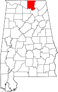
New Hope is located in southeastern Madison County at 34°32′17″N86°24′44″W / 34.53806°N 86.41222°W (34.538194, −86.412129), [4] along U.S. Route 431. It is 19 miles (31 km) southeast of the center of Huntsville and the same distance northwest of Guntersville
According to the U.S. Census Bureau, the city has a total area of 8.7 square miles (22.6 km2), of which 8.6 square miles (22.4 km2) are land and 0.06 square miles (0.15 km2), or 0.66%, are water. [1]
Historical population | |||
---|---|---|---|
Census | Pop. | %± | |
1880 | 146 | — | |
1900 | 208 | — | |
1910 | 301 | 44.7% | |
1920 | 315 | 4.7% | |
1930 | 446 | 41.6% | |
1960 | 953 | — | |
1970 | 1,300 | 36.4% | |
1980 | 1,546 | 18.9% | |
1990 | 2,248 | 45.4% | |
2000 | 2,539 | 12.9% | |
2010 | 2,810 | 10.7% | |
2020 | 2,889 | 2.8% | |
U.S. Decennial Census [5] 2013 Estimate [6] |
Note that New Hope did not appear on the 1890 and 1940-1950 U.S. Censuses. In the case of the latter two years, it is likely their incorporation charter lapsed and was not renewed until prior to its reappearance on the 1960 U.S. Census.
As of the census [7] of 2000, there were 2,539 people in 1,033 households, including 729 families, in the city. The population density was 287.6 inhabitants per square mile (111.0/km2). There were 1,124 housing units at an average density of 127.3 per square mile (49.2/km2). The racial makeup of the city was 94.80% White, 0.39% Black or African American, 1.81% Native American, 0.24% Asian, 0.67% from other races, and 2.09% from two or more races. 0.95% of the population were Hispanic or Latino of any race.
Of the 1,033 households 34.2% had children under the age of 18 living with them, 54.1% were married couples living together, 12.3% had a female householder with no husband present, and 29.4% were non-families. 26.8% of households were one person and 11.3% were one person aged 65 or older. The average household size was 2.46 and the average family size was 2.97.
The age distribution was 26.0% under the age of 18, 8.5% from 18 to 24, 30.8% from 25 to 44, 21.4% from 45 to 64, and 13.3% 65 or older. The median age was 36 years. For every 100 females, there were 90.5 males. For every 100 females age 18 and over, there were 89.5 males.
The median household income was $31,458 and the median family income was $39,427. Males had a median income of $30,852 versus $20,263 for females. The per capita income for the city was $15,655. About 8.2% of families and 11.4% of the population were below the poverty line, including 14.4% of those under age 18 and 15.1% of those age 65 or over.
As of the census [8] of 2010, there were 2,810 people in 1,143 households, including 795 families, in the city. The population density was 325 inhabitants per square mile (125/km2). There were 1,258 housing units at an average density of 146.3 per square mile (56.5/km2). The racial makeup of the city was 93.7% White, 0.2% Black or African American, 2.5% Native American, 0.3% Asian, 0.7% from other races, and 2.5% from two or more races. 1.4% of the population were Hispanic or Latino of any race.
Of the 1,143 households 30.0% had children under the age of 18 living with them, 51.8% were married couples living together, 12.5% had a female householder with no husband present, and 30.4% were non-families. 25.5% of households were one person and 11.0% were one person aged 65 or older. The average household size was 2.46 and the average family size was 2.93.
The age distribution was 23.5% under the age of 18, 8.5% from 18 to 24, 27.6% from 25 to 44, 27.7% from 45 to 64, and 12.7% 65 or older. The median age was 38.2 years. For every 100 females, there were 96.5 males. For every 100 females age 18 and over, there were 95.7 males.
The median household income was $38,423 and the median family income was $47,396. Males had a median income of $33,135 versus $24,167 for females. The per capita income for the city was $19,104. About 5.7% of families and 11.5% of the population were below the poverty line, including 15.3% of those under age 18 and 9.8% of those age 65 or over.
Race | Num. | Perc. |
---|---|---|
White (non-Hispanic) | 2,541 | 87.95% |
Black or African American (non-Hispanic) | 38 | 1.32% |
Native American | 60 | 2.08% |
Asian | 6 | 0.21% |
Pacific Islander | 3 | 0.1% |
Other/Mixed | 150 | 5.19% |
Hispanic or Latino | 91 | 3.15% |
As of the 2020 United States census, there were 2,889 people, 1,087 households, and 834 families residing in the city.
The local school district is Madison County Schools. [10]
Etowah County is a county located in the northeastern part of the U.S. state of Alabama. As of the 2020 census the population was 103,436. Its county seat is Gadsden. Its name is from a Cherokee word meaning "edible tree". In total area, it is the smallest county in Alabama, but one of the most densely populated. Etowah County comprises the Gadsden Metropolitan Statistical Area.
Marshall County is a county of the state of Alabama, United States. As of the 2020 census the population was 97,612. Its county seat is Guntersville. A second courthouse is in Albertville. Its name is in honor of John Marshall, famous Chief Justice of the United States. Marshall County is a dry county, with the exception of the four cities of Albertville, Arab, Guntersville, and Boaz. Marshall County comprises the Albertville, AL Micropolitan Statistical Area, which is also included in the Huntsville-Decatur-Albertville, AL Combined Statistical Area.
Walker County is a county located in the central portion of the U.S. state of Alabama. As of the 2020 census, the population was 65,342. Its county seat is Jasper. Its name is in honor of John Williams Walker, a member of the United States Senate.
Calera is a city in Shelby and Chilton counties in the U.S. state of Alabama. It is the location of the Shelby County Airport.
Opp is a city in Covington County, Alabama, United States. At the 2020 census, the population was 6,771. Opp is named after Henry Opp, a lawyer for the Louisville and Nashville Railroad.
Dozier is a town in Crenshaw County, Alabama, United States. At the 2020 census, the population was 285. Dozier was incorporated in 1907.
Good Hope is a city in Cullman County, Alabama, United States. As of the 2010 census, the population of the city was 2,264. It incorporated in April 1962.
Hanceville is a city in Cullman County, Alabama, United States. At the 2020 census, the population was 3,217.
Shiloh is a town in DeKalb County, Alabama, United States. It incorporated in 1962. At the 2020 census, the population was 321. Shiloh is located atop Sand Mountain.
Eclectic is a town in Elmore County, Alabama, United States. It incorporated in 1907. At the 2020 census, the population was 1,193. It is part of the Montgomery Metropolitan Statistical Area.
Samson is a city in Geneva County, Alabama, United States. It is part of the Dothan, Alabama Metropolitan Statistical Area. At the 2010 census the population was 1,940, down from 2,071 in 2000. Samson incorporated in 1905, although other sources cited 1906.
Trafford is a town in Jefferson County, Alabama, United States. A small portion extends into Blount County. The town was incorporated in 1948. At the 2020 census, the population was 613.
Guin is a city in Marion County, Alabama, United States. It incorporated in December 1889. At the 2020 census, the population was 2,195.
Hartselle is the second largest city in Morgan County, Alabama, United States, 13 miles (21 km) south of Decatur. It is part of the Decatur Metropolitan Area and the Huntsville-Decatur Combined Statistical Area.
Priceville is the third largest municipality in Morgan County, Alabama, United States and is included in the Decatur Metropolitan Area, as well as the Huntsville-Decatur Combined Statistical Area. The 2020 census counted a population of 3,512, up from 2,658 in 2010.
Somerville is a town in Morgan County, Alabama, United States. It is included in the Decatur Metropolitan Area and the Huntsville-Decatur Combined Statistical Area. As of the 2020 census, the population of the town was 796.
Columbiana is a city and the county seat of Shelby County, Alabama, United States. At the 2020 census, the population was 4,462.
Springville is a city in St. Clair County, Alabama, United States. It incorporated in December 1880. At the 2010 census the population was 4,080, up from 2,521 in 2000.
Brookwood is a city in Tuscaloosa County, Alabama, United States. It incorporated in September 1977. As of the 2020 census, the population of the town is 2,504.
Heikkala Lake is an unorganized territory in Saint Louis County, Minnesota, United States. The population was 322 at the 2000 census.
Coordinates: 34°32′17″N86°24′44″W / 34.538194°N 86.412129°W