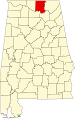
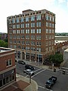
[3] Name on the Register Image Date listed [4] Location City or town Description 1 Alabama Agricultural and Mechanical University Historic District Alabama Agricultural and Mechanical University Historic District December 31, 2001 (# 01001407 Chase Rd. 34°46′43″N 86°34′18″W / 34.778611°N 86.571667°W / 34.778611; -86.571667 (Alabama Agricultural and Mechanical University Historic District ) Huntsville 2 Beckers Block Beckers Block September 22, 1980 (# 80000703 105–111 N. Jefferson St.s 34°43′53″N 86°35′13″W / 34.731389°N 86.586944°W / 34.731389; -86.586944 (Beckers Block ) Huntsville 3 James H. Bibb House James H. Bibb House April 12, 1984 (# 84000651 11 Allen St. 34°41′33″N 86°45′13″W / 34.6925°N 86.753611°W / 34.6925; -86.753611 (James H. Bibb House ) Madison 4 Big Spring Big Spring September 22, 1980 (# 80000704 W. Side Sq. 34°43′47″N 86°35′09″W / 34.729722°N 86.585833°W / 34.729722; -86.585833 (Big Spring ) Huntsville 5 Building at 105 S. Washington Street Building at 105 S. Washington Street May 23, 1984 (# 84000653 105 S. Washington St. 34°43′53″N 86°35′07″W / 34.731389°N 86.585278°W / 34.731389; -86.585278 (Building at 105 S. Washington Street ) Huntsville 6 Building at 305 Jefferson Building at 305 Jefferson November 15, 2003 (# 03001134 305 Jefferson St. 34°44′00″N 86°35′18″W / 34.733333°N 86.588333°W / 34.733333; -86.588333 (Building at 305 Jefferson ) Huntsville 7 Buildings at 104–128 S. Side Sq. Buildings at 104–128 S. Side Sq. September 22, 1980 (# 80004472 104–128 S. Side Sq. 34°43′47″N 86°35′05″W / 34.72969°N 86.5847°W / 34.72969; -86.5847 (Buildings at 104–128 S. Side Sq. ) Huntsville 8 William Burritt Mansion William Burritt Mansion May 29, 1992 (# 92000627 3101 Burritt Dr., SE. 34°42′57″N 86°32′22″W / 34.715833°N 86.539444°W / 34.715833; -86.539444 (William Burritt Mansion ) Huntsville 9 Butlers' Store Butlers' Store August 31, 1992 (# 92001089 5498 Main Dr. 34°32′13″N 86°23′40″W / 34.536925°N 86.394406°W / 34.536925; -86.394406 (Butlers' Store ) New Hope 10 Church of the Visitation Church of the Visitation September 22, 1980 (# 80000705 222 N. Jefferson St. 34°43′58″N 86°35′14″W / 34.732778°N 86.587222°W / 34.732778; -86.587222 (Church of the Visitation ) Huntsville 11 Clemens House Clemens House October 16, 1974 (# 74000419 Pratt Ave. at Meridian St. 34°44′19″N 86°35′03″W / 34.738611°N 86.584167°W / 34.738611; -86.584167 (Clemens House ) Huntsville Moved from its original location (Clinton Ave. at Church St.) in 2004 [5] 12 Dallas Mill Dallas Mill September 18, 1978 (# 78000496 701 Dallas Ave. 34°44′50″N 86°34′49″W / 34.747222°N 86.580278°W / 34.747222; -86.580278 (Dallas Mill ) Huntsville Destroyed by fire in 1991 13 Dallas Mill Village Historic District Dallas Mill Village Historic District June 27, 2011 (# 11000406 Bounded by Dickson St. NE. to Russell St. NE., Rison Ave. NE. to Pratt Ave. NE. 34°44′33″N 86°34′44″W / 34.7425°N 86.578889°W / 34.7425; -86.578889 (Dallas Mill Village Historic District ) Huntsville 14 Domestic Science Building Domestic Science Building April 11, 1973 (# 73000358 Alabama Agricultural and Mechanical University campus 34°47′07″N 86°34′09″W / 34.785278°N 86.569167°W / 34.785278; -86.569167 (Domestic Science Building ) Huntsville 15 Donegan Block Donegan Block September 22, 1980 (# 80000706 105–109 N. Side Sq. 34°43′51″N 86°35′08″W / 34.730833°N 86.585556°W / 34.730833; -86.585556 (Donegan Block ) Huntsville 16 Downtown Chevron Station Downtown Chevron Station September 22, 1980 (# 80000707 300 E. Clinton Ave. 34°43′56″N 86°35′03″W / 34.73225°N 86.58412°W / 34.73225; -86.58412 (Downtown Chevron Station ) Huntsville Demolished in 1980s. 17 Dunnavant's Building Dunnavant's Building September 22, 1980 (# 80000708 100 N. Washington St. 34°43′55″N 86°35′08″W / 34.7319°N 86.5856°W / 34.7319; -86.5856 (Dunnavant's Building ) Huntsville 18 Joel Eddins House Joel Eddins House September 12, 1996 (# 96001004 3101 Burritt Drive 34°43′01″N 86°32′23″W / 34.71696°N 86.53966°W / 34.71696; -86.53966 (Joel Eddins House ) Huntsville Moved in 2007, originally located near Ardmore in Limestone County [6] 19 Edmonton Heights Historic District Upload image June 21, 2021 (# 100006659 3800-3822 Colton Ln. NE, 3802-3831 Crane Dr. NE, 3802-3811 Eton Rd. NE, 3812-3818 Melody Cir. NE, 3800-3836 Melody Rd. NE, 3800-3814 Meridian St. North, 200-303 Salem Dr. NE, 202-250 Victory Ln. NE, 100-125 Whitney Ave. NE, 100-199 Wilkenson Dr. NE 34°46′35″N 86°34′02″W / 34.7765°N 86.5671°W / 34.7765; -86.5671 (Edmonton Heights Historic District ) Huntsville 20 Episcopal Church of the Nativity Episcopal Church of the Nativity October 9, 1974 (# 74000420 212 Eustis St. 34°43′48″N 86°35′00″W / 34.73°N 86.5833°W / 34.73; -86.5833 (Episcopal Church of the Nativity ) Huntsville 21 Everett Building Everett Building September 22, 1980 (# 80000709 115–123 N. Washington St. 34°43′56″N 86°35′10″W / 34.732222°N 86.586111°W / 34.732222; -86.586111 (Everett Building ) Huntsville 22 First National Bank First National Bank October 25, 1974 (# 74000421 West Side Sq. 34°43′47″N 86°35′09″W / 34.729722°N 86.585833°W / 34.729722; -86.585833 (First National Bank ) Huntsville 23 Five Points Historic District Five Points Historic District August 20, 2012 (# 12000522 Roughly Beirne, Clinton, Eustis, Grayson, McCullough, Pratt, Randolph, Russell, Ward, Wellman, & Wells Aves. 34°44′19″N 86°34′21″W / 34.738747°N 86.572385°W / 34.738747; -86.572385 (Five Points Historic District ) Huntsville 24 Flint River Place Flint River Place January 18, 1982 (# 82002050 1997 Jordan Rd. 34°47′01″N 86°29′37″W / 34.7836°N 86.49354°W / 34.7836; -86.49354 (Flint River Place ) Huntsville 25 Hezekiah Ford House Hezekiah Ford House June 13, 2014 (# 14000318 920 Countess Rd. 34°49′13″N 86°32′56″W / 34.820304°N 86.548889°W / 34.820304; -86.548889 (Hezekiah Ford House ) Huntsville 26 Fowler's Department Store Fowler's Department Store May 30, 1996 (# 96000597 116 Washington and 214 Holmes Sts. 34°43′57″N 86°35′09″W / 34.7325°N 86.585833°W / 34.7325; -86.585833 (Fowler's Department Store ) Huntsville Partially deconstructed in 2011–12. The façade was retained and used for the Belk Husdon Lofts. [7] 27 Glenwood Cemetery Upload image September 20, 2023 (# 100009123 2300 Hall Ave. 34°43′34″N 86°36′08″W / 34.7261°N 86.6022°W / 34.7261; -86.6022 (Glenwood Cemetery ) Huntsville 28 Gurley Historic District Gurley Historic District June 2, 2004 (# 04000562 Section Line St., Railroad St., Maple Boulevard and Church St. between Gurley Pike and Jackson St. 34°42′00″N 86°22′25″W / 34.7°N 86.373611°W / 34.7; -86.373611 (Gurley Historic District ) Gurley 29 Halsey Grocery Warehouse Halsey Grocery Warehouse September 22, 1980 (# 80000710 301 N. Jefferson St. 34°43′59″N 86°35′18″W / 34.733056°N 86.588333°W / 34.733056; -86.588333 (Halsey Grocery Warehouse ) Huntsville 30 W. L. Halsey Warehouse W. L. Halsey Warehouse September 22, 1980 (# 80000711 300 N. Jefferson St. 34°44′00″N 86°35′17″W / 34.733333°N 86.588056°W / 34.733333; -86.588056 (W. L. Halsey Warehouse ) Huntsville 31 Henderson National Bank Henderson National Bank September 22, 1980 (# 80000712 118 S. Jefferson St. 34°43′50″N 86°35′10″W / 34.730556°N 86.586111°W / 34.730556; -86.586111 (Henderson National Bank ) Huntsville 32 Hotel Russel Erskine Hotel Russel Erskine September 22, 1980 (# 80000713 123 W. Clinton Ave. 34°43′50″N 86°35′14″W / 34.730556°N 86.587222°W / 34.730556; -86.587222 (Hotel Russel Erskine ) Huntsville 33 David C. Humphreys House David C. Humphreys House August 3, 1977 (# 77000211 109 Gates Ave. 34°43′41″N 86°35′07″W / 34.728056°N 86.585278°W / 34.728056; -86.585278 (David C. Humphreys House ) Huntsville Originally located at 510 W. Clinton Ave. W. 34 Hundley House Hundley House May 22, 1978 (# 78000497 401 Madison St. 34°43′43″N 86°35′04″W / 34.728611°N 86.584444°W / 34.728611; -86.584444 (Hundley House ) Huntsville 35 Hundley Rental Houses Hundley Rental Houses September 22, 1980 (# 80000714 108 Gates St. and 400 Franklin St. 34°43′44″N 86°35′02″W / 34.728889°N 86.583889°W / 34.728889; -86.583889 (Hundley Rental Houses ) Huntsville 36 Terry Hutchens Building Terry Hutchens Building September 22, 1980 (# 80000715 102 W. Clinton Ave. 34°43′52″N 86°35′13″W / 34.731111°N 86.586944°W / 34.731111; -86.586944 (Terry Hutchens Building ) Huntsville 37 W. T. Hutchens Building W. T. Hutchens Building December 28, 1983 (# 83004374 100–104 S. Jefferson St. 34°43′51″N 86°35′12″W / 34.730833°N 86.586667°W / 34.730833; -86.586667 (W. T. Hutchens Building ) Huntsville 38 George Jude House George Jude House February 24, 2000 (# 00000139 2132 Winchester Rd. 34°47′37″N 86°35′12″W / 34.793611°N 86.586667°W / 34.793611; -86.586667 (George Jude House ) Huntsville 39 Kelly Brothers and Rowe Building Kelly Brothers and Rowe Building September 22, 1980 (# 80000716 307 N. Jefferson St. 34°44′00″N 86°35′18″W / 34.733333°N 86.588333°W / 34.733333; -86.588333 (Kelly Brothers and Rowe Building ) Huntsville 40 Kildare-McCormick House Kildare-McCormick House July 15, 1982 (# 82002051 2005 Kildare St. 34°44′59″N 86°35′06″W / 34.749722°N 86.585°W / 34.749722; -86.585 (Kildare-McCormick House ) Huntsville 41 Kress Building Kress Building September 22, 1980 (# 80000717 107 S. Washington St. 34°43′53″N 86°35′07″W / 34.731389°N 86.585278°W / 34.731389; -86.585278 (Kress Building ) Huntsville 42 William Lanford House William Lanford House May 20, 1994 (# 94000499 7400 Old Madison Pike 34°42′54″N 86°41′44″W / 34.71511°N 86.69546°W / 34.71511; -86.69546 (William Lanford House ) Huntsville 43 Leech-Hauer House Leech-Hauer House December 8, 1978 (# 78000498 502 Governors Dr. 34°43′14″N 86°35′13″W / 34.720556°N 86.586944°W / 34.720556; -86.586944 (Leech-Hauer House ) Huntsville Demolished, now a medical office building on site 44 Lincoln Mill and Mill Village Historic District Lincoln Mill and Mill Village Historic District April 26, 2010 (# 10000200 Bounded by Meridian St., Oakwood Ave., Front St., Mountain View Dr., Davidson St., Cottage St, and King Ave. 34°44′52″N 86°34′55″W / 34.747792°N 86.582008°W / 34.747792; -86.582008 (Lincoln Mill and Mill Village Historic District ) Huntsville 45 Lincoln School Lincoln School December 27, 1982 (# 82001608 1110 N. Meridian St. 34°44′43″N 86°35′02″W / 34.745278°N 86.583889°W / 34.745278; -86.583889 (Lincoln School ) Huntsville 46 Lombardo Building Lombardo Building September 22, 1980 (# 80000718 315 N. Jefferson St. 34°44′01″N 86°35′19″W / 34.733611°N 86.588611°W / 34.733611; -86.588611 (Lombardo Building ) Huntsville 47 Lowe Mill and Mill Village Historic District Lowe Mill and Mill Village Historic District June 24, 2011 (# 11000375 Bounded by Triana Blvd. SW., 10th Ave. SW., Summer St. & Governor's Dr. 34°43′02″N 86°36′11″W / 34.717222°N 86.603056°W / 34.717222; -86.603056 (Lowe Mill and Mill Village Historic District ) Huntsville 48 Lowry House Lowry House October 29, 2001 (# 01001165 1205 Kildare Ave. 34°44′49″N 86°35′08″W / 34.746944°N 86.585556°W / 34.746944; -86.585556 (Lowry House ) Huntsville 49 Madison Station Historic District Madison Station Historic District March 29, 2006 (# 06000185 Roughly bounded by the Wall Triana Highway, Mill Rd., Church St., Maple St., Martin St., and Bradley St. 34°41′46″N 86°44′51″W / 34.696111°N 86.7475°W / 34.696111; -86.7475 (Madison Station Historic District ) Madison 50 Maple Hill Cemetery Maple Hill Cemetery August 22, 2012 (# 12000523 203 Maple Hill Dr. 34°43′59″N 86°34′24″W / 34.732975°N 86.573364°W / 34.732975; -86.573364 (Maple Hill Cemetery ) Huntsville 51 Mason Building Mason Building September 22, 1980 (# 80000719 115 E. Clinton Ave. 34°43′54″N 86°35′09″W / 34.731667°N 86.585833°W / 34.731667; -86.585833 (Mason Building ) Huntsville 52 May and Cooney Dry Goods Company May and Cooney Dry Goods Company September 22, 1980 (# 80000720 205 E. Side Sq. 34°43′51″N 86°35′04″W / 34.730833°N 86.584444°W / 34.730833; -86.584444 (May and Cooney Dry Goods Company ) Huntsville 53 McCartney-Bone House McCartney-Bone House December 16, 1977 (# 77000213 3 miles northeast of Maysville on Hurricane Rd. 34°47′39″N 86°24′32″W / 34.794167°N 86.408889°W / 34.794167; -86.408889 (McCartney-Bone House ) Maysville 54 McCrary House McCrary House June 1, 1982 (# 82002052 Northeast of Huntsville 34°50′43″N 86°29′14″W / 34.8454°N 86.48717°W / 34.8454; -86.48717 (McCrary House ) Huntsville 55 McThornmor Acres Subdivision Historic District McThornmor Acres Subdivision Historic District February 9, 2022 (# 100004119 Holmes Ave. NW, Brickell Rd. NW, Northington St. NW and Woodall Ln. NW 34°43′51″N 86°37′53″W / 34.7308°N 86.6315°W / 34.7308; -86.6315 (McThornmor Acres Subdivision Historic District ) Huntsville 56 Merrimack Mill Village Historic District Merrimack Mill Village Historic District April 16, 2010 (# 10000172 Alpine St., Triana Blvd., Dunn Dr., Cobb Rd., Drake Ave., & Grote St. 34°42′15″N 86°36′41″W / 34.704258°N 86.611406°W / 34.704258; -86.611406 (Merrimack Mill Village Historic District ) Huntsville 57 Milligan Block Milligan Block September 22, 1980 (# 80000721 201–203 E. Side Sq. 34°43′51″N 86°35′05″W / 34.730833°N 86.584722°W / 34.730833; -86.584722 (Milligan Block ) Huntsville 58 Monte Sano Railroad Workers' House Monte Sano Railroad Workers' House August 14, 1998 (# 98001019 4119 Shelby Ave. 34°44′29″N 86°31′26″W / 34.741389°N 86.523889°W / 34.741389; -86.523889 (Monte Sano Railroad Workers' House ) Huntsville 59 Neutral Buoyancy Space Simulator Neutral Buoyancy Space Simulator October 3, 1985 (# 85002807 George C. Marshall Space Flight Center 34°39′11″N 86°40′39″W / 34.65298°N 86.6774°W / 34.65298; -86.6774 (Neutral Buoyancy Space Simulator ) Huntsville 60 New Market Historic District New Market Historic District March 31, 2004 (# 04000237 Roughly bounded by Mountain Fork, College St., Davis St., Winchester Rd. to Cochran St., and parts of Cochran St. and Cedar St. 34°54′30″N 86°25′43″W / 34.908333°N 86.428611°W / 34.908333; -86.428611 (New Market Historic District ) New Market 61 New Market Presbyterian Church New Market Presbyterian Church August 25, 1988 (# 88001348 1723 New Market Rd. 34°54′37″N 86°25′46″W / 34.910278°N 86.429444°W / 34.910278; -86.429444 (New Market Presbyterian Church ) New Market 62 New Market United Methodist Church New Market United Methodist Church June 14, 1990 (# 90000919 310 Hurricane Rd. 34°54′26″N 86°25′36″W / 34.907222°N 86.426667°W / 34.907222; -86.426667 (New Market United Methodist Church ) New Market 63 Old Town Historic District Old Town Historic District July 18, 1978 (# 78000499 Roughly bounded by Dement and Lincoln Sts. and Randolph and Walker Aves.; 305, 309, 310 Dallas St. & 115, 118, 120 Walker Ave. 34°44′07″N 86°34′50″W / 34.735278°N 86.580556°W / 34.735278; -86.580556 (Old Town Historic District ) Huntsville Second set of address represent a boundary increase listed March 17, 2015 64 William Madison Otey House William Madison Otey House January 19, 1982 (# 82002056 South of Meridianville 34°50′10″N 86°34′13″W / 34.836111°N 86.570278°W / 34.836111; -86.570278 (William Madison Otey House ) Meridianville 65 Phelps-Jones House Phelps-Jones House February 19, 1982 (# 82002053 6112 Pulaski Pike 34°48′02″N 86°37′10″W / 34.800556°N 86.619444°W / 34.800556; -86.619444 (Phelps-Jones House ) Huntsville 66 Propulsion and Structural Test Facility Propulsion and Structural Test Facility October 3, 1985 (# 85002804 George C. Marshall Space Flight Center 34°37′31″N 86°39′31″W / 34.625278°N 86.658611°W / 34.625278; -86.658611 (Propulsion and Structural Test Facility ) Huntsville 67 Rand Building Rand Building September 22, 1980 (# 80000722 113 N. Side Sq. 34°43′51″N 86°35′07″W / 34.730833°N 86.585278°W / 34.730833; -86.585278 (Rand Building ) Huntsville 68 Randolph Street Church of Christ Randolph Street Church of Christ September 22, 1980 (# 80000723 210 Randolph Ave. 34°43′52″N 86°35′03″W / 34.731111°N 86.584167°W / 34.731111; -86.584167 (Randolph Street Church of Christ ) Huntsville 69 Redstone Test Stand Redstone Test Stand May 13, 1976 (# 76000341 George C. Marshall Space Flight Center 34°37′58″N 86°40′00″W / 34.632778°N 86.666667°W / 34.632778; -86.666667 (Redstone Test Stand ) Huntsville 70 John Robinson House John Robinson House October 6, 1977 (# 77000212 2709 Meridian St., N. 34°45′38″N 86°34′38″W / 34.760556°N 86.577222°W / 34.760556; -86.577222 (John Robinson House ) Huntsville 71 Mrs. William Robinson House Mrs. William Robinson House February 4, 1982 (# 82002054 401 Quietdale Dr., NE. 34°45′25″N 86°34′26″W / 34.756944°N 86.573889°W / 34.756944; -86.573889 (Mrs. William Robinson House ) Huntsville 72 Saturn V Dynamic Test Stand Saturn V Dynamic Test Stand October 3, 1985 (# 85002806 George C. Marshall Space Flight Center 34°37′51″N 86°39′40″W / 34.630833°N 86.661111°W / 34.630833; -86.661111 (Saturn V Dynamic Test Stand ) Huntsville 73 Saturn V Space Vehicle Saturn V Space Vehicle November 22, 1978 (# 78000500 Tranquility Base 34°42′36″N 86°39′21″W / 34.71°N 86.655833°W / 34.71; -86.655833 (Saturn V Space Vehicle ) Huntsville 74 Schiffman Building Schiffman Building September 22, 1980 (# 80000724 231 E. Side Sq. 34°43′49″N 86°35′03″W / 34.730278°N 86.584167°W / 34.730278; -86.584167 (Schiffman Building ) Huntsville 75 Southern Railway System Depot Southern Railway System Depot September 10, 1971 (# 71000101 330 Church St. 34°44′04″N 86°35′27″W / 34.734444°N 86.590833°W / 34.734444; -86.590833 (Southern Railway System Depot ) Huntsville 76 Steele-Fowler House Steele-Fowler House June 20, 1974 (# 74000422 808 Maysville Rd. 34°44′40″N 86°33′52″W / 34.744444°N 86.564444°W / 34.744444; -86.564444 (Steele-Fowler House ) Huntsville 77 Steger House Steger House June 1, 1982 (# 82002055 3141 Maysville Rd. 34°46′17″N 86°25′46″W / 34.77133°N 86.42949°W / 34.77133; -86.42949 (Steger House ) Maysville 78 Struve-Hay Building Struve-Hay Building September 22, 1980 (# 80000725 117–123 N. Jefferson St. 34°43′55″N 86°35′14″W / 34.731944°N 86.587222°W / 34.731944; -86.587222 (Struve-Hay Building ) Huntsville 79 Times Building Times Building September 22, 1980 (# 80000726 228 E. Holmes Ave. 34°43′59″N 86°35′07″W / 34.733056°N 86.585278°W / 34.733056; -86.585278 (Times Building ) Huntsville 80 Twickenham Historic District Twickenham Historic District January 4, 1973 (# 73000357 Roughly bounded by Clinton Ave., California St., Newman Ave. and S. Green St., and Franklin St. 34°43′47″N 86°34′43″W / 34.729722°N 86.578611°W / 34.729722; -86.578611 (Twickenham Historic District ) Huntsville Boundary increase May 26, 2015 81 U.S. Courthouse and Post Office U.S. Courthouse and Post Office February 24, 1981 (# 81000129 101 E. Holmes Ave. 34°43′57″N 86°35′13″W / 34.7325°N 86.586944°W / 34.7325; -86.586944 (U.S. Courthouse and Post Office ) Huntsville 82 Urquhart House Urquhart House February 13, 1992 (# 92000034 8042 Pulaski Pike 34°51′01″N 86°38′12″W / 34.8502°N 86.63665°W / 34.8502; -86.63665 (Urquhart House ) Huntsville 83 Vaught House Vaught House December 15, 1981 (# 81000130 701 Ward Ave. 34°44′24″N 86°34′36″W / 34.740000°N 86.576667°W / 34.740000; -86.576667 (Vaught House ) Huntsville 84 Warden's Residence Warden's Residence May 17, 2010 (# 10000258 151 Stone St. 34°34′53″N 86°43′56″W / 34.581357°N 86.732166°W / 34.581357; -86.732166 (Warden's Residence ) Triana 85 White-Turner-Sanford House White-Turner-Sanford House April 12, 1984 (# 84000655 601 Madison St. 34°43′33″N 86°34′54″W / 34.725833°N 86.581667°W / 34.725833; -86.581667 (White-Turner-Sanford House ) Huntsville 86 Whitman-Cobb House Whitman-Cobb House January 18, 1982 (# 82002057 Winchester Rd. 34°54′13″N 86°25′45″W / 34.903601°N 86.429288°W / 34.903601; -86.429288 (Whitman-Cobb House ) New Market 87 Withers-Chapman House Withers-Chapman House December 8, 1978 (# 78000501 2409 Dairy Lane, NE. 34°45′24″N 86°33′42″W / 34.756667°N 86.561667°W / 34.756667; -86.561667 (Withers-Chapman House ) Huntsville 88 Yarbrough Hotel Yarbrough Hotel September 22, 1980 (# 80000727 127–129 N. Washington St. 34°43′57″N 86°35′11″W / 34.7325°N 86.586389°W / 34.7325; -86.586389 (Yarbrough Hotel ) Huntsville