National Register of Historic Places listings in Baldwin County, Alabama

Last updated

Location of Baldwin County in Alabama Map of Alabama highlighting Baldwin County.svg
Location of Baldwin County in Alabama

This is a list of the National Register of Historic Places listings in Baldwin County, Alabama.

Contents

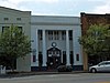
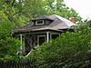
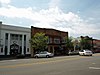
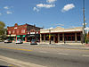
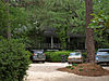
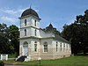
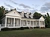
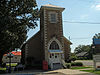
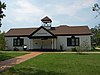
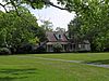
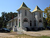
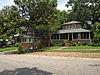
This is intended to be a complete list of the properties and districts on the National Register of Historic Places in Baldwin County, Alabama, United States. Latitude and longitude coordinates are provided for many National Register properties and districts; these locations may be seen together in an online map. [1]

There are 65 properties and districts listed on the National Register in the county, including 2 National Historic Landmarks.


    This National Park Service list is complete through NPS recent listings posted March 1, 2024. [2]

Current listings

[3] Name on the RegisterImageDate listed [4] Location City or townDescription
1 Allen House
Allen House Allen House Bon Secour May 2013 1.jpg
Allen House
December 20, 1988
(#88002809)
Off County Road 10 on the northern bank of the Bon Secour River
30°18′09″N87°44′13″W / 30.3025°N 87.736944°W / 30.3025; -87.736944 (Allen House)
Bon Secour
2 American Legion Post 199
American Legion Post 199 American Legion Post 199.jpg
American Legion Post 199
September 6, 2018
(#100002858)
700 S Mobile St.
30°30′48″N87°55′06″W / 30.51330°N 87.91846°W / 30.51330; -87.91846 (American Legion Post 199)
Fairhope American Legion post building
3 Bank of Fairhope
Bank of Fairhope Bank of Fairhope Sept 2012.jpg
Bank of Fairhope
July 1, 1988
(#88001008)
396 Fairhope Ave.
30°31′22″N87°54′12″W / 30.522778°N 87.903333°W / 30.522778; -87.903333 (Bank of Fairhope)
Fairhope
4 Battles Wharf Historic District April 28, 1988
(#88000107)
U.S. Route 98 (Eastern Shore Boulevard) roughly between Woolworth Ave. and Buerger La.
30°29′37″N87°55′38″W / 30.493611°N 87.927222°W / 30.493611; -87.927222 (Battles Wharf Historic District)
Battles Wharf
5 Beckner House
Beckner House Beckner House Sept 2012 02.jpg
Beckner House
July 1, 1988
(#88001007)
63 S. Church St.
30°31′15″N87°54′17″W / 30.520833°N 87.904722°W / 30.520833; -87.904722 (Beckner House)
Fairhope
6 Blakeley
Blakeley Blakeley Battleground Union Boyaux fortification.jpg
Blakeley
June 25, 1974
(#74000397)
Along the Tensaw River north of Spanish Fort [5]
30°44′32″N87°55′27″W / 30.742222°N 87.924167°W / 30.742222; -87.924167 (Blakeley)
Spanish Fort
7 Carl L. Bloxham Building
Carl L. Bloxham Building Carl L. Bloxham Building Sept 2012.jpg
Carl L. Bloxham Building
June 30, 1988
(#88001005)
327 Fairhope Ave.
30°31′23″N87°54′15″W / 30.523056°N 87.904167°W / 30.523056; -87.904167 (Carl L. Bloxham Building)
Fairhope
8 Bottle Creek Indian Mounds
Bottle Creek Indian Mounds Bottle Creek.jpg
Bottle Creek Indian Mounds
December 2, 1974
(#74000398)
Northern end of Mound Island along the eastern side of the Middle River [6]
31°00′32″N87°56′24″W / 31.008889°N 87.940000°W / 31.008889; -87.940000 (Bottle Creek Indian Mounds)
Stockton
9 Brodbeck–Zundel Historic District
Brodbeck-Zundel Historic District 17111 Scenic US 98 Sept 2012.jpg
Brodbeck–Zundel Historic District
April 28, 1988
(#88000520)
Scenic U.S. Route 98 and Old Marlow Rd.
30°28′27″N87°55′09″W / 30.474167°N 87.919167°W / 30.474167; -87.919167 (Brodbeck–Zundel Historic District)
Point Clear
10 Brunell House (Jessamine St.)
Brunell House (Jessamine St.) Brunell House May 2013.jpg
Brunell House (Jessamine St.)
August 22, 1995
(#95001019)
12113 Jessamine St.
30°24′03″N87°46′37″W / 30.40094°N 87.77683°W / 30.40094; -87.77683 (Brunell House (Jessamine St.))
Magnolia Springs Classical Revival cottage built in 1910
11 Captain Adams House December 20, 1988
(#88002810)
907 Captain O'Neal Dr.
30°35′25″N87°54′51″W / 30.590278°N 87.914167°W / 30.590278; -87.914167 (Captain Adams House)
Daphne
12 Clotilda (schooner)
Clotilda (schooner) Wreck of the Slave Ship Clotilda.jpg
Clotilda (schooner)
November 8, 2021
(#100007119)
Address Restricted
Mobile vicinity
13 George W. Cullum House June 14, 1990
(#90000930)
1915 Old County Rd.
30°36′19″N87°54′39″W / 30.605278°N 87.910833°W / 30.605278; -87.910833 (George W. Cullum House)
Daphne
14 Fairhope Bayfront District
Fairhope Bayfront District 50 N Bayview Avenue Fairhope Sept 2012.jpg
Fairhope Bayfront District
July 1, 1988
(#88001003)
Roughly bounded by Blakeney, N. and S. Summit Sts., Fels Ave., and Mobile Bay
30°31′28″N87°54′32″W / 30.524444°N 87.908889°W / 30.524444; -87.908889 (Fairhope Bayfront District)
Fairhope
15 Fairhope Downtown Historic District
Fairhope Downtown Historic District Fairhope Avenue Sept 2012.jpg
Fairhope Downtown Historic District
March 16, 2006
(#04000115)
Roughly bounded by Equality St., Fairhope Ave., Morphy Ave., School St., and Summit St.
30°31′21″N87°54′11″W / 30.5225°N 87.903056°W / 30.5225; -87.903056 (Fairhope Downtown Historic District)
Fairhope
16 First Baptist Church
First Baptist Church Old First Baptist Church Bay Minette June 2013 1.jpg
First Baptist Church
August 25, 1988
(#88001349)
Northern side of D'Olive St.
30°53′05″N87°46′36″W / 30.884722°N 87.776667°W / 30.884722; -87.776667 (First Baptist Church)
Bay Minette
17 Foley Downtown Historic District
Foley Downtown Historic District 100s W Laurel Ave Foley Sept 2012 01.jpg
Foley Downtown Historic District
January 19, 2005
(#04001496)
Parts of Alston, McKenzie, E. and W. Laurel and W. Orange Sts.; also parts of Laurel & Pine Sts., W Myrtle, E & W Rose, W. Orange & W Jessamine Aves.
30°24′24″N87°41′02″W / 30.406667°N 87.683889°W / 30.406667; -87.683889 (Foley Downtown Historic District)
Foley Boundaries originally encompassed parts of Alston, N. and S. McKenzie, U.S. Route 98, E. and W. Laurel, Myrtle, Rose, and W. Orange until a boundary decrease of June 4, 2012; boundaries further increased on September 20, 2019.
18 Fort Mims Site
Fort Mims Site Ft. Mims West wall and gate.JPG
Fort Mims Site
September 14, 1972
(#72000153)
Southwestern quarter of Section 36, Township 2 North, Range 2 East [7]
31°10′50″N87°50′17″W / 31.18050°N 87.83797°W / 31.18050; -87.83797 (Fort Mims Site)
Tensaw Site of a battle during the Creek War. On August 30, 1813, Red Stick Creeks killed or captured 517 settlers, militia, and their allies at Fort Mims.
19 Fort Morgan
Fort Morgan FortMorgan02.jpg
Fort Morgan
October 15, 1966
(#66000146)
Western terminus of State Route 180
30°13′41″N88°01′23″W / 30.228056°N 88.023056°W / 30.228056; -88.023056 (Fort Morgan)
Gasque
20 Gaston Building
Gaston Building Gaston Building Sept 2012.jpg
Gaston Building
July 1, 1988
(#88001004)
336 Fairhope Ave.
30°31′22″N87°54′14″W / 30.522778°N 87.903889°W / 30.522778; -87.903889 (Gaston Building)
Fairhope
21 Golf, Gun & Country Club
Golf, Gun & Country Club Golf, Gun & Country Club May 2013 1.jpg
Golf, Gun & Country Club
July 1, 1988
(#88001002)
651 Johnson Ave.
30°31′22″N87°53′41″W / 30.522778°N 87.894722°W / 30.522778; -87.894722 (Golf, Gun & Country Club)
Fairhope
22 Governor's Club
Governor's Club Governor's Club Magnolia Springs May 2013 1.jpg
Governor's Club
August 31, 2000
(#00001031)
11866 Magnolia St.
30°23′46″N87°46′34″W / 30.396111°N 87.776111°W / 30.396111; -87.776111 (Governor's Club)
Magnolia Springs Also known as "Brunell House", but different than Brunell House (Jessamine St.), also in Magnolia Springs
23 Hamner House
Hamner House Hamner House May 2013 1.jpg
Hamner House
December 20, 1988
(#88002811)
Oak Rd. off County Road 6
30°19′07″N87°42′27″W / 30.318611°N 87.7075°W / 30.318611; -87.7075 (Hamner House)
Bon Secour
24 C.S.S. Huntsville and C.S.S. Tuscaloosa Historic and Archaeological District July 18, 2022
(#100007894)
Address Restricted
Mobile vicinity
25 Jenkins Farm and House
Jenkins Farm and House Jenkins Family Farm.jpg
Jenkins Farm and House
December 20, 2016
(#16000862)
28898 Jenkins Farm Rd., 29040 Jenkins Farm Rd.
30°38′51″N87°48′15″W / 30.647529°N 87.804053°W / 30.647529; -87.804053 (Jenkins Farm and House)
Loxley A boundary increase was approved November 14, 2023.
26 Axil Johnson House
Axil Johnson House Axil Johnson House Sept 2012 02.jpg
Axil Johnson House
July 3, 1997
(#97000649)
751 Edwards St.
30°31′39″N87°53′24″W / 30.5275°N 87.89°W / 30.5275; -87.89 (Axil Johnson House)
Fairhope
27 Killcreas House
Killcreas House Killcreas House June 2013.jpg
Killcreas House
May 4, 1995
(#95000556)
46833 State Route 225
30°54′26″N87°51′23″W / 30.907222°N 87.856389°W / 30.907222; -87.856389 (Killcreas House)
Bay Minette
28 Latham United Methodist Church
Latham United Methodist Church Latham United Methodist Church June 2013 6.jpg
Latham United Methodist Church
August 25, 1988
(#88001350)
Eastern side of State Route 59
31°05′54″N87°49′51″W / 31.098333°N 87.830833°W / 31.098333; -87.830833 (Latham United Methodist Church)
Latham
29 Lebanon Chapel AME Church
Lebanon Chapel AME Church Lebanon Chapel AME Church Sept 2012 02.jpg
Lebanon Chapel AME Church
August 25, 1988
(#88001351)
Bounded by Young St. on the west and Middle St. on the north
30°30′48″N87°53′39″W / 30.513333°N 87.894167°W / 30.513333; -87.894167 (Lebanon Chapel AME Church)
Fairhope
30 Magnolia Springs Historic District
Magnolia Springs Historic District Magnolia Springs Community Hall May 2013.jpg
Magnolia Springs Historic District
January 27, 2012
(#11001046)
Roughly along Oak, Spring, Bay, Jessamine, Magnolia, Pine & Rock Sts., Island, Cedar & Holly Aves. & Magnolia Springs Highway
30°23′59″N87°46′34″W / 30.399642°N 87.7761°W / 30.399642; -87.7761 (Magnolia Springs Historic District)
Magnolia Springs
31 Malbis Plantation
Malbis Plantation Malbis Plantation House Sept 2012 01.jpg
Malbis Plantation
May 10, 2011
(#11000238)
10145 US 90
30°39′13″N87°50′32″W / 30.653611°N 87.842222°W / 30.653611; -87.842222 (Malbis Plantation)
Daphne
32 Manly-Strong House
Manly-Strong House Manly-Strong House.jpg
Manly-Strong House
August 22, 2019
(#100004134)
100 Deer Ct.
30°35′23″N87°54′51″W / 30.5896°N 87.9143°W / 30.5896; -87.9143 (Manly-Strong House)
Daphne
33 McMillan House
McMillan House McMillan House Daphne Sept 2012 02.jpg
McMillan House
December 20, 1988
(#88002812)
1404 Captain O'Neal Ave.
30°35′52″N87°54′42″W / 30.597778°N 87.911667°W / 30.597778; -87.911667 (McMillan House)
Daphne
34 Methodist Episcopal Church, South
Methodist Episcopal Church, South Old Methodist Church Daphne Sept 2012 02.jpg
Methodist Episcopal Church, South
September 22, 1980
(#80000679)
1608 Old County Rd.
30°36′06″N87°54′31″W / 30.601667°N 87.908611°W / 30.601667; -87.908611 (Methodist Episcopal Church, South)
Daphne
35 Montgomery Hill Baptist Church
Montgomery Hill Baptist Church Montgomery Hill Baptist Church June 2013 6.jpg
Montgomery Hill Baptist Church
August 25, 1988
(#88001352)
Eastern side of State Route 59 on County Road 80
31°09′46″N87°47′12″W / 31.162778°N 87.786667°W / 31.162778; -87.786667 (Montgomery Hill Baptist Church)
Tensaw
36 Montrose Historic District
Montrose Historic District Chapman-Scott House Sept 2012.jpg
Montrose Historic District
June 3, 1976
(#76000310)
Main (State Route 42) and 2nd Sts.
30°34′07″N87°54′02″W / 30.568611°N 87.900556°W / 30.568611; -87.900556 (Montrose Historic District)
Montrose
37 Moore Store
Moore Store Moore Brothers General Store May 2013 3.jpg
Moore Store
November 30, 2001
(#00001027)
14770 Oak St.
30°24′04″N87°46′15″W / 30.401111°N 87.770833°W / 30.401111; -87.770833 (Moore Store)
Magnolia Springs
38 Nelson House
Nelson House Nelson House Latham June 2013.jpg
Nelson House
December 20, 1988
(#88002814)
State Route 59, North
31°05′08″N87°49′52″W / 31.085556°N 87.831111°W / 31.085556; -87.831111 (Nelson House)
Latham
39 Nicholson House
Nicholson House Nicholson House Oyster Bay May 2013 1.jpg
Nicholson House
December 20, 1988
(#88002813)
County Road 6
30°17′33″N87°44′13″W / 30.2925°N 87.736944°W / 30.2925; -87.736944 (Nicholson House)
Oyster Bay
40 Orrell House
Orrell House Orrell House May 2013 2.jpg
Orrell House
December 20, 1988
(#88002815)
County Road 6
30°18′59″N87°42′14″W / 30.316389°N 87.703889°W / 30.316389; -87.703889 (Orrell House)
Bon Secour
41 People's Supply Company
People's Supply Company People's Supply Company Sept 2012 01.jpg
People's Supply Company
February 21, 1997
(#97000096)
21950 Broad St.
30°32′41″N87°45′03″W / 30.544722°N 87.750833°W / 30.544722; -87.750833 (People's Supply Company)
Silverhill
42 Point Clear Historic District April 28, 1988
(#88000515)
Western side of U.S. Route 98/Eastern Shore Boulevard
30°28′48″N87°55′40″W / 30.48°N 87.927778°W / 30.48; -87.927778 (Point Clear Historic District)
Point Clear
43 St. Mark's Lutheran Church
St. Mark's Lutheran Church St. Mark's Lutheran Elberta Sept 2012 03.jpg
St. Mark's Lutheran Church
August 25, 1988
(#88001353)
Western side of County Road 83
30°25′01″N87°35′55″W / 30.416944°N 87.598611°W / 30.416944; -87.598611 (St. Mark's Lutheran Church)
Elberta
44 St. Patrick's Catholic Church
St. Patrick's Catholic Church St. Patrick's Catholic Church Loxley Sept 2012 02.jpg
St. Patrick's Catholic Church
August 25, 1988
(#88001354)
Eastern side of U.S. Route 90
30°37′11″N87°45′10″W / 30.619722°N 87.752778°W / 30.619722; -87.752778 (St. Patrick's Catholic Church)
Loxley
45 St. Paul's Episcopal Church
St. Paul's Episcopal Church St. Paul's Episcopal Magnolia Springs May 2013 2.jpg
St. Paul's Episcopal Church
August 25, 1988
(#88001355)
Northern side of Oak Ave.
30°24′05″N87°46′17″W / 30.401389°N 87.771389°W / 30.401389; -87.771389 (St. Paul's Episcopal Church)
Magnolia Springs
46 Sand Island Light
Sand Island Light Sandislandal1962 300.jpg
Sand Island Light
November 12, 1975
(#75000305)
Southwest of Fort Morgan off Mobile Point
30°11′15″N88°03′02″W / 30.1875°N 88.050556°W / 30.1875; -88.050556 (Sand Island Light)
Fort Morgan
47 School of Organic Education
School of Organic Education Marietta Johnson Museum Sept 2012 01.jpg
School of Organic Education
July 1, 1988
(#88001010)
Bounded by Fairhope and Morphy Aves. and Bancroft and School Sts.
30°31′17″N87°54′05″W / 30.521389°N 87.901389°W / 30.521389; -87.901389 (School of Organic Education)
Fairhope
48 Lewis Starke House June 14, 1990
(#90000929)
2103 Old County Rd.
30°36′26″N87°54′39″W / 30.607222°N 87.910833°W / 30.607222; -87.910833 (Lewis Starke House)
Daphne
49 State Bank Silverhill
State Bank Silverhill State Bank Silverhill Sept 2012 01.jpg
State Bank Silverhill
December 31, 2001
(#01001410)
15950 Silverhill Ave.
30°32′42″N87°45′05″W / 30.545°N 87.751389°W / 30.545; -87.751389 (State Bank Silverhill)
Silverhill
50 Stockton Methodist Church
Stockton Methodist Church Stockton United Methodist Church.jpg
Stockton Methodist Church
August 25, 1988
(#88001356)
Eastern side of State Route 59
31°00′57″N87°51′11″W / 31.015833°N 87.853056°W / 31.015833; -87.853056 (Stockton Methodist Church)
Stockton
51 Street House
Street House Street House May 2013.jpg
Street House
December 20, 1988
(#88002816)
Wood Acres Rd. off County Road 3
30°27′52″N87°53′54″W / 30.464444°N 87.898333°W / 30.464444; -87.898333 (Street House)
Point Clear
52 Henry Stuart House
Henry Stuart House Tolstoy Park Sept 2012 01.jpg
Henry Stuart House
October 27, 2006
(#05000841)
22787 U.S. Route 98
30°33′23″N87°53′38″W / 30.556389°N 87.893889°W / 30.556389; -87.893889 (Henry Stuart House)
Montrose
53 Sunnyside Hotel
Sunnyside Hotel Sunnyside Hotel May 2013 2.jpg
Sunnyside Hotel
February 20, 1998
(#98000111)
14469 Oak St.
30°23′59″N87°46′36″W / 30.399722°N 87.776667°W / 30.399722; -87.776667 (Sunnyside Hotel)
Magnolia Springs
54 Svea Land Company Office
Svea Land Company Office Svea Land Company Office Sept 2012 02.jpg
Svea Land Company Office
March 7, 1985
(#85000443)
S. 6th St.
30°32′41″N87°45′14″W / 30.544722°N 87.753889°W / 30.544722; -87.753889 (Svea Land Company Office)
Silverhill
55 Swift-Coles House
Swift-Coles House East side 8-2015.jpg
Swift-Coles House
December 6, 2016
(#16000814)
1 Swift Coles Ln.
30°18′46″N87°43′35″W / 30.312761°N 87.726491°W / 30.312761; -87.726491 (Swift-Coles House)
Bon Secour
56 Swift Presbyterian Church
Swift Presbyterian Church Swift Presbyterian Church Sept 2012 01.jpg
Swift Presbyterian Church
August 25, 1988
(#88001357)
Swift Church Rd.
30°22′30″N87°37′41″W / 30.375°N 87.628056°W / 30.375; -87.628056 (Swift Presbyterian Church)
Miflin
57 The Texas
The Texas The Texas Daphne Sept 2012 02.jpg
The Texas
December 20, 1988
(#88002817)
306 Dryer Ave.
30°36′02″N87°54′37″W / 30.600556°N 87.910278°W / 30.600556; -87.910278 (The Texas)
Daphne
58 Twelvemile Island Ship Graveyard Historical and Archaeological District December 6, 2021
(#100007203)
Address Restricted
30°47′30″N87°59′32″W / 30.7917°N 87.9923°W / 30.7917; -87.9923 (Twelvemile Island Ship Graveyard Historical and Archaeological District)
Mobile vicinity
59 Twin Beach AME Church
Twin Beach AME Church Twin Beach AME Sept 2012 02.jpg
Twin Beach AME Church
August 25, 1988
(#88001358)
Southern side of County Road 44
30°30′04″N87°54′34″W / 30.501111°N 87.909444°W / 30.501111; -87.909444 (Twin Beach AME Church)
Fairhope
60 U.S.S. TECUMSEH
U.S.S. TECUMSEH USS Tecumseh (1863).jpg
U.S.S. TECUMSEH
May 14, 1975
(#75000306)
Northwest of Fort Morgan in Mobile Bay
30°13′54″N88°01′33″W / 30.231667°N 88.025833°W / 30.231667; -88.025833 (U.S.S. TECUMSEH)
Fort Morgan
61 US Post Office
US Post Office Courier Building (Old Post Office) Sept 2012.jpg
US Post Office
July 1, 1988
(#88001001)
325 Fairhope Ave.
30°31′23″N87°54′15″W / 30.523056°N 87.904167°W / 30.523056; -87.904167 (US Post Office)
Fairhope
62 Walker House December 20, 1988
(#88002818)
905 Captain O'Neal Dr.
30°35′23″N87°54′51″W / 30.589722°N 87.914167°W / 30.589722; -87.914167 (Walker House)
Daphne
63 White Avenue Historic District
White Avenue Historic District 55-57 White Ave Fairhope May 2013.jpg
White Avenue Historic District
July 1, 1988
(#88001009)
White Ave.
30°31′10″N87°54′04″W / 30.519444°N 87.901111°W / 30.519444; -87.901111 (White Avenue Historic District)
Fairhope
64 Whittier Hall
Whittier Hall Whittier Hall Sept 2012 01.jpg
Whittier Hall
March 7, 1985
(#85000442)
201 Magnolia Ave.
30°31′29″N87°53′45″W / 30.524722°N 87.895833°W / 30.524722; -87.895833 (Whittier Hall)
Fairhope
65 Zurhorst House
Zurhorst House Zurhorst House Sept 2012 01.jpg
Zurhorst House
July 1, 1988
(#88001006)
200 Fels Ave.
30°31′16″N87°54′23″W / 30.521111°N 87.906389°W / 30.521111; -87.906389 (Zurhorst House)
Fairhope

See also

Related Research Articles

<span class="mw-page-title-main">National Register of Historic Places listings in Mobile County, Alabama</span>

This is a list of the National Register of Historic Places listings in Mobile County, Alabama.

<span class="mw-page-title-main">National Register of Historic Places listings in Lancaster County, Pennsylvania</span>

This is a list of the National Register of Historic Places listings in Lancaster County, Pennsylvania.

<span class="mw-page-title-main">National Register of Historic Places listings in Fayette County, Pennsylvania</span>

This is a list of the National Register of Historic Places listings in Fayette County, Pennsylvania.

<span class="mw-page-title-main">National Register of Historic Places listings in York County, Pennsylvania</span>

This is a list of the National Register of Historic Places listings in York County, Pennsylvania.

<span class="mw-page-title-main">National Register of Historic Places listings in Cuyahoga County, Ohio</span>

This is a list of the National Register of Historic Places listings in Cuyahoga County, Ohio.

<span class="mw-page-title-main">National Register of Historic Places listings in Franklin County, Ohio</span>

This is a list of the National Register of Historic Places listings in Franklin County, Ohio.

<span class="mw-page-title-main">National Register of Historic Places listings in Dauphin County, Pennsylvania</span>

This is a list of the National Register of Historic Places listings in Dauphin County, Pennsylvania.

<span class="mw-page-title-main">National Register of Historic Places listings in Alachua County, Florida</span>

This is a list of the National Register of Historic Places listings in Alachua County, Florida.

<span class="mw-page-title-main">National Register of Historic Places listings in Delaware County, Ohio</span>

This is a list of the National Register of Historic Places listings in Delaware County, Ohio.

<span class="mw-page-title-main">National Register of Historic Places listings in Licking County, Ohio</span>

This is a list of the National Register of Historic Places listings in Licking County, Ohio.

<span class="mw-page-title-main">National Register of Historic Places listings in Warren County, Ohio</span>

This is a list of the National Register of Historic Places listings in Warren County, Ohio.

<span class="mw-page-title-main">National Register of Historic Places listings in Greene County, Ohio</span>

This is a list of the National Register of Historic Places listings in Greene County, Ohio.

<span class="mw-page-title-main">National Register of Historic Places listings in Pickaway County, Ohio</span>

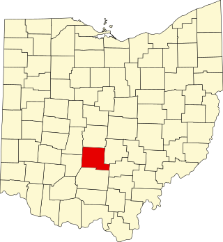
This is a list of the National Register of Historic Places listings in Pickaway County, Ohio, USA.

<span class="mw-page-title-main">National Register of Historic Places listings in Adams County, Ohio</span>

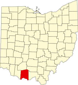
This is a list of the National Register of Historic Places listings in Adams County, Ohio.

<span class="mw-page-title-main">National Register of Historic Places listings in San Bernardino County, California</span>

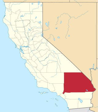
This is a list of the National Register of Historic Places listings in San Bernardino County, California.

<span class="mw-page-title-main">National Register of Historic Places listings in Centre County, Pennsylvania</span>

This is a list of the National Register of Historic Places listings in Centre County, Pennsylvania.

<span class="mw-page-title-main">National Register of Historic Places listings in Greene County, Pennsylvania</span>

This is a list of the National Register of Historic Places listings in Greene County, Pennsylvania.

<span class="mw-page-title-main">National Register of Historic Places listings in Sandoval County, New Mexico</span>

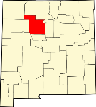
This is a list of the National Register of Historic Places listings in Sandoval County, New Mexico, United States.

<span class="mw-page-title-main">National Register of Historic Places listings in Hocking County, Ohio</span>

This is a list of the National Register of Historic Places listings in Hocking County, Ohio.

This is a list of the National Register of Historic Places listings in Smith County, Tennessee.

References

  1. The latitude and longitude information provided in this table was derived originally from the National Register Information System, which has been found to be fairly accurate for about 99% of listings. Some locations in this table may have been corrected to current GPS standards.
  2. National Park Service, United States Department of the Interior, "National Register of Historic Places: Weekly List Actions", retrieved March 1, 2024.
  3. Numbers represent an alphabetical ordering by significant words. Various colorings, defined here, differentiate National Historic Landmarks and historic districts from other NRHP buildings, structures, sites or objects.
  4. The eight-digit number below each date is the number assigned to each location in the National Register Information System database, which can be viewed by clicking the number.
  5. Location derived from its GNIS feature record; the NRIS lists the site as "Address Restricted"
  6. Location derived from its placement on USGS topographical maps [ permanent dead link ]; the NRIS lists the site as "Address Restricted"
  7. Riccio, Joseph F., and Conrad A. Gazzier. "Infrared Color Photography of the Fort Mims Site, Alabama". Journal of Alabama Archaeology 20.2 (1974): 216-221: 216.